Category:Kriegskaserne Büel (Biel 1.1, Andermatt)
| Object location | | View all coordinates using: OpenStreetMap |
|---|
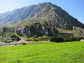
military building in Andermatt in the canton of Uri, Switzerland  | |||||
| Upload media | |||||
| Instance of | |||||
|---|---|---|---|---|---|
| Part of | |||||
| Location | Andermatt, Uri, Switzerland | ||||
| Street address |
| ||||
| Heritage designation | |||||
 | |||||
Media in category "Kriegskaserne Büel (Biel 1.1, Andermatt)"
The following 2 files are in this category, out of 2 total.
-
 Andermatt Kriegskaserne.JPG 2,816 × 2,112; 1.43 MB
-
 Bühl AW A8675.JPG 2,816 × 2,112; 2.17 MB
