<nowiki>Krumhermsdorf; Krumhermsdorf; Krumhermsdorf; Krumhermsdorf; Krumhermsdorf; Krumhermsdorf; Krumhermsdorf; Krumhermsdorf; Krumhermsdorf; Krumhermsdorf; Krumhermsdorf; Krumhermsdorf; Krumhermsdorf; Krumhermsdorf; Krumhermsdorf; Krumhermsdorf; Krumhermsdorf; Krumhermsdorf; Krumhermsdorf; Krumhermsdorf; Krumhermsdorf; Krumhermsdorf; Krumhermsdorf; Krumhermsdorf; Krumhermsdorf; Krumhermsdorf; Krumhermsdorf; Krumhermsdorf; Krumhermsdorf; Krumhermsdorf; Krumhermsdorf; Krumhermsdorf; Krumhermsdorf; Krumhermsdorf; Krumhermsdorf; Krumhermsdorf; Krumhermsdorf; Krumhermsdorf; Krumhermsdorf; Krumhermsdorf; Krumhermsdorf; Krumhermsdorf; Krumhermsdorf; Krumhermsdorf; Krumhermsdorf; Krumhermsdorf; Krumhermsdorf; Krumhermsdorf; Krumhermsdorf; Krumhermsdorf; Krumhermsdorf; Krumhermsdorf; Krumhermsdorf; Krumhermsdorf; Krumhermsdorf; Krumhermsdorf; Krumhermsdorf; Krumhermsdorf; Krumhermsdorf; Krumhermsdorf; Krumhermsdorf; Krumhermsdorf; Krumhermsdorf; Krumhermsdorf; Krumhermsdorf; Krumhermsdorf; Krumhermsdorf; Krumhermsdorf; Krumhermsdorf; Krumhermsdorf; Krumhermsdorf; Krumhermsdorf; Krumhermsdorf; établissement humain en Allemagne; населений пункт у Німеччині; ortsteil in Neustadt in Sachsen, Duitsland; ജര്മ്മനിയിലെ ഒരു സ്ഥലം; Ortsteil von Neustadt i. Sa.; οικισμός της Γερμανίας; human settlement in Germany; բնակավայր Գերմանիայում; místní část města Neustadt in Sachsen; مستوطنة بشرية في ألمانيا</nowiki>
Subcategories
This category has the following 2 subcategories, out of 2 total.

_Rittergut_Herrenhaus.jpg)

 Krumhermsdorf 01.jpg 3,648 × 2,736; 2.12 MB
 Krumhermsdorf 02.jpg 3,648 × 2,736; 2.04 MB
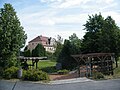 Krumhermsdorf 03.jpg 3,648 × 2,736; 2.12 MB
 Krumhermsdorf 04.jpg 3,648 × 2,736; 2 MB
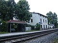 Krumhermsdorf 05.jpg 3,648 × 2,736; 2.04 MB
 Wikipedia Meetup in Jiřetín pod Jedlovou 2023 001.jpg 4,032 × 3,024; 5.63 MB


