Category:Kumreut
neighborhood in Röhrnbach, Germany   | |||||
| Upload media | |||||
| Instance of |
| ||||
|---|---|---|---|---|---|
| Location | Röhrnbach, Freyung-Grafenau, Lower Bavaria, Bavaria, Germany | ||||
| Population |
| ||||
| Elevation above sea level |
| ||||
 | |||||
Media in category "Kumreut"
The following 4 files are in this category, out of 4 total.
-
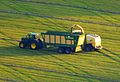 Heuernte bei Kumreut P1060049 b.jpg 2,066 × 1,417; 1,019 KB
-
 Kumreut vom Geyersberg 3.jpg 3,000 × 1,872; 816 KB
-
 Kumreuth Luftaufnahme (2021).jpg 4,056 × 3,040; 6.5 MB
-
 Wappen Kumreut.png 369 × 367; 19 KB

.jpg)