Category:Kurenivka cemetery
.jpg)  | |||||
| Upload media | |||||
| Instance of | |||||
|---|---|---|---|---|---|
| Location |
| ||||
| Located on street |
| ||||
| Date of official closure |
| ||||
| Area |
| ||||
| Number of graves |
| ||||
 | |||||
Subcategories
This category has the following 2 subcategories, out of 2 total.
G
M
Media in category "Kurenivka cemetery"
The following 3 files are in this category, out of 3 total.
-
 Kurenivske-cemetery-plan s.jpg 850 × 1,664; 308 KB
-
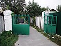 Куренівське кладовище. Вхід..JPG 4,000 × 3,000; 4.43 MB
-
 Куренівське кладовище.JPG 800 × 586; 147 KB

