Category:La Paz County, Arizona
county in Arizona, United States   | |||||
| Upload media | |||||
| Instance of | |||||
|---|---|---|---|---|---|
| Named after |
| ||||
| Location | Arizona | ||||
| Capital | |||||
| Inception |
| ||||
| Population |
| ||||
| Area |
| ||||
| Different from | |||||
| official website | |||||
 | |||||
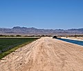
English: Media related to La Paz County, Arizona, a county along the Colorado River on the western edge of Arizona, United States.
Subcategories
This category has the following 23 subcategories, out of 23 total.
Media in category "La Paz County, Arizona"
The following 19 files are in this category, out of 19 total.
-
 ARIZONA (7456336246).jpg 3,045 × 2,601; 2.74 MB
-
 Colorado River Edge near Cibola Arizona- graffiti and trash.jpg 3,072 × 4,096; 8.01 MB
-
 Colorado River Edge near Cibola Arizona- trash left by campers and homeless.jpg 4,096 × 3,072; 6.74 MB
-
 Colorado River Edge near Cibola Arizona- wildfire after trailer purposefully set on fire.jpg 4,096 × 3,072; 4.46 MB
-
 East side of the Plomosa Mountains - Flickr - aspidoscelis.jpg 3,600 × 2,400; 4.47 MB
-
 Harquahala Peak Solar Observatory, La Paz County, Arizona.jpg 4,187 × 2,731; 3.37 MB
-

-
 I-10 Plomosa Pass, AZ, View W Desert Pavement, 2011 - panoramio.jpg 4,000 × 3,000; 4.06 MB
-
 I-PHONE (5435225932).jpg 1,779 × 2,505; 549 KB
-
 I10-Arizona.jpg 1,935 × 1,575; 257 KB
-
 July 2007 California Runner Wildland Fire Rehabilitation - panoramio.jpg 1,504 × 1,000; 1.48 MB
-
 LaPaz, AZ, Interstate 10 E of Quartzsite, 2011 - panoramio.jpg 3,264 × 2,448; 1.36 MB
-
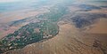 Parker Valley facing S.jpg 2,040 × 1,044; 364 KB
-
 Re-claymation - panoramio.jpg 3,264 × 1,812; 2.28 MB
-
 Saguaro near Yuma Arizona ^^ (Very)Prickly ^ Hot place - panoramio.jpg 1,600 × 1,200; 487 KB
-
 Southwest of the Harcuvar Mountains - Flickr - aspidoscelis.jpg 3,600 × 2,400; 4.24 MB
-
 U.S. Route 60 Salome, AZ Terminus (24590458252).jpg 4,111 × 3,289; 10.55 MB
-
 USA La Paz County, Arizona age pyramid.svg 520 × 600; 7 KB
-
.jpg)


.jpg)


Prickly_%5E_Hot_place_-_panoramio.jpg)

.jpg)

_(3-4-14)_near_parker_dam,_la_paz_co,_az_(1)_(13071462333).jpg)