Category:Laaglandse Molen
| Object location | | View all coordinates using: OpenStreetMap |
|---|
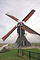
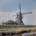
windmill in Hellouw, Netherlands .jpg) | |||||
| Upload media | |||||
| Instance of | |||||
|---|---|---|---|---|---|
| Location | Hellouw, West Betuwe, Gelderland, Netherlands | ||||
| Street address |
| ||||
| Located on street |
| ||||
| Has use |
| ||||
| Heritage designation |
| ||||
| Source of energy | |||||
 | |||||
|
This is a category about rijksmonument number 30348
|
Nederlands: Zomerhuis molenaar:
|
This is a category about a municipal monument in West Betuwe with number WNN36 |
Nederlands: Brug:
|
This is a category about a municipal monument in West Betuwe with number WNL28 |
| Address |
|
Subcategories
This category has the following 3 subcategories, out of 3 total.
L
- Laaglandse Molen bovenas (27 F)
R
Media in category "Laaglandse Molen"
The following 110 files are in this category, out of 110 total.
-
 A traditional Dutch windmill for watermaintenance in the polders - panoramio.jpg 4,928 × 3,264; 1.25 MB
-
 Achterste Hellouwse Molen - Hellouw - 20107928 - RCE.jpg 1,200 × 1,192; 198 KB
-
 Achterste molen van polder Hellouw en Haaften, aanzicht - Hellouw - 20107929 - RCE.jpg 1,200 × 1,172; 263 KB
-

-
 Hellouw-Laaglandse Molen foto 2.jpg 1,000 × 1,500; 222 KB
-
 Hellouw-Laaglandse Molen.jpg 1,000 × 1,500; 212 KB
-
 Laaglandse molen 8 juni 2008 (12).jpg 1,704 × 2,272; 753 KB
-
 Laaglandse molen 8 juni 2008 (14).jpg 1,704 × 2,272; 827 KB
-
 Laaglandse molen 8 juni 2008 (7).jpg 1,744 × 2,302; 846 KB
-
 Laaglandse molen krooshek 8 juni 2008.jpg 1,704 × 2,272; 1.62 MB
-
 Laaglandse molen scheprad 8 juni 2008.jpg 1,657 × 2,208; 866 KB
-
 Molen Laaglandse molen 9-10-2012 (1).jpg 2,448 × 3,264; 1.87 MB
-
 Molen Laaglandse molen 9-10-2012 (2).jpg 2,301 × 3,137; 1.14 MB
-
 Molen Laaglandse molen 9-10-2012 (3).jpg 2,448 × 3,264; 1.46 MB
-
 Molen Laaglandse molen 9-10-2012 (4).jpg 2,448 × 3,264; 1.82 MB
-
 Molen Laaglandse molen 9-10-2012.jpg 2,448 × 3,264; 1.62 MB
-
 Molen Laaglandse molen achterwaterloop.jpg 3,264 × 2,448; 3.86 MB
-
 Molen Laaglandse Molen bedstee.jpg 4,912 × 7,360; 2.92 MB
-
 Molen Laaglandse molen biotoop (1).jpg 2,364 × 3,191; 947 KB
-
 Molen Laaglandse molen biotoop.jpg 2,292 × 3,174; 1.37 MB
-
 Molen Laaglandse molen bovenwielstut.jpg 2,448 × 3,264; 2.49 MB
-
 Molen Laaglandse molen bovenzetel console.jpg 2,448 × 3,264; 2.4 MB
-
 Molen Laaglandse molen bovenzetel.jpg 3,264 × 2,448; 1.52 MB
-
 Molen Laaglandse molen dakspant.jpg 2,448 × 3,264; 1.78 MB
-
 Molen Laaglandse Molen generator waterwiel (1).jpg 6,624 × 4,421; 3.2 MB
-
 Molen Laaglandse Molen generator waterwiel (2).jpg 6,624 × 4,421; 3.01 MB
-
 Molen Laaglandse Molen kachel.jpg 4,912 × 7,360; 3.79 MB
-
 Molen Laaglandse molen kruisbalk.jpg 2,276 × 3,159; 1.82 MB
-
 Molen Laaglandse molen tempelbalk daklijst.jpg 3,264 × 2,448; 2.12 MB
-
 Molen Laaglandse molen vang evenaar.jpg 2,448 × 3,264; 1.42 MB
-
 Molen Laaglandse molen vangbalk (1).jpg 3,264 × 2,448; 1.46 MB
-
 Molen Laaglandse molen vangbalk.jpg 3,264 × 2,448; 1.86 MB
-
 Molen Laaglandse molen vangstukken (1).jpg 2,448 × 3,264; 2.02 MB
-
 Molen Laaglandse molen vangstukken.jpg 3,035 × 2,258; 1.54 MB
-
 Molen Laaglandse molen voorwaterloop.jpg 2,448 × 3,264; 2.62 MB
-
 Molen Laaglandse molen windpeluw blokkeel.jpg 2,448 × 3,264; 1.97 MB
-
 Molen Laaglandse molen windpeluw daklijst.jpg 3,264 × 2,448; 2.44 MB
-
 Molen Laaglandse molen zijkant linkerzijde (1).jpg 3,264 × 2,448; 1.72 MB
-
 Molen Laaglandse molen zijkant linkerzijde (3).jpg 2,448 × 3,264; 1.44 MB
-
 Molen Laaglandse molen zijkant linkerzijde.jpg 3,264 × 2,448; 1.34 MB
-
 Molen Laaglandse molen zijkant rechterzijde (1).jpg 2,221 × 3,071; 1.02 MB
-
 Molen Laaglandse molen zijkant rechterzijde (2).jpg 2,448 × 3,264; 1.22 MB
-
 Molen Laaglandse molen zijkant rechterzijde.jpg 3,264 × 2,448; 1.51 MB
-
 Molen Laaglandse molen, Hellouw, Franse roe.jpg 3,264 × 2,448; 2.01 MB
-
 Molen Laaglandse molen, Hellouw, koker onderkant (1).jpg 2,448 × 3,264; 1.37 MB
-
 Molen Laaglandse molen, Hellouw, koker onderkant.jpg 2,448 × 3,264; 1.9 MB
-
 Molen Laaglandse molen, Hellouw, kokerstijl op kokerbalk.jpg 2,448 × 3,264; 1.88 MB
-
 Molen Laaglandse molen, Hellouw, ondertoren bovenmantelbalk torenstijl.jpg 3,264 × 2,448; 1.53 MB
-
 Molen Laaglandse molen, Hellouw, ondertoren koker onderzetel.jpg 3,104 × 2,257; 1.52 MB
-
 Molen Laaglandse molen, Hellouw, ondertoren ondermiddenstijl torenstijl.jpg 2,448 × 3,264; 1.5 MB
-
 Molen Laaglandse molen, Hellouw, potroe.jpg 3,264 × 2,448; 2.48 MB
-
 Molen Laaglandse molen, Hellouw, Roeketting.jpg 2,448 × 3,264; 2.81 MB
-
 Molen Laaglandse molen, Hellouw, Scheprad schoepen.jpg 2,448 × 3,264; 1.56 MB
-
 Molen Laaglandse molen, Hellouw, Scheprad wachtkozijn.jpg 2,448 × 3,264; 2.36 MB
-
 Molen Laaglandse molen, Hellouw, stormbint boven kruisbalk hoekstijl.jpg 2,448 × 3,264; 1.85 MB
-
 Molen Laaglandse molen, Hellouw, stormbint boven kruisbalk.jpg 3,264 × 2,448; 1.74 MB
-
 Molen Laaglandse molen, Hellouw, stormbint kruisbalk borstnaald.jpg 2,324 × 3,170; 1.3 MB
-
 Molen Laaglandse molen, Hellouw, stormbint kruisbalk.jpg 2,448 × 3,264; 1.65 MB
-
 Molen Laaglandse molen, Hellouw, stormbint tempelbalk windpeluw.jpg 2,448 × 3,264; 2.5 MB
-
 Molen Laaglandse molen, Hellouw, Waterwiel onderrondsel (1).jpg 3,264 × 2,448; 1.35 MB
-
 Molen Laaglandse molen, Hellouw, Waterwiel onderrondsel (2).jpg 2,948 × 2,138; 1.17 MB
-
 Molen Laaglandse molen, Hellouw, Waterwiel onderrondsel.jpg 2,448 × 3,264; 1.7 MB
-
 Molen Laaglandse molen, Hellouw, Waterwiel wateras.jpg 2,160 × 2,952; 1.21 MB
-
 Molen Laaglandse molen, Hellouw, Waterwiel.jpg 2,160 × 3,018; 1.01 MB
-
 Overzicht - Hellouw - 20363637 - RCE.jpg 1,200 × 1,182; 191 KB
-
 Overzicht - Hellouw - 20363638 - RCE.jpg 1,200 × 1,197; 226 KB
-
 Overzicht - Hellouw - 20363639 - RCE.jpg 1,200 × 1,194; 264 KB
-
 Overzicht achterzijde - Hellouw - 20363640 - RCE.jpg 1,200 × 1,188; 250 KB
-
 Overzicht achterzijde - Hellouw - 20363641 - RCE.jpg 1,200 × 1,200; 405 KB
-
 Windmill in Hellouw - Laaglandse molen.jpg 1,321 × 1,218; 572 KB
-
 Wipmolen Laaglandse Molen Hellouw (2).jpg 1,608 × 2,210; 635 KB
-
 Wipmolen Laaglandse Molen Hellouw borstnaald.jpg 1,704 × 2,272; 664 KB
-
 Wipmolen Laaglandse Molen Hellouw bovenhuis met trap.jpg 1,704 × 2,272; 766 KB
-
 Wipmolen Laaglandse Molen Hellouw boventafelement.jpg 1,704 × 2,272; 926 KB
-
 Wipmolen Laaglandse Molen Hellouw bovenwiel en rondsel.jpg 1,704 × 2,272; 911 KB
-
 Wipmolen Laaglandse Molen Hellouw bovenwiel.jpg 2,272 × 1,704; 1.02 MB
-
 Wipmolen Laaglandse Molen Hellouw evenaar met vangbalk (2).jpg 1,704 × 2,272; 690 KB
-
 Wipmolen Laaglandse Molen Hellouw evenaar met vangbalk.jpg 1,704 × 2,272; 1 MB
-
 Wipmolen Laaglandse molen Hellouw ezel.jpg 1,704 × 2,272; 876 KB
-
 Wipmolen Laaglandse Molen Hellouw halslager (1).jpg 1,704 × 2,272; 1.14 MB
-
 Wipmolen Laaglandse Molen Hellouw halslager bovenas.jpg 2,272 × 1,704; 1.05 MB
-
 Wipmolen Laaglandse Molen Hellouw ijzerbalk.jpg 1,704 × 2,272; 1.42 MB
-
 Wipmolen Laaglandse Molen Hellouw keuvelensbalk.jpg 1,704 × 2,272; 1.11 MB
-
 Wipmolen Laaglandse Molen Hellouw koebout vang.jpg 1,704 × 2,272; 849 KB
-
 Wipmolen Laaglandse Molen Hellouw koker.jpg 1,704 × 2,272; 969 KB
-
 Wipmolen Laaglandse Molen Hellouw koningsspil en busdeur.jpg 2,272 × 1,704; 1.06 MB
-
 Wipmolen Laaglandse Molen Hellouw kruilier.jpg 1,704 × 2,272; 871 KB
-
 Wipmolen Laaglandse Molen Hellouw onderwiel.jpg 1,704 × 2,272; 1.08 MB
-
 Wipmolen Laaglandse Molen Hellouw penlager bovenas.jpg 2,272 × 1,704; 901 KB
-
 Wipmolen Laaglandse Molen Hellouw scheprad bij wachtdeur.jpg 1,704 × 2,272; 1.07 MB
-
 Wipmolen Laaglandse Molen Hellouw scheprad.jpg 1,704 × 2,272; 901 KB
-
 Wipmolen Laaglandse Molen Hellouw taats koningsspil (1).jpg 6,289 × 4,045; 5.16 MB
-
 Wipmolen Laaglandse Molen Hellouw taats koningsspil.jpg 2,272 × 1,704; 952 KB
-
 Wipmolen Laaglandse Molen Hellouw trap.jpg 1,661 × 2,221; 463 KB
-
 Wipmolen Laaglandse Molen Hellouw trapbint.jpg 1,704 × 2,272; 625 KB
-
 Wipmolen Laaglandse Molen Hellouw vangbalk.jpg 2,272 × 1,704; 1 MB
-
 Wipmolen Laaglandse Molen Hellouw voorwaterloop.jpg 2,192 × 1,597; 766 KB
-
 Wipmolen Laaglandse Molen Hellouw wateras buitenlager.jpg 2,272 × 1,704; 759 KB
-
 Wipmolen Laaglandse Molen Hellouw waterasbinnenlager (1).jpg 7,360 × 4,912; 7.09 MB
-
 Wipmolen Laaglandse Molen Hellouw waterasbinnenlager.jpg 1,704 × 2,272; 1.05 MB
-
 Wipmolen Laaglandse Molen Hellouw.jpg 1,704 × 2,272; 782 KB
-
 Wipwatermolen "De Achterste molen - Hellouw - 20107936 - RCE.jpg 1,200 × 1,190; 488 KB
-
 Wipwatermolen "De Achterste molen" - Hellouw - 20107931 - RCE.jpg 1,200 × 1,159; 256 KB
-
 Wipwatermolen "De Achterste molen" - Hellouw - 20107932 - RCE.jpg 1,200 × 1,165; 275 KB
-
 Wipwatermolen "De Achterste molen" - Hellouw - 20107935 - RCE.jpg 1,200 × 1,172; 252 KB
-
 Wipwatermolen "De Achtkante Molen", in restauratie - Hellouw - 20107947 - RCE.jpg 1,200 × 1,200; 225 KB
-
 Wipwatermolen "De Achtkante Molen", in restauratie - Hellouw - 20107948 - RCE.jpg 1,200 × 1,200; 251 KB
-
 Wipwatermolen - Hellouw - 20107925 - RCE.jpg 885 × 1,200; 209 KB
-
 Wipwatermolen De Achterste molen - Hellouw - 20107934 - RCE.jpg 1,200 × 1,163; 319 KB
-
 Wipwatermolen nr.21, initialen op de borstnaald - Hellouw - 20107926 - RCE.jpg 1,188 × 1,200; 210 KB


.jpg)
.jpg)


.jpg)
.jpg)
.jpg)
.jpg)


.jpg)


.jpg)
.jpg)


.jpg)

.jpg)


.jpg)
.jpg)

.jpg)
.jpg)


.jpg)


.jpg)
.jpg)


.jpg)


.jpg)


.jpg)


.jpg)


.jpg)


