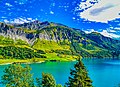
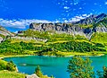
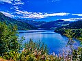
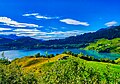
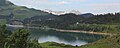
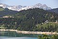
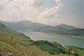
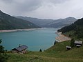
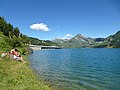
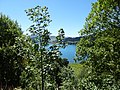
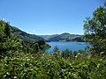
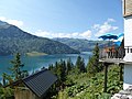
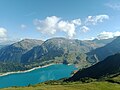
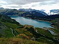
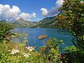
Category:Lac de Roselend
| Object location | | View all coordinates using: OpenStreetMap |
|---|
.jpg)  | |||||
| Upload media | |||||
| Instance of | |||||
|---|---|---|---|---|---|
| Part of | |||||
| Named after | |||||
| Location | Beaufort, canton of Beaufort | ||||
| Operator | |||||
| Inception |
| ||||
| Width |
| ||||
| Length |
| ||||
| Mountain range | |||||
| Area |
| ||||
| Elevation above sea level |
| ||||
| Inflows | |||||
| Outflows | |||||
| Drainage basin |
| ||||
| Dam | |||||
 | |||||
Subcategories
This category has the following 3 subcategories, out of 3 total.
Media in category "Lac de Roselend"
The following 133 files are in this category, out of 133 total.
-
 Am Lac de Roselend.jpg 1,500 × 1,000; 1.85 MB
-
 Barrage de Roselend 3.jpg 6,956 × 3,456; 9.28 MB
-
 Barrage de Roselend.jpg 1,024 × 685; 625 KB
-
 Beaufortain Passeur de la Mintaz.jpg 4,608 × 3,456; 5.63 MB
-
 Carrière de Roselend.jpg 4,608 × 3,456; 5.76 MB
-
 Col de Méraillet.jpg 4,608 × 3,456; 5.12 MB
-
 Cormet de Roselend, Barrage de Roselend - panoramio - pyraniton.jpg 2,272 × 1,704; 1.04 MB
-
 Cormet de Roselend, Barrage de Roselend - panoramio.jpg 2,272 × 1,704; 1.12 MB
-
 Cormet-de-Roselend-2.jpg 2,984 × 1,789; 2.25 MB
-
 Environs du lac de reselend - panoramio.jpg 4,000 × 3,000; 2.01 MB
-
 Haute-Savoie Lac de Roselend 01.jpg 4,586 × 3,440; 18.33 MB
-
 Haute-Savoie Lac de Roselend 02.jpg 4,559 × 3,294; 18.06 MB
-
 Haute-Savoie Lac de Roselend 03.jpg 4,564 × 3,335; 18.76 MB
-
 Haute-Savoie Lac de Roselend 04.jpg 4,553 × 3,360; 18.29 MB
-
 Haute-Savoie Lac de Roselend 05.jpg 4,536 × 3,344; 18.56 MB
-
 Haute-Savoie Lac de Roselend 06.jpg 4,493 × 2,980; 17.56 MB
-
 Haute-Savoie Lac de Roselend 07.jpg 4,536 × 3,193; 21.09 MB
-
 Haute-Savoie Lac de Roselend 08.jpg 3,349 × 4,544; 19.67 MB
-
 Haute-Savoie Lac de Roselend 09.jpg 4,548 × 3,429; 17.58 MB
-
 Haute-Savoie Lac de Roselend 10.jpg 4,563 × 3,408; 19.25 MB
-
 Haute-Savoie Lac de Roselend 11.jpg 4,576 × 3,428; 18.01 MB
-
 Haute-Savoie Lac de Roselend 12.jpg 4,589 × 3,341; 20.35 MB
-
 Haute-Savoie Lac de Roselend 13.jpg 4,544 × 3,313; 20.45 MB
-
 Haute-Savoie Lac de Roselend 14.jpg 4,579 × 3,317; 23.97 MB
-
 Haute-Savoie Lac de Roselend 15.jpg 4,554 × 3,365; 20.43 MB
-
 Haute-Savoie Lac de Roselend 16.jpg 4,536 × 3,202; 20.95 MB
-
 Haute-Savoie Lac de Roselend 17.jpg 4,454 × 3,256; 21.7 MB
-
 Haute-Savoie Lac de Roselend 18.jpg 4,544 × 3,282; 20.14 MB
-
 Haute-Savoie Lac de Roselend 19.jpg 4,536 × 3,198; 17.47 MB
-
 Haute-Savoie Lac de Roselend 20.jpg 4,582 × 3,330; 22.26 MB
-
 Haute-Savoie Lac de Roselend 21.jpg 4,524 × 3,356; 22.65 MB
-
 Haute-Savoie Lac de Roselend 22.jpg 4,554 × 3,174; 18.51 MB
-
 Haute-Savoie Lac de Roselend 23.jpg 4,509 × 3,184; 17.09 MB
-
 Haute-Savoie Lac de Roselend 24.jpg 4,478 × 3,118; 16.93 MB
-
 Haute-Savoie Lac de Roselend 25.jpg 4,523 × 3,252; 18.89 MB
-
 Haute-Savoie Lac de Roselend 26.jpg 4,407 × 3,092; 17.75 MB
-
 Haute-Savoie Lac de Roselend 27.jpg 4,440 × 3,039; 16.51 MB
-
 Haute-Savoie Lac de Roselend 28.jpg 4,359 × 3,014; 15.96 MB
-
 Haute-Savoie Lac de Roselend 29.jpg 4,500 × 3,322; 21.54 MB
-
 Haute-Savoie Lac de Roselend 30.jpg 4,582 × 3,305; 18.91 MB
-
 Haute-Savoie Lac de Roselend 31.jpg 4,564 × 3,114; 18.3 MB
-
 Haute-Savoie Lac de Roselend 32.jpg 4,554 × 3,251; 21.51 MB
-
 Haute-Savoie Lac de Roselend 33.jpg 4,564 × 3,410; 22 MB
-
 Haute-Savoie Montagnes autour Lac de Roselend 1.jpg 4,589 × 3,113; 18.12 MB
-
 Lac de Roselend (1).jpg 1,984 × 1,488; 682 KB
-
 Lac de Roselend - img 44763.jpg 5,616 × 3,744; 9.4 MB
-
 Lac de Roselend D20120904 b.jpg 4,416 × 3,312; 2.15 MB
-
 Lac de Roselend D20120904 c.jpg 4,416 × 3,312; 2.3 MB
-
 Lac de Roselend D20120904 d.jpg 4,416 × 3,312; 1.11 MB
-
 Lac de Roselend D20120904 e.jpg 4,416 × 3,312; 1.49 MB
-
 Lac de Roselend F.jpg 2,560 × 1,920; 2.09 MB
-
 Lac de Roselend Grand Mont Rocher du Vent.jpg 4,608 × 3,456; 4.65 MB
-
 Lac de Roselend Rocher du Vent.jpg 3,456 × 4,608; 3.41 MB
-
 Lac de Roselend, Pierra Menta, route du Col du Pré.jpg 2,048 × 1,536; 602 KB
-
 Lac de Roselend, Savoie, France 001.JPG 2,500 × 1,500; 1.36 MB
-
 Lac de Roselend, Savoie, France 002.jpg 2,500 × 1,000; 1.13 MB
-
 Lac de Roselend, Savoie, France 003.jpg 3,500 × 1,100; 1.49 MB
-
 Lac de Roselend, Savoie, France 004.jpg 2,500 × 900; 1.16 MB
-
 Lac de Roselend, Savoie, France 005.JPG 2,500 × 1,500; 1.58 MB
-
 Lac de Roselend, Savoie, France 006.jpg 2,500 × 1,000; 800 KB
-
 Lac de Roselend, Savoie, France 007.JPG 1,500 × 900; 588 KB
-
 Lac de Roselend, Savoie, France 008.JPG 2,500 × 1,500; 1,018 KB
-
 Lac de Roselend, Savoie, France 009.JPG 2,500 × 1,667; 1.62 MB
-
 Lac de Roselend, Savoie, France 010.jpg 3,500 × 1,200; 1.63 MB
-
 Lac de Roselend, Savoie, France 011.jpg 3,500 × 1,200; 1.63 MB
-
 Lac de Roselend, Savoie, France 012.jpg 3,500 × 1,200; 2.1 MB
-
 Lac de Roselend, Savoie, France 016.JPG 1,400 × 2,500; 1.68 MB
-
 Lac de Roselend.jpg 1,984 × 1,488; 710 KB
-
 Lac du Roselend.jpg 1,600 × 1,200; 378 KB
-
 Lac du Roselend02.jpg 1,536 × 1,024; 262 KB
-
 Lac du Roselend03.jpg 1,536 × 1,024; 336 KB
-
 Lac du Roselend04.jpg 1,536 × 1,024; 260 KB
-
 Lac et Chapelle de Roselend.JPG 2,496 × 1,664; 3.07 MB
-

-
 Lac Roselend Orage.JPG 1,280 × 960; 229 KB
-
 Lac réservoir de Roselend.jpg 4,320 × 3,240; 2.5 MB
-
 LacRoselendÎle.jpg 5,184 × 3,888; 5.52 MB
-
 Le lac de roselend - panoramio (1).jpg 4,000 × 3,000; 1.95 MB
-
 Le lac de roselend - panoramio (10).jpg 4,000 × 3,000; 4.8 MB
-
 Le lac de roselend - panoramio (11).jpg 4,000 × 3,000; 4.92 MB
-
 Le lac de roselend - panoramio (12).jpg 4,000 × 3,000; 4.71 MB
-
 Le lac de roselend - panoramio (13).jpg 4,000 × 3,000; 5.01 MB
-
 Le lac de roselend - panoramio (14).jpg 4,000 × 3,000; 4.98 MB
-
 Le lac de roselend - panoramio (15).jpg 4,000 × 3,000; 5.01 MB
-
 Le lac de roselend - panoramio (16).jpg 4,000 × 3,000; 5.06 MB
-
 Le lac de roselend - panoramio (17).jpg 4,000 × 3,000; 5.1 MB
-
 Le lac de roselend - panoramio (18).jpg 4,000 × 3,000; 4.98 MB
-
 Le lac de roselend - panoramio (19).jpg 4,000 × 3,000; 4.73 MB
-
 Le lac de roselend - panoramio (2).jpg 4,000 × 3,000; 1.89 MB
-
 Le lac de roselend - panoramio (20).jpg 4,000 × 3,000; 5.22 MB
-
 Le lac de roselend - panoramio (21).jpg 4,000 × 3,000; 4.62 MB
-
 Le lac de roselend - panoramio (22).jpg 4,000 × 3,000; 4.85 MB
-
 Le lac de roselend - panoramio (23).jpg 4,000 × 3,000; 5.24 MB
-
 Le lac de roselend - panoramio (24).jpg 2,192 × 864; 841 KB
-
 Le lac de roselend - panoramio (25).jpg 2,384 × 832; 792 KB
-
 Le lac de roselend - panoramio (26).jpg 4,000 × 3,000; 4.7 MB
-
 Le lac de roselend - panoramio (3).jpg 4,000 × 3,000; 1.91 MB
-
 Le lac de roselend - panoramio (4).jpg 4,320 × 3,240; 5.97 MB
-
 Le lac de roselend - panoramio (5).jpg 4,320 × 3,240; 6.55 MB
-
 Le lac de roselend - panoramio (6).jpg 4,320 × 3,240; 6.47 MB
-
 Le lac de roselend - panoramio (7).jpg 4,320 × 3,240; 5.57 MB
-
 Le lac de roselend - panoramio (8).jpg 4,320 × 3,240; 5.58 MB
-
 Le lac de roselend - panoramio (9).jpg 4,000 × 3,000; 4.83 MB
-
 Le lac de roselend - panoramio.jpg 4,000 × 3,000; 1.99 MB
-
 Le lac de roselend aout 2012 - panoramio.jpg 4,000 × 3,000; 1.92 MB
-
 Le lac et le barrage de roselend - panoramio (1).jpg 4,000 × 3,000; 4.76 MB
-
 Le lac et le barrage de roselend - panoramio.jpg 4,000 × 3,000; 5.02 MB
-
 Les Sauces, Lac de Roselend, Savoie, France 001.jpg 2,500 × 1,000; 1.03 MB
-
 Les Sauces, Lac de Roselend, Savoie, France 002.JPG 2,500 × 1,667; 2.03 MB
-
 Montagne d'Outray Lac de Roselend.jpg 4,608 × 3,456; 4.09 MB
-
 On The Lake Shore (222785229).jpeg 1,365 × 2,048; 1.45 MB
-
 Reflection (222785315).jpeg 1,365 × 2,048; 925 KB
-
 Rochers des Enclaves Lac de Roselend.jpg 4,608 × 3,456; 4.03 MB
-
 Lac de roselend.jpg 1,920 × 1,080; 753 KB
-
 Roselend after storm1.jpg 4,608 × 3,456; 3.06 MB
-
 Roselend after storm2.jpg 4,608 × 3,456; 1.91 MB
-
 Roselend after storm3.jpg 4,608 × 3,456; 4.07 MB
-
 Roselend after storm4.jpg 4,608 × 3,456; 2.34 MB
-
 Roselend after storm5.jpg 4,608 × 3,456; 3.86 MB
-
 Roselend after storm6.jpg 4,608 × 3,456; 5.19 MB
-
 Roselend after storm7.jpg 4,608 × 3,456; 5.02 MB
-
 Roselend after storm8.jpg 4,608 × 3,456; 4.39 MB
-
 Roselend after storm9.jpg 4,608 × 3,456; 4.29 MB
-
 Roselend col du pré.JPG 1,205 × 384; 57 KB
-
 Roselend Dam001.JPG 3,264 × 2,448; 1.42 MB
-
 Roselend Dam002.JPG 3,264 × 2,448; 1.82 MB
-
 Roselend ETP.png 1,755 × 1,241; 71 KB
-
 Savoie Lac Roselend - panoramio.jpg 1,600 × 1,200; 649 KB
-
 Sunset On Roselend Lake (222785337).jpeg 2,048 × 1,365; 1.1 MB
-
 Sunset On Roselend Lake (222785351).jpeg 2,048 × 1,365; 769 KB
-
 Treicol - img 44804.jpg 5,616 × 3,744; 8.99 MB
-
 Vache-tarentaise-et-le-lac-de-roseland-ferme--6614e1T650.jpg 650 × 433; 67 KB
-
 View On The Dam Of Roselend (222785269).jpeg 2,048 × 1,365; 778 KB


.jpg)


_looking_to_the_West_-_panoramio.jpg)


.jpg)
.jpg)
.jpg)
.jpg)
.jpg)
.jpg)
.jpg)
.jpg)
.jpg)
.jpg)
.jpg)
.jpg)
.jpg)
.jpg)
.jpg)
.jpg)
.jpg)
.jpg)
.jpg)
.jpg)
.jpg)
.jpg)
.jpg)


.jpg)


.jpeg)
.jpeg)


.jpeg)
.jpeg)


.jpeg)
.jpg)
.jpg)