Category:Lamlash
village in North Ayrshire, Scotland, UK  | |||||
| Upload media | |||||
| Instance of | |||||
|---|---|---|---|---|---|
| Location |
| ||||
| Population |
| ||||
 | |||||
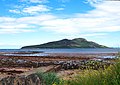
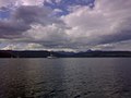
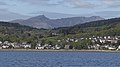
English: Lamlash is the largest village by population on the Isle of Arran, in the Firth of Clyde, Scotland. It lies 4 miles to the south of ferry port Brodick, in a bay on the island's east coast, facing Holy Isle.
Gàidhlig: 'S e baile beag ann an Arainn a th' ann an Loch an Eilein neo An t-Eilean Àrd. (Beurla: Lamlash). Ann an 2001, 's e 1,000 an àireamh-shluaigh a tha aige. Tha am baile 4 mìltean air falbh san àird a deas bho Bhreadhaig.
Subcategories
This category has the following 5 subcategories, out of 5 total.
Media in category "Lamlash"
The following 141 files are in this category, out of 141 total.
-
 American Ship Coming Into Lamlash, by Robert Salmon.jpg 720 × 487; 393 KB
-
 Arran east coast near Clauchland - geograph.org.uk - 307790.jpg 640 × 467; 56 KB
-
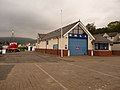
 Arran Lifeboat Station, Lamlash (geograph 5772034).jpg 640 × 480; 67 KB
-
 Arran satellite lamlash.jpg 396 × 599; 50 KB
-
 Beach at Lamlash - geograph.org.uk - 5944331.jpg 4,000 × 3,000; 6.67 MB
-
 Becalmed - geograph.org.uk - 3403866.jpg 1,228 × 1,000; 996 KB
-
 Blairbeg - geograph.org.uk - 3065932.jpg 640 × 471; 93 KB
-
 Boat in Lamlash.jpg 2,577 × 3,859; 1.96 MB
-
 Brambles, Kirk Care House Lamlash - geograph.org.uk - 1473569.jpg 640 × 425; 74 KB
-
 Building in Lamlash.jpg 3,888 × 2,592; 2.58 MB
-
 Clauchlands, Arran - geograph.org.uk - 185763.jpg 640 × 480; 79 KB
-
 Clearances plaque.jpg 3,648 × 2,736; 3.85 MB
-
 Clyde puffer at Lamlash pier, April 1962 - geograph.org.uk - 5188612.jpg 800 × 557; 142 KB
-
 Concealed Burn, Lamlash - geograph.org.uk - 1473588.jpg 425 × 640; 104 KB
-
 Digitalis purpurea Foxglove (2) (27628101359).jpg 4,500 × 2,997; 4.52 MB
-
 Digitalis purpurea Foxglove (39405313221).jpg 2,889 × 2,808; 1.5 MB
-
 European Hare. Lepus europaeus (24502730167).jpg 3,513 × 2,842; 1.8 MB
-
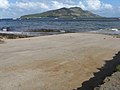
 Foreshore at Lamlash Bay - geograph.org.uk - 5447512.jpg 1,024 × 747; 179 KB
-
 Former St George's United Free Church, Lamlash - geograph.org.uk - 3593145.jpg 1,600 × 1,067; 507 KB
-
 Grey heron at Margnaheglish - geograph.org.uk - 449050.jpg 640 × 456; 54 KB
-
 Grey Heron. Ardea cinerea (24502749567).jpg 2,728 × 2,071; 914 KB
-
 Highland Clearances memorial Lamlash.jpg 3,648 × 2,736; 3.91 MB
-
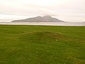
 Holy Isle - panoramio.jpg 1,634 × 1,152; 231 KB
-
-
 Lamlash Bay - geograph.org.uk - 2405408.jpg 2,592 × 1,944; 3.05 MB
-
 Lamlash Bay - geograph.org.uk - 6343353.jpg 800 × 533; 589 KB
-
 Lamlash Bay at low tide - geograph.org.uk - 3945169.jpg 1,920 × 1,280; 414 KB
-
 Lamlash Bay from Margnaheglish - geograph.org.uk - 2410987.jpg 2,592 × 1,944; 2.96 MB
-
 Lamlash Bay, Lamlash, Arran - geograph.org.uk - 5772011.jpg 640 × 480; 92 KB
-
 Lamlash Beach - geograph.org.uk - 2924702.jpg 4,608 × 3,456; 5.54 MB
-
 Lamlash Beach - geograph.org.uk - 3593568.jpg 1,600 × 1,067; 422 KB
-
 Lamlash from the Holy Isle ferry - geograph.org.uk - 2742555.jpg 1,440 × 810; 604 KB
-

-
 Lamlash Golf Club - panoramio.jpg 1,972 × 1,456; 282 KB
-
 Lamlash Pier - geograph.org.uk - 5791282.jpg 4,000 × 3,000; 3.51 MB
-
 Lamlash Pier - geograph.org.uk - 799964.jpg 640 × 430; 68 KB
-
 Lamlash Pier - geograph.org.uk - 977095.jpg 640 × 480; 111 KB
-
 Lamlash Pier and Holy Island - geograph.org.uk - 37727.jpg 640 × 424; 97 KB
-
 Lamlash Seafront - geograph.org.uk - 3593184.jpg 5,184 × 3,456; 6.84 MB
-
 Lamlash Seafront - geograph.org.uk - 3593192.jpg 1,600 × 1,067; 452 KB
-
 Lamlash Seafront - geograph.org.uk - 3593234.jpg 5,184 × 3,456; 6.71 MB
-
 Lamlash Shore - geograph.org.uk - 3065936.jpg 500 × 640; 111 KB
-
 Lamlash waterfront, Arran - geograph.org.uk - 167731.jpg 600 × 393; 263 KB
-
 Lamlash, Arran 1.jpg 3,881 × 2,580; 2.23 MB
-
 Lamlash, Arran 2.jpg 3,878 × 2,574; 3.06 MB
-
 Lamlash, Arran.jpg 3,886 × 2,580; 2.5 MB
-
 Lamlash, bench with island view - geograph.org.uk - 2094880.jpg 640 × 480; 55 KB
-

-
 Lamlash, Hamilton Terrace - geograph.org.uk - 2094911.jpg 640 × 480; 65 KB
-
 Lamlash, lawn by the shore - geograph.org.uk - 2094872.jpg 640 × 480; 51 KB
-

-

-

-
 Lamlash, shoreline and parish church - geograph.org.uk - 2094876.jpg 640 × 480; 66 KB
-
 Lamlash, submerged slipway - geograph.org.uk - 2094938.jpg 640 × 480; 38 KB
-

-
 Lamlash, the clock house - geograph.org.uk - 2095543.jpg 640 × 480; 41 KB
-
 Lamlash, the lifeboat station - geograph.org.uk - 2094947.jpg 640 × 480; 56 KB
-
 Lamlash, The Mound - geograph.org.uk - 2095629.jpg 640 × 480; 62 KB
-
 Lamlash, The Mound and Holy Island - geograph.org.uk - 2095630.jpg 640 × 480; 50 KB
-
 Lamlash, the pier and Holy Island - geograph.org.uk - 2094921.jpg 640 × 480; 54 KB
-

-
 Lamlash, village and pier - geograph.org.uk - 860613.jpg 640 × 286; 55 KB
-
 Lamlash.jpg 3,888 × 2,592; 2.52 MB
-
 Launch ramp at Lamlash - geograph.org.uk - 2405426.jpg 2,592 × 1,944; 2.19 MB
-
 Lifeboat and Sea King at Lamlash - geograph.org.uk - 1462876.jpg 423 × 640; 65 KB
-
 Lifeboat Launch at Lamlash - geograph.org.uk - 1462873.jpg 423 × 640; 111 KB
-

-
 Pharmacy, Lamlash - geograph.org.uk - 978067.jpg 640 × 480; 90 KB
-
 Pier House ^ Clock Tower, Lamlash - geograph.org.uk - 3593227.jpg 1,600 × 1,067; 514 KB
-
 Pier, Lamlash - geograph.org.uk - 2751609.jpg 640 × 480; 323 KB
-
 Plant in Lamlash 1.jpg 3,888 × 2,592; 2.32 MB
-
 Plant in Lamlash.jpg 3,888 × 2,592; 2.79 MB
-
 Ribwort Plantain head. Plantago lanceolata (39324146172).jpg 2,733 × 2,226; 960 KB
-
 Road at Margnaheglish - geograph.org.uk - 6274997.jpg 1,024 × 575; 146 KB
-
 Salvage tug Holland 1.jpg 2,699 × 1,800; 988 KB
-
 Salvage tug Holland.jpg 2,789 × 1,860; 1.04 MB
-
 Scotland, Isle of Arran, Lamlash, Hamilton Terrace.JPG 1,716 × 1,140; 922 KB
-
 Scotland, Isle of Arran, Lamlash, the seafront .JPG 1,716 × 1,140; 958 KB
-
 Scotland, Isle of Arran, Lamlash, the seafront.JPG 1,716 × 1,140; 621 KB
-
 Scotland, Isle of Arran, Lamlash, Villa the Lookout.JPG 1,501 × 997; 962 KB
-
 Shore at Lamlash - geograph.org.uk - 3065950.jpg 640 × 480; 102 KB
-
 Shore at Lamlash - geograph.org.uk - 3065957.jpg 640 × 480; 102 KB
-
 Slipway ^ Seafront, Lamlash - geograph.org.uk - 3593273.jpg 5,184 × 3,456; 7.17 MB
-
 Slipway ^ Seafront, Lamlash - geograph.org.uk - 3593297.jpg 5,184 × 3,456; 7.52 MB
-
 Statice or Sea Lavender. Limonium sp (39353345201).jpg 3,235 × 2,545; 1.38 MB
-
 Sunny Lamlash - geograph.org.uk - 5620158.jpg 640 × 425; 96 KB
-
 Swans with their cygnets. Cygnus olor (24502711627).jpg 4,608 × 3,072; 3.95 MB
-
 The path to Clauchlands Point - geograph.org.uk - 445103.jpg 640 × 480; 73 KB
-
 The Royal Navy during the Second World War A12034.jpg 800 × 609; 83 KB
-
 The Royal Navy during the Second World War A12046.jpg 800 × 609; 62 KB
-
 The Royal Navy during the Second World War A12049.jpg 800 × 603; 72 KB
-
 The Royal Navy during the Second World War A30252.jpg 800 × 608; 47 KB
-
 The Royal Navy during the Second World War A30253.jpg 800 × 602; 47 KB
-
 The Royal Navy during the Second World War A30258.jpg 800 × 597; 61 KB
-
 The slip at Lamlash - geograph.org.uk - 1375144.jpg 640 × 480; 64 KB
-
 Tipula oleracea. female (27256460769).jpg 3,079 × 2,491; 1,017 KB
-
 Two visitors' moorings at Lamlash - geograph.org.uk - 1818340.jpg 640 × 480; 72 KB
-
 Urie Loch, Isle of Arran - geograph.org.uk - 199905.jpg 640 × 480; 53 KB
-
 Volucella bombylans female (25162388238).jpg 1,730 × 1,542; 621 KB
-
 Volucella bombylans male (25162388038).jpg 1,348 × 1,153; 426 KB
-
 Wall and cleared beach visible at low tide - geograph.org.uk - 3945199.jpg 1,920 × 1,280; 2.45 MB
-
 Water Avens - Geum rivale (27611753149).jpg 2,763 × 2,436; 1.18 MB
-
 Benlister Glen cascade - geograph.org.uk - 452321.jpg 640 × 414; 72 KB
-
 Benlister Glen falls - geograph.org.uk - 452324.jpg 640 × 417; 81 KB
-
 Between Lamlash and Whiting Bay - geograph.org.uk - 446546.jpg 640 × 501; 67 KB
-
 Boulders on the Clauchlands shore - geograph.org.uk - 445128.jpg 640 × 480; 83 KB
-
 Clauchlands Farmland, Lamlash, Arran - geograph.org.uk - 185770.jpg 640 × 424; 53 KB
-
 Clauchlands Farmland, Lamlash, Arran - geograph.org.uk - 185773.jpg 424 × 640; 74 KB
-
 Cotton Grass at Urie Loch - geograph.org.uk - 199908.jpg 640 × 480; 163 KB
-
 Forest being felled - geograph.org.uk - 594243.jpg 480 × 640; 127 KB
-
 Forest track used for cycle path - geograph.org.uk - 594240.jpg 640 × 480; 85 KB
-
 Forest walk near Dyemill - geograph.org.uk - 273400.jpg 640 × 480; 64 KB
-
 Forestry road above Lamlash - geograph.org.uk - 594230.jpg 640 × 480; 98 KB
-
 Glen Monamore, Arran. - geograph.org.uk - 210720.jpg 640 × 480; 73 KB
-
 Lamlash - geograph.org.uk - 699817.jpg 640 × 480; 176 KB
-

-
 Loch Urie - geograph.org.uk - 594267.jpg 640 × 480; 94 KB
-

-
 Looking down Sguiler burn - geograph.org.uk - 594270.jpg 640 × 480; 89 KB
-
 Looking down to Lamlash - geograph.org.uk - 594233.jpg 640 × 480; 95 KB
-
 Main road at Margnaheglish - geograph.org.uk - 449125.jpg 640 × 480; 62 KB
-
 McKelvie Road, Lamlash - geograph.org.uk - 406697.jpg 640 × 423; 76 KB
-
 Mist and Heather on the Ross Road, Arran - geograph.org.uk - 699821.jpg 640 × 480; 288 KB
-
 Monkeypuzzle at Gortonallister - geograph.org.uk - 446540.jpg 480 × 640; 107 KB
-
 On the South East end of Urie Loch - geograph.org.uk - 594249.jpg 640 × 480; 69 KB
-
 Rope swing over Monamore Burn - geograph.org.uk - 594275.jpg 480 × 640; 112 KB
-
 Sguiler Burn. - geograph.org.uk - 210718.jpg 640 × 480; 55 KB
-
 The road to Kings Cross, Isle of Arran - geograph.org.uk - 19860.jpg 640 × 480; 81 KB
-
 The Ross from the A841 at Cordon - geograph.org.uk - 405611.jpg 640 × 423; 77 KB
-
 The Ross Road - geograph.org.uk - 446523.jpg 640 × 480; 78 KB
-
 The Ross Road, Arran - geograph.org.uk - 20866.jpg 640 × 482; 70 KB
-
 The Ross road, Monamore Glen - geograph.org.uk - 282482.jpg 640 × 480; 49 KB
-
 The Ross road, Monamore Glen - geograph.org.uk - 282486.jpg 640 × 480; 37 KB
-
 The trig on Dun Fionn - geograph.org.uk - 445110.jpg 640 × 480; 64 KB
-
 The Urie - geograph.org.uk - 594237.jpg 640 × 480; 74 KB
-
 Top of Monamore Glen, Arran. - geograph.org.uk - 210719.jpg 640 × 480; 104 KB
-
 Top waterfall Benlister Glen - geograph.org.uk - 452335.jpg 441 × 640; 61 KB
-

-
 Where the path divides - geograph.org.uk - 445121.jpg 640 × 480; 62 KB
-
 Woodland habitat near Dyemill - geograph.org.uk - 273406.jpg 640 × 480; 66 KB


.jpg)


_(27628101359).jpg)
.jpg)
.jpg)


.jpg)


.jpg)


.jpg)

.jpg)


.jpg)


.jpg)
.jpg)
.jpg)


