Category:Landhuis de Rozenhof
| Object location | | View all coordinates using: OpenStreetMap |
|---|
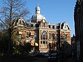
villa in Dordrecht, Netherlands  | |||||
| Upload media | |||||
| Instance of | |||||
|---|---|---|---|---|---|
| Part of | |||||
| Location | Dordrecht, South Holland, Netherlands | ||||
| Street address |
| ||||
| Located on street | |||||
| Heritage designation |
| ||||
 | |||||
|
This is a category about rijksmonument number 13642
|
| Address |
|
Media in category "Landhuis de Rozenhof"
The following 17 files are in this category, out of 17 total.
-
 Achtergevel - Dordrecht - 20062534 - RCE.jpg 1,200 × 954; 389 KB
-
 Gevel - Dordrecht - 20062530 - RCE.jpg 1,200 × 959; 323 KB
-
 Gevel - Dordrecht - 20062531 - RCE.jpg 1,200 × 956; 266 KB
-
 Landhuis de Rozenhof - Dordrecht - 20062510 - RCE.jpg 1,200 × 804; 189 KB
-
 Linker zijgevel - Dordrecht - 20062532 - RCE.jpg 1,200 × 962; 279 KB
-
 Mozaiek Villa Rozenhof, Dordrecht. De Architectuur.JPG 2,304 × 3,072; 2.77 MB
-
 Overzicht - Dordrecht - 20062515 - RCE.jpg 1,200 × 957; 215 KB
-
 Overzicht - Dordrecht - 20062518 - RCE.jpg 1,200 × 960; 272 KB
-
 Overzicht - Dordrecht - 20062519 - RCE.jpg 1,200 × 968; 311 KB
-
 Overzicht - Dordrecht - 20062520 - RCE.jpg 1,200 × 962; 309 KB
-
 Overzicht - Dordrecht - 20062521 - RCE.jpg 1,200 × 959; 302 KB
-
 Overzicht - Dordrecht - 20062529 - RCE.jpg 1,200 × 954; 265 KB
-
 Overzicht voorgevel - Dordrecht - 20377030 - RCE.jpg 1,200 × 956; 299 KB
-
 Rechter zijgevel - Dordrecht - 20062533 - RCE.jpg 964 × 1,200; 295 KB
-
 Rijksmonument - Arco Ardon - Dordrecht - Rozenhof.jpg 3,238 × 2,428; 3.06 MB
-
 Rozenhof, Dordrecht (12171957606).jpg 5,646 × 3,764; 14.25 MB
-
 Villa Rozenhof.JPG 3,072 × 2,304; 4.01 MB


.jpg)