Category:Landkey
English: Landkey is a small village in the county of Devon in the south-west of England with a population of 2274. It is situated from the nearest town of Barnstaple.
village in the United Kingdom  | |||||
| Upload media | |||||
| Instance of | |||||
|---|---|---|---|---|---|
| Location | North Devon, Devon, South West England, England | ||||
 | |||||
Subcategories
This category has the following 5 subcategories, out of 5 total.
A
- Acland Barton (4 F)
L
- Landkey War Memorial (3 F)
- Landkey, Venn Quarry (3 F)
M
- Millennium Green, Landkey (10 F)
S
Media in category "Landkey"
The following 200 files are in this category, out of 298 total.
(previous page) (next page)-
 A bridge joining Church Meadow with Brook Court - geograph.org.uk - 3236515.jpg 1,600 × 1,063; 638 KB
-

-

-

-
 A Bridge Over Venn Stream Between Higher ^ Lower Venn - geograph.org.uk - 3187977.jpg 1,600 × 1,063; 815 KB
-
 A Bridge Over Venn Stream Between Lower ^ Higher Venn - geograph.org.uk - 3187982.jpg 1,600 × 1,063; 810 KB
-
 A Bridge over Venn Stream Between Lower ^ Higher Venn - geograph.org.uk - 3187997.jpg 1,600 × 1,063; 827 KB
-
 A Bridge Over Venn Stream On Bableigh Road At Landkey - geograph.org.uk - 3220247.jpg 1,600 × 1,063; 755 KB
-
 A corner of Portmore Golf Park - geograph.org.uk - 661587.jpg 640 × 359; 47 KB
-
 A drain enters Venn Stream to the left of the image - geograph.org.uk - 3217923.jpg 1,600 × 1,063; 770 KB
-
 A footbridge which takes the footpath over Venn Quarry - geograph.org.uk - 3217927.jpg 1,600 × 1,063; 763 KB
-
 A footpath between Landkey and Venn - geograph.org.uk - 3252261.jpg 1,063 × 1,600; 931 KB
-
 A glimpse of the quarry plant in the Venn Valley - geograph.org.uk - 6359716.jpg 1,024 × 768; 299 KB
-

-
 A hidden bridge which carried the Devon and Somerset Railway - geograph.org.uk - 5675979.jpg 6,000 × 4,000; 5.05 MB
-
 A hidden bridge which carried the Devon and Somerset Railway - geograph.org.uk - 5675981.jpg 6,000 × 4,000; 4.84 MB
-
 A hidden bridge which carried the Devon and Somerset Railway - geograph.org.uk - 5675986.jpg 6,000 × 4,000; 5.18 MB
-

-
 A steep valley below the Eastern rim of Codden Hill - geograph.org.uk - 4991049.jpg 3,648 × 2,048; 1.81 MB
-
 A stream passing under Mill Road - geograph.org.uk - 3236964.jpg 1,063 × 1,600; 680 KB
-

-
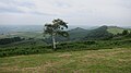
 A tree on a hill at Landkey - geograph.org.uk - 3252275.jpg 1,600 × 1,063; 408 KB
-

-

-

-
 A view of Venn Quarry from a footbridge - geograph.org.uk - 3217928.jpg 1,600 × 1,063; 454 KB
-
 A waterway alongside Tanners Lane - geograph.org.uk - 3236951.jpg 1,063 × 1,600; 455 KB
-

-
 A361 northwest bound - geograph.org.uk - 3126914.jpg 640 × 480; 64 KB
-
 A361 northwest bound - geograph.org.uk - 3126916.jpg 640 × 480; 59 KB
-
 A361 northwest bound - geograph.org.uk - 3126922.jpg 640 × 480; 58 KB
-
 A361 northwest bound - geograph.org.uk - 3126931.jpg 640 × 480; 60 KB
-
 A361 northwest bound - geograph.org.uk - 3126945.jpg 640 × 480; 54 KB
-
 A361 northwest bound - geograph.org.uk - 3126970.jpg 640 × 480; 49 KB
-
 A361 northwest bound - geograph.org.uk - 3126971.jpg 640 × 480; 49 KB
-
 A361 northwest bound - geograph.org.uk - 3126973.jpg 640 × 480; 52 KB
-
 A361 northwest bound - geograph.org.uk - 3126979.jpg 640 × 480; 56 KB
-
 A361 southeast bound - geograph.org.uk - 3289546.jpg 640 × 480; 80 KB
-
 A361 southeast bound - geograph.org.uk - 3335918.jpg 640 × 480; 48 KB
-
 A361 southwest bound - geograph.org.uk - 3126983.jpg 640 × 480; 48 KB
-
 A361, the Barnstaple by-pass - geograph.org.uk - 4043129.jpg 1,536 × 1,152; 955 KB
-
 Acland Road bridge over A361 - geograph.org.uk - 6109800.jpg 1,600 × 1,067; 928 KB
-
 Airwave Tetra Mast on Greysholt Cross - geograph.org.uk - 4929106.jpg 1,200 × 1,600; 385 KB
-
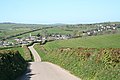
 Approaching Landkey - geograph.org.uk - 610143.jpg 640 × 428; 122 KB
-
 Approaching Portmore Roundabout from the A361 westbound - geograph.org.uk - 5273115.jpg 6,000 × 4,000; 4.61 MB
-
 Approaching Portmore Roundabout from the A361 westbound - geograph.org.uk - 5273117.jpg 6,000 × 4,000; 5.06 MB
-
 Approaching the new Portmore Roundabout from the east - geograph.org.uk - 5480497.jpg 6,000 × 4,000; 4.74 MB
-
 Approaching the new Portmore Roundabout from the south west - geograph.org.uk - 5480517.jpg 6,000 × 4,000; 4.56 MB
-
 Approaching the Portmore Roundabout from the East - geograph.org.uk - 5313534.jpg 4,000 × 3,000; 4.13 MB
-
 Bableigh Road, Landkey - geograph.org.uk - 6360649.jpg 1,024 × 830; 183 KB
-
 Barns at East Acland and sign to Acland Barton - geograph.org.uk - 6109811.jpg 1,600 × 1,200; 572 KB
-
 Barnstaple , The A361 - geograph.org.uk - 3359331.jpg 4,288 × 2,848; 6 MB
-
 BeaupelArms.png 1,108 × 1,214; 231 KB
-
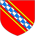 BeaupleArms.PNG 274 × 283; 46 KB
-
 Beech wood - geograph.org.uk - 667692.jpg 640 × 480; 148 KB
-

-
 Birch Road - geograph.org.uk - 6290859.jpg 1,024 × 771; 312 KB
-
 Birch Road - geograph.org.uk - 6290959.jpg 1,024 × 768; 347 KB
-
 Bishop's Tawton , Landkey Scenery - geograph.org.uk - 6422250.jpg 6,000 × 4,000; 6.65 MB
-
 Blakes Hill Road, Landkey - geograph.org.uk - 4763765.jpg 1,920 × 1,280; 412 KB
-
 Blakes Hill Road, Landkey - geograph.org.uk - 6290852.jpg 1,024 × 805; 139 KB
-
 Bradninch Cross - geograph.org.uk - 6109826.jpg 1,600 × 1,174; 632 KB
-
 Bridge over Venn Stream - geograph.org.uk - 6359569.jpg 1,024 × 815; 331 KB
-

-
 Bus shelter on north-west of Landkey - geograph.org.uk - 4043120.jpg 1,536 × 1,023; 906 KB
-
 Castle Mill, Landkey - geograph.org.uk - 3602592.jpg 640 × 480; 79 KB
-

-

-
 Coney Gut valley - geograph.org.uk - 1757578.jpg 640 × 403; 62 KB
-
 Coronavirus Lockdown Skeletons in Landkey.jpg 4,388 × 3,177; 11.85 MB
-
 Dead end - geograph.org.uk - 6086891.jpg 1,024 × 768; 290 KB
-
 East Acland - geograph.org.uk - 6109809.jpg 1,600 × 1,200; 1.07 MB
-

-
 Farm building at East Acland - geograph.org.uk - 6179126.jpg 1,024 × 768; 213 KB
-
 Farmland above Willesleigh - geograph.org.uk - 6179625.jpg 1,024 × 776; 200 KB
-
 Farmyard at East Acland - geograph.org.uk - 6179148.jpg 1,024 × 768; 216 KB
-
 Field by Stony Lane - geograph.org.uk - 4763751.jpg 2,678 × 1,714; 1.05 MB
-
 Footbridge on the Millennium Green - geograph.org.uk - 6085876.jpg 1,024 × 768; 361 KB
-
 For the homeless - geograph.org.uk - 6086886.jpg 640 × 480; 88 KB
-
 From Greysholt Cross - geograph.org.uk - 4763747.jpg 1,920 × 1,280; 788 KB
-

-
 Greysholt Cross - geograph.org.uk - 4763739.jpg 1,920 × 1,280; 1,002 KB
-
 Greysholt Cross - geograph.org.uk - 4763744.jpg 1,920 × 1,280; 638 KB
-
 Hall Farmhouse - geograph.org.uk - 6178970.jpg 1,024 × 768; 226 KB
-
 Hedgeless banks on road to Bradninch - geograph.org.uk - 6109815.jpg 1,600 × 941; 543 KB
-
 Higher Bableigh Farm - geograph.org.uk - 4913064.jpg 5,761 × 3,840; 5.5 MB
-
 Higher Harford - geograph.org.uk - 618954.jpg 640 × 331; 38 KB
-
 Higher Venn Cross - geograph.org.uk - 6359719.jpg 1,024 × 768; 325 KB
-
 Higher Venn Cross near Venn Quarries - geograph.org.uk - 3217160.jpg 1,600 × 1,063; 856 KB
-
 Houses along Blakes Hill Road, Landkey.jpg 4,592 × 3,448; 11.86 MB
-
 Houses at Mount View - geograph.org.uk - 750043.jpg 640 × 480; 53 KB
-
 Information board, Venn Quarry - geograph.org.uk - 3704237.jpg 3,776 × 2,889; 1.55 MB
-
 Jon Beer Auto Services, Cradleman's Cross - geograph.org.uk - 6360661.jpg 1,024 × 760; 137 KB
-
 Joy Cross - geograph.org.uk - 1757816.jpg 640 × 480; 95 KB
-
 Lake near Landkey - geograph.org.uk - 3704277.jpg 1,920 × 1,334; 605 KB
-
 Lake near Landkey - geograph.org.uk - 3704284.jpg 1,920 × 1,323; 529 KB
-
 Landkey , Aggregate Industries - geograph.org.uk - 6424288.jpg 6,000 × 4,000; 7.87 MB
-
 Landkey , Bableigh Cross - geograph.org.uk - 6422090.jpg 6,000 × 4,000; 7.15 MB
-
 Landkey , Bableigh Road - geograph.org.uk - 6422075.jpg 6,000 × 4,000; 4.42 MB
-
 Landkey , Bableigh Road - geograph.org.uk - 6422080.jpg 6,000 × 4,000; 4.57 MB
-
 Landkey , Bakery Way - geograph.org.uk - 6424437.jpg 6,000 × 4,000; 7.5 MB
-
 Landkey , Blakes Hill Road - geograph.org.uk - 5232449.jpg 6,000 × 4,000; 5.7 MB
-
 Landkey , Blakes Hill Road - geograph.org.uk - 5232450.jpg 5,580 × 3,721; 6.97 MB
-
 Landkey , Blakes Hill Road - geograph.org.uk - 6420755.jpg 6,000 × 4,000; 5.73 MB
-
 Landkey , Blakes Hill Road - geograph.org.uk - 6420761.jpg 6,000 × 4,000; 5.68 MB
-
 Landkey , Blakes Hill Road - geograph.org.uk - 6424472.jpg 6,000 × 4,000; 6.74 MB
-
 Landkey , Challacombe Close - geograph.org.uk - 6424449.jpg 6,000 × 4,000; 5.83 MB
-
 Landkey , Clement's Lane - geograph.org.uk - 6422092.jpg 6,000 × 4,000; 7.81 MB
-
 Landkey , Clement's Lane - geograph.org.uk - 6422094.jpg 6,000 × 4,000; 7.86 MB
-
 Landkey , Clement's Lane - geograph.org.uk - 6422102.jpg 4,000 × 6,000; 6.96 MB
-
 Landkey , Clement's Lane - geograph.org.uk - 6422106.jpg 6,000 × 4,000; 4.58 MB
-
 Landkey , Country Lane - geograph.org.uk - 6422016.jpg 6,000 × 4,000; 6.21 MB
-
 Landkey , Countryside Scenery - geograph.org.uk - 6422033.jpg 6,000 × 4,000; 7.28 MB
-
 Landkey , Countryside Scenery - geograph.org.uk - 6422061.jpg 6,000 × 4,000; 7.36 MB
-
 Landkey , Countryside Scenery - geograph.org.uk - 6422095.jpg 6,000 × 4,000; 4.69 MB
-
 Landkey , Footbridge - geograph.org.uk - 6424302.jpg 6,000 × 4,000; 7.03 MB
-
 Landkey , Footpath - geograph.org.uk - 6424281.jpg 6,000 × 4,000; 7.35 MB
-
 Landkey , Footpath - geograph.org.uk - 6424282.jpg 6,000 × 4,000; 7.88 MB
-
 Landkey , Footpath - geograph.org.uk - 6424284.jpg 4,000 × 6,000; 7.61 MB
-
 Landkey , Footpath - geograph.org.uk - 6424286.jpg 6,000 × 4,000; 6.11 MB
-
 Landkey , Footpath - geograph.org.uk - 6424297.jpg 6,000 × 4,000; 7.34 MB
-
 Landkey , Footpath - geograph.org.uk - 6424300.jpg 6,000 × 4,000; 6.67 MB
-
 Landkey , Footpath - geograph.org.uk - 6424301.jpg 6,000 × 4,000; 6.52 MB
-
 Landkey , Footpath - geograph.org.uk - 6424337.jpg 6,000 × 4,000; 7.42 MB
-
 Landkey , Footpath - geograph.org.uk - 6424340.jpg 6,000 × 4,000; 7.04 MB
-
 Landkey , Footpath - geograph.org.uk - 6424342.jpg 6,000 × 4,000; 7.45 MB
-
 Landkey , Footpath - geograph.org.uk - 6424386.jpg 6,000 × 4,000; 6.42 MB
-
 Landkey , Grassy Field - geograph.org.uk - 6422024.jpg 6,000 × 4,000; 4.78 MB
-
 Landkey , Grassy Field - geograph.org.uk - 6422045.jpg 6,000 × 4,000; 4.71 MB
-
 Landkey , Grassy Field - geograph.org.uk - 6422047.jpg 6,000 × 4,000; 7.28 MB
-
 Landkey , Grassy Field - geograph.org.uk - 6422048.jpg 6,000 × 4,000; 5.71 MB
-
 Landkey , Grassy Field - geograph.org.uk - 6422071.jpg 6,000 × 4,000; 5.82 MB
-
 Landkey , Grassy Field - geograph.org.uk - 6422076.jpg 6,000 × 4,000; 7.14 MB
-
 Landkey , Grassy Field - geograph.org.uk - 6422077.jpg 6,000 × 4,000; 7.78 MB
-
 Landkey , Grassy Field - geograph.org.uk - 6424290.jpg 6,000 × 4,000; 5.15 MB
-
 Landkey , Grassy Field - geograph.org.uk - 6424292.jpg 6,000 × 4,000; 6.31 MB
-
 Landkey , Grassy Field - geograph.org.uk - 6424383.jpg 6,000 × 4,000; 5.91 MB
-
 Landkey , Grassy Field - geograph.org.uk - 6424403.jpg 6,000 × 4,000; 7.45 MB
-
 Landkey , Grassy Field ^ Gate - geograph.org.uk - 6422010.jpg 6,000 × 4,000; 5.3 MB
-
 Landkey , Grassy Field ^ Sheep - geograph.org.uk - 6422072.jpg 6,000 × 4,000; 4.78 MB
-
 Landkey , Grassy Field ^ Sheep - geograph.org.uk - 6422073.jpg 6,000 × 4,000; 7.54 MB
-
 Landkey , Grassy Field ^ Sheep - geograph.org.uk - 6422074.jpg 6,000 × 4,000; 4.29 MB
-
 Landkey , Higher Bableigh - geograph.org.uk - 6422082.jpg 6,000 × 4,000; 5.41 MB
-
 Landkey , Higher Bableigh - geograph.org.uk - 6422087.jpg 6,000 × 4,000; 5.3 MB
-
 Landkey , House - geograph.org.uk - 6424431.jpg 6,000 × 4,000; 7.32 MB
-
 Landkey , Landkey Scenery - geograph.org.uk - 6422003.jpg 6,000 × 4,000; 5.28 MB
-
 Landkey , Landkey Scenery - geograph.org.uk - 6422025.jpg 6,000 × 4,000; 6.32 MB
-
 Landkey , Landkey Stores - geograph.org.uk - 6424468.jpg 6,000 × 4,000; 4.71 MB
-
 Landkey , Manor Road - geograph.org.uk - 5232451.jpg 5,509 × 3,673; 6.52 MB
-
 Landkey , Manor Road - geograph.org.uk - 6424424.jpg 6,000 × 4,000; 6.27 MB
-
 Landkey , Manor Road - geograph.org.uk - 6424434.jpg 6,000 × 4,000; 7.42 MB
-
 Landkey , Newland - geograph.org.uk - 5232452.jpg 6,000 × 4,000; 5.06 MB
-
 Landkey , Newland Park - geograph.org.uk - 6422006.jpg 6,000 × 4,000; 4.61 MB
-
 Landkey , Newland Park Road - geograph.org.uk - 6422001.jpg 6,000 × 4,000; 7.55 MB
-
 Landkey , Newland Park Road - geograph.org.uk - 6422004.jpg 6,000 × 4,000; 7.75 MB
-
 Landkey , Newland Park Road - geograph.org.uk - 6422008.jpg 6,000 × 4,000; 6.6 MB
-
 Landkey , Newland Park Road - geograph.org.uk - 6422014.jpg 6,000 × 4,000; 5.76 MB
-
 Landkey , Road - geograph.org.uk - 6420759.jpg 6,000 × 4,000; 6.92 MB
-
 Landkey , South Hayes Copse - geograph.org.uk - 6420764.jpg 6,000 × 4,000; 7.84 MB
-
 Landkey , St Paul's Church - geograph.org.uk - 6424418.jpg 6,000 × 4,000; 6.79 MB
-
 Landkey , Stream - geograph.org.uk - 6420768.jpg 6,000 × 4,000; 6.61 MB
-
 Landkey , Stream - geograph.org.uk - 6420774.jpg 6,000 × 4,000; 6.48 MB
-
 Landkey , Stream - geograph.org.uk - 6420775.jpg 6,000 × 4,000; 5.05 MB
-
 Landkey , Venn Hill - geograph.org.uk - 6424298.jpg 6,000 × 4,000; 6.56 MB
-
 Landkey , Venn Hill - geograph.org.uk - 6424321.jpg 6,000 × 4,000; 6.58 MB
-
 Landkey , Venn Stream - geograph.org.uk - 6424318.jpg 6,000 × 4,000; 7.31 MB
-
 Landkey , Venn Stream - geograph.org.uk - 6424320.jpg 6,000 × 4,000; 7.25 MB
-
 Landkey , Venn Stream - geograph.org.uk - 6424329.jpg 6,000 × 4,000; 6.54 MB
-
 Landkey , Venn Stream - geograph.org.uk - 6424334.jpg 6,000 × 4,000; 7.14 MB
-
 Landkey , War Memorial - geograph.org.uk - 6424466.jpg 6,000 × 4,000; 7.13 MB
-
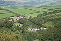
 Landkey as viewed from Codden Hill - geograph.org.uk - 1754397.jpg 1,024 × 683; 171 KB
-
 Landkey Church and its surrounds - geograph.org.uk - 3015355.jpg 1,600 × 1,175; 484 KB
-
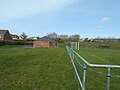
 Landkey Playing Fields - geograph.org.uk - 3582302.jpg 640 × 480; 131 KB
-
 Landkey Town FC - geograph.org.uk - 6085863.jpg 1,024 × 768; 147 KB
-
 Landkey Village Hall - geograph.org.uk - 4043109.jpg 1,536 × 1,025; 795 KB
-
 Landkey, barn - geograph.org.uk - 405229.jpg 640 × 427; 261 KB
-
 Landkey, by West Bradninch - geograph.org.uk - 405252.jpg 640 × 427; 189 KB
-
 Landkey, Early Purple Orchid - geograph.org.uk - 405235.jpg 640 × 427; 217 KB
-
 Landkey, Higher Bableigh - geograph.org.uk - 555025.jpg 640 × 427; 213 KB
-
 Landkey, Joy Cross - geograph.org.uk - 405248.jpg 640 × 427; 228 KB
-
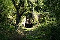 Landkey, old limekiln - geograph.org.uk - 555007.jpg 640 × 427; 281 KB
-
 Landkey, ruin by Venn Quarry - geograph.org.uk - 555006.jpg 640 × 427; 281 KB
-
 Landkey, St Paul's church, Landkey Town - geograph.org.uk - 554998.jpg 640 × 427; 183 KB
-
 Landkey, Tarka Trail - geograph.org.uk - 555012.jpg 640 × 427; 270 KB
-
 Landkey, towards Barnstaple - geograph.org.uk - 405215.jpg 640 × 427; 180 KB
-
 Landkey, towards Goodleigh - geograph.org.uk - 405243.jpg 640 × 427; 161 KB
-
 Landkey, towards Landkey Newland - geograph.org.uk - 554996.jpg 640 × 427; 145 KB
-
 Landkey, towards Venn Quarry - geograph.org.uk - 555000.jpg 640 × 427; 202 KB
-
 Lane at East Acland - geograph.org.uk - 1757964.jpg 640 × 480; 110 KB
-
 Lane at Westacott - geograph.org.uk - 1757572.jpg 465 × 640; 120 KB
-
 Lane junction near Bableigh - geograph.org.uk - 4763733.jpg 1,920 × 1,280; 758 KB
-
 Lane near East Acland - geograph.org.uk - 1757924.jpg 640 × 479; 100 KB
-
 Lane north of Westacott - geograph.org.uk - 1757592.jpg 640 × 480; 102 KB
-
 Lane to East Acland - geograph.org.uk - 1757932.jpg 640 × 480; 80 KB
-
 Lane to Willesleigh Cross - geograph.org.uk - 1757688.jpg 640 × 445; 101 KB
-
 Lay-by (westbound) by A361 south of Westacott - geograph.org.uk - 4043127.jpg 1,536 × 1,153; 868 KB
-
 Lay-by by A361 south of Westacott - geograph.org.uk - 4043125.jpg 1,536 × 1,022; 730 KB
-

-
 Looking down a stream from Mill Road - geograph.org.uk - 3236961.jpg 1,600 × 1,063; 655 KB
-


_by_A361_south_of_Westacott_-_geograph.org.uk_-_4043127.jpg)


