Category:Lange Voorhout 27, The Hague
| Object location | | View all coordinates using: OpenStreetMap |
|---|
building in The Hague, Netherlands  | |||||
| Upload media | |||||
| Instance of | |||||
|---|---|---|---|---|---|
| Location | The Hague, South Holland, Netherlands | ||||
| Located on street |
| ||||
| Heritage designation |
| ||||
 | |||||
|
This is a category about rijksmonument number 17685
|
| Address |
|
Media in category "Lange Voorhout 27, The Hague"
The following 7 files are in this category, out of 7 total.
-
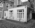
 Achterzijde - 's-Gravenhage - 20091141 - RCE.jpg 960 × 1,200; 226 KB
-
 Achterzijde - 's-Gravenhage - 20091142 - RCE.jpg 1,200 × 971; 285 KB
-
 Den Haag - Lange Voorhout 27.JPG 2,736 × 3,648; 4.83 MB
-
 Ingang - 's-Gravenhage - 20091136 - RCE.jpg 866 × 1,200; 205 KB
-
 Overzicht gevels - 's-Gravenhage - 20091139 - RCE.jpg 1,200 × 952; 344 KB
-
 Overzicht gevels - 's-Gravenhage - 20091140 - RCE.jpg 1,200 × 958; 328 KB
-
 Voordeuren - 's-Gravenhage - 20091138 - RCE.jpg 886 × 1,200; 190 KB


