Category:Langendijk 54, Vianen
| Object location | | View all coordinates using: OpenStreetMap |
|---|
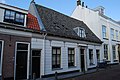
building in Vianen, Netherlands  | |||||
| Upload media | |||||
| Instance of | |||||
|---|---|---|---|---|---|
| Location | Vianen, Vijfheerenlanden, Utrecht, Netherlands | ||||
| Street address |
| ||||
| Located on street |
| ||||
| Heritage designation |
| ||||
 | |||||
|
This is a category about rijksmonument number 37292
|
| Address |
|
Media in category "Langendijk 54, Vianen"
The following 6 files are in this category, out of 6 total.
-
 Kelder - Vianen - 20242073 - RCE.jpg 1,200 × 952; 173 KB
-
 Spiltrap - Vianen - 20242074 - RCE.jpg 950 × 1,200; 130 KB
-
 Vianen - Langendijk 54 - Rijksmonument 37292.JPG 3,872 × 2,592; 3.76 MB
-
 Voorgevel - Vianen - 20242069 - RCE.jpg 1,195 × 1,200; 305 KB
-
 Voorgevel - Vianen - 20242071 - RCE.jpg 1,200 × 958; 250 KB
-
 Voorkamer (linker) - Vianen - 20242072 - RCE.jpg 959 × 1,200; 148 KB


_-_Vianen_-_20242072_-_RCE.jpg)