Category:Langestraat 41, Nijkerk
| Object location | | View all coordinates using: OpenStreetMap |
|---|
 | |||||
| Upload media | |||||
| Instance of |
| ||||
|---|---|---|---|---|---|
| Location | Nijkerk, Gelderland, Netherlands | ||||
| Street address |
| ||||
| Located on street |
| ||||
| Heritage designation |
| ||||
 | |||||
|
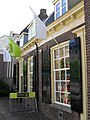
This is a category about rijksmonument number 30998
|
| Address |
|
Media in category "Langestraat 41, Nijkerk"
The following 2 files are in this category, out of 2 total.
-
 Langestraat 41.JPG 2,736 × 3,648; 1.63 MB
-
 Overzicht, reproductie van prentbriefkaart - Nijkerk - 20166599 - RCE.jpg 1,200 × 976; 258 KB
