Category:Langwith, Derbyshire
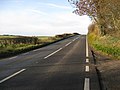
English: Langwith is one of a close group of four villages crossing the Derbyshire–Nottinghamshire border, on the River Poulter only about two miles from Warsop, and about four miles from Bolsover, on the A632 road, south of Whaley Thorns.

village and civil parish in Derbyshire, United Kingdom  | |||||
| Upload media | |||||
| Instance of | |||||
|---|---|---|---|---|---|
| Location | Bolsover, Derbyshire, East Midlands, England | ||||
 | |||||
Subcategories
This category has the following 4 subcategories, out of 4 total.
Media in category "Langwith, Derbyshire"
The following 200 files are in this category, out of 200 total.
-
 "Private Woodland Keep Out", Scarcliffe Park - geograph.org.uk - 4937521.jpg 5,184 × 3,888; 7.39 MB
-
 56022 & 56126 Norwood Crossing.jpg 1,500 × 1,021; 176 KB
-
 A former Langwith Colliery Coal Wagon - geograph.org.uk - 4334612.jpg 1,600 × 1,062; 648 KB
-
 A path across a planted field - geograph.org.uk - 2269869.jpg 3,648 × 2,736; 5.56 MB
-
 A632 at Cross Hills - geograph.org.uk - 3013168.jpg 640 × 462; 61 KB
-

-
 A632 at Pit Hill - geograph.org.uk - 3530081.jpg 640 × 420; 62 KB
-
 A632 at Pit Hill junction - geograph.org.uk - 3013109.jpg 640 × 316; 49 KB
-
 A632 at Scarcliffe Lanes - geograph.org.uk - 3013118.jpg 640 × 430; 51 KB
-
 A632 at The Gate Hotel - geograph.org.uk - 3530087.jpg 640 × 352; 52 KB
-
 A632 at Upper Langwith - geograph.org.uk - 2044049.jpg 640 × 480; 51 KB
-
 A632 at Upper Langwith road junction - geograph.org.uk - 3013171.jpg 640 × 401; 53 KB
-
 A632 entering Langwith - geograph.org.uk - 5765713.jpg 1,024 × 768; 295 KB
-
 A632 heading west - geograph.org.uk - 2044891.jpg 640 × 480; 42 KB
-
 A632 in Langwith - geograph.org.uk - 2044045.jpg 640 × 480; 79 KB
-
 A632 Langwith - geograph.org.uk - 99299.jpg 640 × 423; 73 KB
-
 A632 near Langwith - geograph.org.uk - 2044047.jpg 640 × 480; 53 KB
-
 A632 near Langwith - geograph.org.uk - 2044048.jpg 640 × 480; 61 KB
-
 A632 near Langwith - geograph.org.uk - 2224342.jpg 900 × 675; 306 KB
-
 A632 near Scarcliffe - geograph.org.uk - 2044888.jpg 640 × 480; 79 KB
-
 A632 near Upper Langwith - geograph.org.uk - 2044050.jpg 640 × 480; 47 KB
-
 A632 on Fox Hill - geograph.org.uk - 2044894.jpg 640 × 480; 43 KB
-
 A632 road junction at Old Hall - geograph.org.uk - 3013111.jpg 640 × 400; 42 KB
-
 A632 towards Chesterfield - geograph.org.uk - 4302040.jpg 640 × 480; 58 KB
-

-
 Across the field to Langwith - geograph.org.uk - 3817684.jpg 4,000 × 2,248; 4.81 MB
-
 Acute junction on the A632 - geograph.org.uk - 2224450.jpg 900 × 548; 228 KB
-

-
 Arable field north of Langwith Road - near Bolsover - geograph.org.uk - 3220514.jpg 4,168 × 2,779; 2.85 MB
-
 Ash Tree by the Archaeological Way - geograph.org.uk - 2668397.jpg 3,296 × 2,472; 1.01 MB
-
 Autumnal Scene in Upper Langwith - geograph.org.uk - 2668255.jpg 3,296 × 2,472; 1.01 MB
-
 Bridge over the railway south of Langwith - geograph.org.uk - 4937902.jpg 5,045 × 3,783; 4.74 MB
-
 Bridleway in Scarcliffe Park - geograph.org.uk - 3818140.jpg 4,000 × 2,248; 7.73 MB
-
 Bridleway to Whaley - geograph.org.uk - 5788283.jpg 1,024 × 768; 137 KB
-
 Bridleway towards Scarcliffe Park - geograph.org.uk - 3584458.jpg 1,600 × 1,200; 612 KB
-
 Bridleway, Scarcliffe Park - geograph.org.uk - 5183322.jpg 1,938 × 2,000; 2.02 MB
-
 Buildings on Pit Hill, Nether Langwith - geograph.org.uk - 4334563.jpg 1,600 × 1,062; 614 KB
-
 By the southern path into Scarcliffe Park Woods - geograph.org.uk - 4937538.jpg 3,888 × 5,184; 5.27 MB
-
 Chapel Street, Whaley Thorns - geograph.org.uk - 4334572.jpg 1,600 × 1,062; 587 KB
-
 Country road near Langwith Junction - geograph.org.uk - 2044885.jpg 640 × 480; 40 KB
-
 Dale Close, Nether Langwith - geograph.org.uk - 4334539.jpg 1,600 × 1,144; 818 KB
-
 East end of Rectory Road, Upper Langwith - geograph.org.uk - 5765627.jpg 1,024 × 768; 255 KB
-
 East end of Whaley Road, Langwith - geograph.org.uk - 5765726.jpg 1,024 × 768; 220 KB
-
 Entry to car park for Poulter Country Park - geograph.org.uk - 3818135.jpg 4,000 × 2,248; 6.44 MB
-
 Farm at Scarcliffe Lanes - geograph.org.uk - 3530169.jpg 640 × 409; 48 KB
-
 Farm buildings at Scarcliffe Grange - geograph.org.uk - 2269892.jpg 3,648 × 2,736; 5.66 MB
-
 Farmland near Langwith - geograph.org.uk - 4034850.jpg 800 × 495; 61 KB
-
 Farmland near Scarcliffe Park - geograph.org.uk - 2241538.jpg 3,648 × 2,736; 6 MB
-
 Farmland near Whaley - geograph.org.uk - 4304093.jpg 640 × 480; 66 KB
-
-
 Field between Scarcliffe Park and Langwith - geograph.org.uk - 2824602.jpg 1,024 × 769; 300 KB
-
 Fields and a cottage, Scarcliffe - geograph.org.uk - 2269898.jpg 3,648 × 2,736; 5.83 MB
-
-
 Footbridge across the A632 west of Langwith - geograph.org.uk - 5765689.jpg 1,024 × 768; 249 KB
-
 Footbridge over the railway - geograph.org.uk - 5787967.jpg 1,024 × 768; 365 KB
-
 Footbridge over the River Poulter - geograph.org.uk - 2241548.jpg 1,600 × 1,200; 405 KB
-
 Footpath crossing the Owl Sick - geograph.org.uk - 5793137.jpg 1,024 × 768; 425 KB
-
 Footpath north of Langwith Junction - geograph.org.uk - 5765570.jpg 1,024 × 768; 172 KB
-
 Footpath over stubble field - geograph.org.uk - 4302037.jpg 640 × 480; 97 KB
-
 Footpath to Langwith - geograph.org.uk - 2224221.jpg 900 × 672; 362 KB
-
 Footpath to Park View - geograph.org.uk - 5792232.jpg 1,024 × 768; 326 KB
-
 Footpath to Whaley Road - geograph.org.uk - 5793119.jpg 1,024 × 768; 327 KB
-
 Footpath, Poulter Country Park - geograph.org.uk - 3281817.jpg 1,024 × 759; 368 KB
-
 Former Chapel on West Street, Whaley Thorns - geograph.org.uk - 4334574.jpg 1,600 × 1,062; 720 KB
-

-
 Former railway cutting - geograph.org.uk - 2252902.jpg 900 × 675; 449 KB
-
 Garage in Langwith - geograph.org.uk - 2044040.jpg 640 × 480; 50 KB
-
 Gildwells Cottages - geograph.org.uk - 2224438.jpg 900 × 575; 356 KB
-
 Grazing, Whaley - geograph.org.uk - 4304092.jpg 640 × 481; 54 KB
-
 High chair in Scarcliffe Wood - geograph.org.uk - 3819081.jpg 533 × 800; 200 KB
-
 Highest point in the Poulter Country Park - geograph.org.uk - 3281824.jpg 1,024 × 768; 261 KB
-
 Houses in Langwith Junction - geograph.org.uk - 2224171.jpg 900 × 673; 351 KB
-
 Houses on Portland Road, Nether Langwith - geograph.org.uk - 4334564.jpg 1,600 × 1,062; 610 KB
-
 Houses on Portland Road, Nether Langwith - geograph.org.uk - 4334565.jpg 1,600 × 1,062; 664 KB
-

-

-
 Kitchener Terrace, Whaley Thorns - geograph.org.uk - 4301063.jpg 640 × 480; 72 KB
-
 Lake by Whaley Road - geograph.org.uk - 2239677.jpg 679 × 900; 442 KB
-
 Lane towards Norwood level crossing - geograph.org.uk - 3584470.jpg 1,600 × 1,200; 433 KB
-
 Lane towards Norwood level crossing - geograph.org.uk - 3810535.jpg 1,024 × 768; 206 KB
-
 Lane towards Whaley Common - geograph.org.uk - 2824553.jpg 1,024 × 768; 176 KB
-
 Lane west of Norwood level crossing - geograph.org.uk - 3810536.jpg 1,024 × 768; 183 KB
-
 Langwith Basset cave - geograph.org.uk - 3274264.jpg 4,000 × 3,000; 5.07 MB
-
 Langwith Basset cave - geograph.org.uk - 3274274.jpg 4,000 × 3,000; 3.59 MB
-
 Langwith Bassett - Lane Junction - geograph.org.uk - 1003012.jpg 640 × 480; 130 KB
-
 Langwith Junction Loco Shed, 1964 - geograph.org.uk - 2353945.jpg 1,024 × 702; 75 KB
-
 Langwith Junction Social Club - geograph.org.uk - 5764768.jpg 1,024 × 768; 147 KB
-
 Langwith Junction Stores - geograph.org.uk - 4302043.jpg 640 × 480; 69 KB
-
 Langwith Post Office - geograph.org.uk - 4301065.jpg 640 × 480; 63 KB
-
 Langwith Road - geograph.org.uk - 4302050.jpg 640 × 480; 54 KB
-
 Langwith Road the A632 - geograph.org.uk - 2812207.jpg 640 × 472; 100 KB
-
 Langwith shopping - geograph.org.uk - 2044042.jpg 640 × 480; 53 KB
-
 Langwith-Whaley Thorns railway station - geograph.org.uk - 4024615.jpg 800 × 600; 104 KB
-
 Langwith-Whaley Thorns railway station - geograph.org.uk - 4301055.jpg 640 × 480; 103 KB
-

-
 Langwith-Whaley Thorns Station - geograph.org.uk - 5523478.jpg 4,608 × 3,456; 4.95 MB
-
 Langwith-Whaley Thorns Station - geograph.org.uk - 5523490.jpg 4,608 × 3,456; 4.3 MB
-
 Langwith-Whaley Thorns station - geograph.org.uk - 5765749.jpg 1,024 × 768; 193 KB
-
 Looking across arable land - Bolsover Moor - geograph.org.uk - 3220523.jpg 4,608 × 3,072; 3.45 MB
-

-
 Mag Lane, Norwood Level Crossing - geograph.org.uk - 2945392.jpg 3,456 × 2,304; 3.46 MB
-
 Main Street and Post Office in Whaley Thorns - geograph.org.uk - 4102024.jpg 3,822 × 2,753; 1.57 MB
-
 Marshland next to Scarcliffe Park - geograph.org.uk - 994733.jpg 640 × 480; 128 KB
-
 Meadow with buttercups, Whaley Thorns - geograph.org.uk - 5787965.jpg 1,024 × 768; 223 KB
-
 Memento of Langwith Colliery - geograph.org.uk - 5792222.jpg 1,024 × 768; 285 KB
-
 Memorial to the Langwith Colliery - geograph.org.uk - 1205324.jpg 597 × 400; 97 KB
-
 Minor road towards Whaley Common - geograph.org.uk - 4034855.jpg 800 × 580; 80 KB
-
 Moor Lane (A632) - geograph.org.uk - 1045751.jpg 640 × 480; 96 KB
-
 Moor Lane (A632) - geograph.org.uk - 1045754.jpg 640 × 480; 79 KB
-
 Moor Lane, A632 - geograph.org.uk - 1291253.jpg 640 × 480; 221 KB
-
 Mud, mud, glorious mud - geograph.org.uk - 3819076.jpg 533 × 800; 179 KB
-
 Muddy bridleway through Scarcliffe Park - geograph.org.uk - 3818143.jpg 4,000 × 2,248; 7.91 MB
-
 Near Cross Hills - geograph.org.uk - 2044882.jpg 640 × 480; 38 KB
-
 9702 & 31285 , Norwood Crossing.jpg 3,500 × 2,333; 5.08 MB
-
 Norwood level crossing - geograph.org.uk - 3819092.jpg 800 × 533; 84 KB
-
 Norwood Level Crossing and keeper's cottage, Mag Lane - geograph.org.uk - 2945404.jpg 3,456 × 2,304; 3.09 MB
-
 Norwood Level Crossing on Mag Lane - geograph.org.uk - 3817718.jpg 4,000 × 2,248; 4.41 MB
-
 Norwood Level Crossing on Mag Lane - geograph.org.uk - 4102051.jpg 4,000 × 3,000; 2.45 MB
-
 On a path through Scarcliffe Park - geograph.org.uk - 2241531.jpg 3,648 × 2,736; 5.97 MB
-
 Overlooking Scarcliffe Grange - geograph.org.uk - 2668463.jpg 3,296 × 2,472; 1.02 MB
-
 Park pale in Scarcliffe Wood - geograph.org.uk - 3819083.jpg 800 × 533; 191 KB
-
 Park Pale, Scarcliffe Park - geograph.org.uk - 2269854.jpg 3,648 × 2,736; 5.72 MB
-
 Path on disused railway, Whaley Thorns - geograph.org.uk - 4301054.jpg 640 × 480; 128 KB
-
 Path to St. Luke's church - geograph.org.uk - 5792236.jpg 1,024 × 768; 294 KB
-
 Petrol pump, attended service only - geograph.org.uk - 2224315.jpg 695 × 900; 412 KB
-
 Pine Tree at the Fringe of Scarcliffe Wood - geograph.org.uk - 2668454.jpg 3,296 × 2,472; 1.09 MB
-
 Pond in Poulter Country Park - geograph.org.uk - 5793131.jpg 1,024 × 768; 237 KB
-

-
 Poulter Country Park - geograph.org.uk - 5793123.jpg 1,024 × 768; 191 KB
-
 Poulter Country Park - geograph.org.uk - 994709.jpg 640 × 480; 103 KB
-
 Poulter Country Park - North Car Park - geograph.org.uk - 994713.jpg 640 × 480; 99 KB
-
 Power lines over the A632 - geograph.org.uk - 2044901.jpg 640 × 480; 50 KB
-
 Private Track into Scarcliffe Park - geograph.org.uk - 645137.jpg 640 × 480; 131 KB
-
 Rail bridge on Main Road, Nether Langwith - geograph.org.uk - 4334553.jpg 1,600 × 1,062; 852 KB
-
 Rail track - geograph.org.uk - 550979.jpg 640 × 480; 102 KB
-

-
 Railway bridge at Langwith - geograph.org.uk - 2224327.jpg 731 × 900; 374 KB
-

-

-

-
 Railway bridge over Whaley Road - geograph.org.uk - 4304082.jpg 640 × 480; 90 KB
-
 Railway from FB near New Plantation - geograph.org.uk - 6359688.jpg 1,024 × 768; 193 KB
-

-
 Railway line through Langwith - Whaley Thorns station - geograph.org.uk - 2824484.jpg 1,500 × 1,049; 738 KB
-
 Rectory Road, Upper Langwith - geograph.org.uk - 5765618.jpg 1,024 × 768; 233 KB
-
 Ride in Scarcliffe Park - geograph.org.uk - 5793140.jpg 1,024 × 715; 195 KB
-
 Riding ponies through Scarcliffe Park - geograph.org.uk - 5788280.jpg 1,024 × 768; 334 KB
-
 River Poulter enters the Robin Hood County - geograph.org.uk - 3817679.jpg 4,000 × 2,248; 7.71 MB
-
 River Poulter Valley, Upper Langwith - geograph.org.uk - 4302161.jpg 640 × 480; 70 KB
-
 Road to Langwith from Upper Langwith - geograph.org.uk - 5765657.jpg 1,024 × 768; 201 KB
-

-
 Robin Hood Railway Line - geograph.org.uk - 5523496.jpg 4,608 × 3,456; 5.7 MB
-
-
 Scarcliffe Park - Footpath Junction - geograph.org.uk - 994729.jpg 640 × 480; 135 KB
-
 Sheep and River Poulter near Upper Langwith - geograph.org.uk - 2668286.jpg 3,296 × 2,472; 1.16 MB
-
 Small lake near Whaley - geograph.org.uk - 2239691.jpg 675 × 900; 419 KB
-
 Small lake, Poulter Country Park - geograph.org.uk - 2252891.jpg 900 × 675; 454 KB
-
 Spencer's Cottage - geograph.org.uk - 4027108.jpg 800 × 600; 118 KB
-
 Sports field and recent housing, Whaley Thorns - geograph.org.uk - 5792522.jpg 1,024 × 768; 217 KB
-
 St Luke's Church in Whaley Thorns - geograph.org.uk - 4937909.jpg 5,021 × 3,767; 5.7 MB
-
 St. Luke's church, Whaley Thorns - geograph.org.uk - 5792203.jpg 1,024 × 768; 264 KB
-
 Station Road, Langwith Junction - geograph.org.uk - 5764773.jpg 1,024 × 768; 163 KB
-
 Steam and diesel at Langwith Junction, 1964 - geograph.org.uk - 2353966.jpg 1,024 × 686; 72 KB
-
 Stream with ducks, Whaley - geograph.org.uk - 2241526.jpg 3,648 × 2,736; 5.91 MB
-
 Stubble field off the A632, Langwith - geograph.org.uk - 4302039.jpg 640 × 480; 86 KB
-
 Terraced houses, Burlington Avenue - geograph.org.uk - 2224176.jpg 900 × 627; 286 KB
-
 Terraced housing on Portland Road - geograph.org.uk - 4301061.jpg 640 × 480; 64 KB
-
 The A632 towards Nether Langwith - geograph.org.uk - 4334535.jpg 1,600 × 1,088; 461 KB
-
 The Archaeological Way near Upper Langwith - geograph.org.uk - 2668295.jpg 3,296 × 2,472; 1.06 MB
-

-
 The Gate Hotel - geograph.org.uk - 2224319.jpg 900 × 638; 265 KB
-
 The Gate Hotel - geograph.org.uk - 4302033.jpg 640 × 480; 61 KB
-
 The Gate Hotel on Main Street, Nether Langwith - geograph.org.uk - 4334559.jpg 1,600 × 1,022; 459 KB
-

-
 The River Poulter at Langwith - geograph.org.uk - 3817192.jpg 800 × 508; 162 KB
-
 Track in Scarcliffe Park Wood - geograph.org.uk - 2668410.jpg 3,296 × 2,472; 1.1 MB
-
 Track junction in Scarcliffe Park - geograph.org.uk - 3584460.jpg 1,600 × 1,200; 881 KB
-
 Track through Scarcliffe Park - geograph.org.uk - 3818149.jpg 4,000 × 2,248; 6.24 MB
-
 Track through Scarcliffe Park - geograph.org.uk - 3818163.jpg 4,000 × 2,248; 6.02 MB
-
 Track through Scarcliffe Park - geograph.org.uk - 3818204.jpg 4,000 × 2,248; 7.55 MB
-
 Under the railway at Langwith - geograph.org.uk - 2044043.jpg 640 × 480; 64 KB
-

-
 View towards Langwith from the south - geograph.org.uk - 2224214.jpg 900 × 509; 278 KB
-
 Village Green in Whaley Thorns - geograph.org.uk - 4102027.jpg 3,760 × 2,656; 1.86 MB
-
 West end of Main Street, Whaley Thorns - geograph.org.uk - 5765741.jpg 1,024 × 768; 263 KB
-
 Whaley Common - Bridleway meets lane - geograph.org.uk - 1382782.jpg 640 × 480; 66 KB
-
 Whaley Road - geograph.org.uk - 4304086.jpg 640 × 480; 105 KB
-
 Whaley Road - geograph.org.uk - 4304094.jpg 640 × 480; 58 KB
-

-
 Whaley Thorns - Children's Centre - geograph.org.uk - 1820421.jpg 1,600 × 1,200; 360 KB
-
 Whaley Thorns - Long Willows Sports ^ Social Club - geograph.org.uk - 1820404.jpg 1,600 × 1,200; 565 KB
-
 Whaley Thorns - Post Office - geograph.org.uk - 1820413.jpg 1,600 × 1,200; 414 KB
-
 Whaley Thorns - railway footbridge - geograph.org.uk - 1820444.jpg 1,600 × 1,200; 693 KB
-
 Whaley Thorns - Wesleyan Church - geograph.org.uk - 1820439.jpg 1,600 × 1,200; 440 KB
-
 Whaley Thorns post office and convenience store - geograph.org.uk - 4937907.jpg 4,883 × 3,594; 2.98 MB
-
 Whaley Thorns Primary School - geograph.org.uk - 3817713.jpg 3,591 × 1,941; 4.66 MB
-
 Whaley Thorns Station car park - geograph.org.uk - 5523505.jpg 3,711 × 2,783; 2.52 MB
-
 Wooden garages, Whaley Thorns - geograph.org.uk - 5792207.jpg 1,024 × 768; 240 KB
-
 Woodland footpath, Scarcliffe Park - geograph.org.uk - 2239682.jpg 675 × 900; 434 KB
-
 Woodland, Scarcliffe Park - geograph.org.uk - 4304084.jpg 640 × 480; 118 KB


_-_geograph.org.uk_-_1045751.jpg)
_-_geograph.org.uk_-_1045754.jpg)


_-_geograph.org.uk_-_1045757.jpg)


