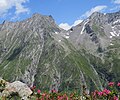
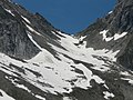
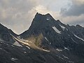
Category:Lapenscharte
col in the Zillertal Alps in Tyrol  | |||||
| Upload media | |||||
| Instance of | |||||
|---|---|---|---|---|---|
| Location | Mayrhofen, Schwaz District, Tyrol, Austria | ||||
| Carries | |||||
| Mountain range | |||||
| Elevation above sea level |
| ||||
 | |||||
Media in category "Lapenscharte"
The following 10 files are in this category, out of 10 total.
-
 Gigalitz (links), Greizer Spitze (rechts), dazwischen die Lapenscharte (von Westen).jpg 4,087 × 3,411; 7.36 MB
-
 Gigalitzturm von Mörchnerscharte.jpg 1,405 × 1,586; 945 KB
-
 Hinterer Floitengrund.jpg 3,264 × 2,448; 3.81 MB
-
 Lapenscharte Blick zum Stillupgrund.jpg 3,264 × 2,448; 3.83 MB
-
 Lapenscharte Stillupgrund-Seite.jpg 3,264 × 2,448; 3.81 MB
-
 Lapenscharte und Gigalitz von Osten.jpg 5,184 × 3,888; 4.91 MB
-
 Lapenscharte von Mörchnerscharte.jpg 3,264 × 2,448; 3.85 MB
-
 Lapenscharte Wollbachspitze.jpg 3,264 × 2,448; 3.45 MB
-
 Lapenscharte.jpg 1,391 × 917; 273 KB
-
 Zillertal Lapenscharte 2015-07.JPG 4,320 × 2,432; 4.32 MB
,_Greizer_Spitze_(rechts),_dazwischen_die_Lapenscharte_(von_Westen).jpg)


