Category:Larling
English: Larling is a village and part of the civil parish of Roundham and Larling, in the English county of Norfolk . The village is 8.5 miles east north east of Thetford, 21.4 miles west south west of Norwich and 94 miles north east of London. The nearest railway station is at Thetford for the Breckland Line which runs between Cambridge and Norwich. The nearest airport is Norwich International Airport. The village is situated a little south of theA11 Trunk road.
village in the United Kingdom  | |||||
| Upload media | |||||
| Instance of | |||||
|---|---|---|---|---|---|
| Location | Roudham and Larling, Breckland, Norfolk, East of England, England | ||||
 | |||||
Subcategories
This category has only the following subcategory.
E
Media in category "Larling"
The following 17 files are in this category, out of 17 total.
-

-
 Capturing the end of the rainbow - geograph.org.uk - 1709792.jpg 640 × 601; 89 KB
-
 OS Flush Bracket G1553 Larling - geograph.org.uk - 1921815.jpg 1,024 × 819; 261 KB
-
 Shaggy Ink Cap - geograph.org.uk - 569515.jpg 480 × 566; 166 KB
-
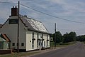
 The Angel - geograph.org.uk - 1866062.jpg 1,600 × 1,200; 424 KB
-
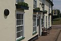
 The Angel, Larling - geograph.org.uk - 1942471.jpg 1,280 × 856; 149 KB
-
 The Angel, Larling - geograph.org.uk - 1942512.jpg 1,280 × 856; 153 KB
-
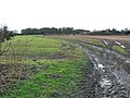
 Track approaching Manor Farm - geograph.org.uk - 1709796.jpg 640 × 480; 161 KB
-
 Track through fields in Larling - geograph.org.uk - 1709794.jpg 640 × 480; 125 KB
-
 Chair factory, Larling - geograph.org.uk - 569527.jpg 640 × 480; 136 KB
-
 East Harling Fen - geograph.org.uk - 223184.jpg 640 × 480; 119 KB
-
 Field Barn - geograph.org.uk - 394645.jpg 640 × 480; 99 KB
-
 For 20 Miles - geograph.org.uk - 385471.jpg 480 × 640; 80 KB
-
 Harling Road level crossing - geograph.org.uk - 383613.jpg 640 × 480; 82 KB
-
 Overa farm stud - geograph.org.uk - 631189.jpg 640 × 480; 83 KB
-
 Pig farm silos at Larling - geograph.org.uk - 569508.jpg 640 × 480; 182 KB
-
 Tree - geograph.org.uk - 383623.jpg 640 × 480; 99 KB


