Category:Lauchert
river in Germany  | |||||
| Upload media | |||||
| Instance of | |||||
|---|---|---|---|---|---|
| Location | Baden-Württemberg, Germany | ||||
| Length |
| ||||
| Elevation above sea level |
| ||||
| Mouth of the watercourse | |||||
| Drainage basin | |||||
| Tributary | |||||
 | |||||
Subcategories
This category has the following 17 subcategories, out of 17 total.
A
- Anna-Kapellen-Höhle (3 F)
B
- Bittelschießer Höhle (3 F)
E
- Eulenloch (5 F)
F
- Fohlenloch (5 F)
G
- Göpfelsteinhöhle (13 F)
H
- Hagentorhöhlen (1 F)
L
- Lauchertgraben (6 F)
N
- Nikolaushöhle (2 F)
Q
- Lauchertquelle (2 F)
S
- Schafstall (cave) (3 F)
- Stadtmühle Gammertingen (5 F)
W
- Walzmühle (Burladingen) (33 F)
- Wasserfall Gieß (65 F)
- Weihhöhle (5 F)
- Woogquelle (4 F)
Media in category "Lauchert"
The following 72 files are in this category, out of 72 total.
-
 20161107 StGeorgen-Ulm 2394 (34514217410).jpg 5,472 × 3,648; 6.53 MB
-
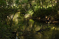
 20230820 Lauchert Erpf.jpg 3,024 × 4,032; 8.31 MB
-
 20240331 Erpf Lauchert.jpg 3,024 × 4,032; 5.95 MB
-
 72501 Gammertingen, Germany - panoramio (3).jpg 1,600 × 1,200; 484 KB
-
 Aue Mittlere-Lauchert Schwäbische Alb.jpg 1,800 × 1,200; 2.59 MB
-
 Bittelschiesser-Taele Schwaebische-Alb.jpg 1,800 × 1,200; 2.87 MB
-
 BittelschiesserTaele2.jpg 1,600 × 1,200; 1.39 MB
-
De-Lauchert.ogg 1.9 s; 19 KB
-
 Erpfmündung.JPG 2,816 × 2,112; 2.39 MB
-
 Felsen im Laucherttal Mariaberg 01.JPG 4,500 × 3,375; 3.73 MB
-
 Felsen im Laucherttal Mariaberg 02.JPG 4,500 × 3,375; 4.24 MB
-
 Fluss-Anzapfung Strunkpass Schwäbische Alb.jpg 1,800 × 1,200; 666 KB
-
 Gallus-Quelle Veringenstadt-Hermentingen historiches Kolben-Pumpwerk 1.jpg 3,456 × 5,184; 5.13 MB
-
 Gallus-Quelle Veringenstadt-Hermentingen historiches Kolben-Pumpwerk 2.jpg 3,456 × 5,184; 4.6 MB
-
 Gallus-Quelle Veringenstadt-Hermentingen historiches Kolben-Pumpwerk 3.jpg 5,184 × 3,456; 4.15 MB
-

-
 Gallus-Quelle Veringenstadt-Hermentingen Infowand zum historichen Pumpwerk.jpg 3,456 × 5,184; 3.97 MB
-
 Gallus-Quelle Veringenstadt-Hermentingen Pavillon mit historischem Kolben-Pumpwerk.jpg 5,184 × 3,456; 7.21 MB
-
 Gallusquelle Hermentingen Schwäbische Alb.jpg 1,800 × 1,200; 2.67 MB
-
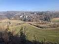
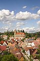
 Gammertingen - Lauchert mit Stadtansicht und Kirche.jpg 3,913 × 1,976; 1.47 MB
-
 Gammertingen - Lauchertbögen.jpg 4,000 × 2,248; 2.01 MB
-
 Gammertingen - Laucherttal mit Fachwerkhaus.jpg 3,933 × 2,147; 2.11 MB
-
 Geokarte+Graben Mittlere Schwäbische Alb.jpg 1,200 × 1,800; 1.4 MB
-
 Geotop Kachelfelsen Hettingen Schwäbische Alb.jpg 1,350 × 1,800; 2.49 MB
-
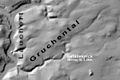 Gruchental Gefälleknick Schwäbische Alb.jpg 1,200 × 800; 379 KB
-
 Hausener-Bröller Laucherttal Schwäbische Alb.jpg 1,200 × 1,800; 3.24 MB
-
 Kalktuffbarre Wasserfall-Lauchert Veringendorf Schwaebische Alb.jpg 1,800 × 1,200; 2.41 MB
-
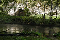
 Kapelle an der Lauchert (Mariaberg).jpg 4,500 × 3,375; 2.59 MB
-
 Karstfelsgruppe Enzenbarn Laucherttal Schwäbische Alb.jpg 1,800 × 1,200; 1.9 MB
-
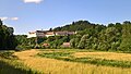 Landappbw 467491 1820 Blick auf das ehemalige Kloster Mariaberg Mariaberg.jpg 3,264 × 1,840; 843 KB
-
 Landappbw 881190 1824 Lauchert Veringenstadt.jpg 1,919 × 1,371; 625 KB
-
 Landappbw 881527 1824 Lauchert Veringenstadt.jpg 1,919 × 1,280; 1.16 MB
-
 Lauchert Altstadt-Veringenstadt Schwäbische Alb.jpg 1,800 × 1,200; 2.3 MB
-
 Lauchert bei Mariaberg 01.JPG 4,500 × 3,375; 3.8 MB
-
 Lauchert bei Mariaberg 02.JPG 4,500 × 3,375; 3.28 MB
-
 Lauchert bei Mariaberg 03.JPG 4,500 × 3,375; 3.33 MB
-
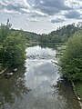
 Lauchert bei Melchingen.jpg 4,032 × 3,024; 6.93 MB
-
 Lauchert Bittelschießer-Täle Schwäbische Alb 2.JPG 1,800 × 1,200; 2.19 MB
-
 Lauchert Bittelschießer-Täle Schwäbische Alb 3.jpg 1,200 × 1,800; 2.16 MB
-
 Lauchert Bittelschießer-Täle Schwäbische Alb 4.jpg 1,200 × 1,800; 2.98 MB
-
 Lauchert Bittelschießer-Täle Schwäbische Alb 5.jpg 800 × 1,200; 308 KB
-
 Lauchert Bittelschießer-Täle Schwäbische Alb.jpg 1,800 × 1,200; 2.44 MB
-
 Lauchert Donau catchment.png 1,523 × 2,602; 2.2 MB
-
 Lauchert Flussterrassen Schwäbische Alb.jpg 1,800 × 1,200; 2.8 MB
-
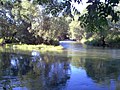
 Lauchert Schwaebische-Alb.jpg 1,800 × 1,192; 2.5 MB
-
 Lauchert Sdf.jpg 1,600 × 1,200; 1.71 MB
-
 Lauchert Sdf2.jpg 1,600 × 1,200; 1.95 MB
-
 Lauchert unterhalb Mariaberg.jpg 4,500 × 3,375; 3.68 MB
-
 Lauchert Veringenstadt Schwäbische Alb.jpg 1,200 × 1,800; 2.64 MB
-
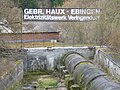 Lauchert Wasserkraftwerk Veringendorf.jpg 2,560 × 1,920; 2.94 MB
-
 Lauchert-Maeander N Gammertingen Schwäbische Alb.jpg 1,800 × 1,200; 1.98 MB
-
 Lauchert-südlich-Veringenstadt Schwäbische Alb.jpg 1,800 × 1,200; 2.03 MB
-
 Lauchertmündung Sigmaringendorf 01.jpg 4,032 × 3,024; 6.66 MB
-
 Lauchertmündung Sigmaringendorf 02.jpg 4,032 × 3,024; 5.28 MB
-
 Lauchertquelle1.JPG 2,816 × 2,112; 2.67 MB
-
 Laucherttal Felsplateau-Mariaberg Schwäbische Alb.jpg 1,800 × 1,200; 2.23 MB
-
 Laucherttal nördlich Sigmaringen.jpg 4,032 × 3,024; 4.21 MB
-
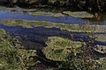 Lauchertwasser eutrophiert Schwäbische Alb.jpg 1,800 × 1,200; 2.09 MB
-
 Massenkalkfelsen Veringenstadt Schwäbische Alb.JPG 1,787 × 1,800; 4.34 MB
-

-
 Mittlere-Lauchert bei-Gammertingen Schwäbische Alb.JPG 1,800 × 1,200; 2.29 MB
-
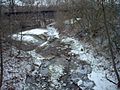
 Mündung Lauchert Lauchertsee Mägerkingen.jpg 3,024 × 4,032; 3.16 MB
-
 Mündung lauchert.jpg 800 × 600; 381 KB
-
 Obere Lauchert Schwäbische Alb.jpg 1,800 × 1,200; 2.29 MB
-
 Schwabenalb S112D, Mariaberg Lauchert Kloster, Hochstetter.jpg 2,000 × 1,686; 882 KB
-
 Sigmaringendorf - Donauufer mit Lauchertmündung rechts.JPG 5,472 × 3,080; 4.98 MB
-
 Staunasse-Lauchertaue Stetten-u-H Schwäbische Alb.jpg 1,200 × 1,800; 2.44 MB
-
 Trockental Woogtal Schwaebische-Alb.jpg 1,800 × 1,200; 2.31 MB
-
 Urtal Oberste-Lauchert Schwäbische Alb.jpg 1,800 × 1,200; 1.6 MB
-
 Veringenstadt - Burg und Peterskapelle - Th-Fink 12.jpg 3,872 × 2,592; 3.15 MB
-
 Veringenstad̠t Schwaebische-Alb.jpg 1,200 × 1,800; 1.77 MB
-
 Vorfluter Donau+Neckar+Flüsse+Strunkpass Schwäbische Alb.jpg 1,800 × 1,431; 669 KB
.jpg)


.jpg)


.jpg)


