Category:Laudermarke
| Object location | | View all coordinates using: OpenStreetMap |
|---|
village in Groningen, Netherlands | |||||
| Upload media | |||||
| Spoken text audio | |||||
|---|---|---|---|---|---|
| Instance of | |||||
| Location | Westerwolde, Groningen, Netherlands | ||||
 | |||||
Subcategories
This category has the following 2 subcategories, out of 2 total.
L
- Lourdesgrot, Laudermarke (2 F)
V
- Veenweg 41, Laudermarke (4 F)
Media in category "Laudermarke"
The following 4 files are in this category, out of 4 total.
-
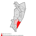
Map NL - Vlagtwedde - Laudermarke.png 800 × 600; 11 KB
-
Nl-Laudermarke-article.ogg 1 min 18 s; 769 KB
-
Aanzicht - Laudermarke - 20129489 - RCE.jpg 1,200 × 1,195; 341 KB


