Category:Lealholm
village in North Yorkshire, UK  | |||||
| Upload media | |||||
| Instance of | |||||
|---|---|---|---|---|---|
| Location | Glaisdale, Scarborough, North Yorkshire, Yorkshire and the Humber, England | ||||
 | |||||
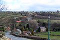
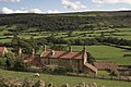
English: Lealholm, sometimes known as Lealholm Bridge, is a small village in the Glaisdale civil parish of the Borough of Scarborough, in North Yorkshire, England. It is sited at a crossing point of the River Esk, in Eskdale which is within the North York Moors National Park. It is from both Middlesbrough and Scarborough. The village is typical of those found all across the North York Moors which straddle the main through-routes along the valley bottoms. It is mostly built of local stone with pantiled or slate roofs.
Subcategories
This category has the following 8 subcategories, out of 8 total.
B
- The Board Inn, Lealholm (13 F)
J
L
- Lealholm War Memorial (11 F)
M
- Lealholm Bridge (18 F)
R
- Lealholm railway station (13 F)
S
Media in category "Lealholm"
The following 147 files are in this category, out of 147 total.
-
 A 'side street' in Lealholm - geograph.org.uk - 1598510.jpg 640 × 480; 92 KB
-
 An Inquisitive Cow, High Walls Farm - geograph.org.uk - 570584.jpg 640 × 427; 45 KB
-
 Backs of Cottages at Lealholm - geograph.org.uk - 633974.jpg 640 × 427; 86 KB
-
 Banks of the Esk - geograph.org.uk - 200399.jpg 640 × 425; 101 KB
-
 Barn at Yew Grange Farm, Glaisdale - geograph.org.uk - 77212.jpg 427 × 640; 127 KB
-
 Barn South of Yew Grange - geograph.org.uk - 232658.jpg 640 × 420; 51 KB
-
 Beautiful trees in Lealholm - geograph.org.uk - 1598466.jpg 640 × 480; 115 KB
-
 Beckside Farm - Fryup Dale - geograph.org.uk - 136077.jpg 640 × 427; 66 KB
-
-

-
 Catholic Church in Lealholm - geograph.org.uk - 5747051.jpg 1,600 × 1,067; 406 KB
-
 Catholic Church, Lealholm - geograph.org.uk - 5317221.jpg 1,600 × 1,200; 437 KB
-
 Cattle grid near Buscoe Beck - geograph.org.uk - 232338.jpg 640 × 427; 53 KB
-
 Caution sheep On Road - geograph.org.uk - 1330267.jpg 640 × 480; 57 KB
-
 Contrasting land-use - geograph.org.uk - 699965.jpg 640 × 480; 134 KB
-
 Cottage at Bainley Bank - geograph.org.uk - 101195.jpg 640 × 436; 107 KB
-
 Cross remains at Black Hill - geograph.org.uk - 149499.jpg 640 × 427; 46 KB
-
 Entering Lealholm - geograph.org.uk - 2657668.jpg 800 × 600; 265 KB
-
 Farm machinery near Head House - geograph.org.uk - 211412.jpg 640 × 427; 55 KB
-
 Farmland near Lealholm - geograph.org.uk - 2672019.jpg 800 × 577; 84 KB
-
 Field Path, Oakley Walls (geograph 3941115).jpg 2,441 × 1,744; 738 KB
-
 High Park farm on a misty morning - geograph.org.uk - 94009.jpg 640 × 427; 44 KB
-
 Inscribed boundary or lengthman stone - geograph.org.uk - 754743.jpg 640 × 427; 121 KB
-
 Junction of tracks - geograph.org.uk - 700069.jpg 640 × 480; 119 KB
-
 Lealholm , North Yorkshire , Service Station ^ Post Office , August 2011 - panoramio.jpg 2,117 × 1,551; 887 KB
-
 Lealholm Auto Services - geograph.org.uk - 2378641.jpg 800 × 533; 247 KB
-
 Lealholm church well - geograph.org.uk - 2687962.jpg 1,600 × 969; 361 KB
-
 Lealholm crunkly.jpg 722 × 480; 131 KB
-
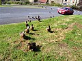 Lealholm ducks - geograph.org.uk - 621944.jpg 640 × 477; 129 KB
-
 Lealholm flood - geograph.org.uk - 2835456.jpg 1,200 × 1,600; 2.03 MB
-
 Lealholm floodmarks.jpg 480 × 722; 117 KB
-
 Lealholm Lane - geograph.org.uk - 2926053.jpg 1,600 × 1,177; 613 KB
-
 Lealholm Lawns Farm - geograph.org.uk - 2657705.jpg 800 × 600; 270 KB
-
 Lealholm mill.jpg 722 × 480; 114 KB
-
 Lealholm postoffice - geograph.org.uk - 2657672.jpg 800 × 600; 325 KB
-
 Lealholm Primary School - geograph.org.uk - 571389.jpg 640 × 427; 76 KB
-
 Lealholm Service Station - geograph.org.uk - 1983606.jpg 640 × 480; 116 KB
-
 Lealholm Service Station and Post Office - geograph.org.uk - 2835799.jpg 1,024 × 768; 855 KB
-
 Lealholm show sports.jpg 1,152 × 856; 193 KB
-
 Lealholm showtent.jpg 722 × 480; 101 KB
-
 Lealholm Side - geograph.org.uk - 552747.jpg 640 × 480; 102 KB
-
 Lealholm Station and Esk Valley Line - geograph.org.uk - 1962555.jpg 2,816 × 2,112; 3 MB
-
 Lealholm steppingstones.jpg 722 × 480; 176 KB
-
 Lealholm Stones - geograph.org.uk - 1015168.jpg 640 × 435; 98 KB
-
 Lealholm Village - geograph.org.uk - 1714515.jpg 1,280 × 853; 481 KB
-
 Lealholm village.jpg 1,408 × 936; 244 KB
-
 Lealholmside.jpg 722 × 480; 101 KB
-
 Low Wood Lane, Lealholm - geograph.org.uk - 2657666.jpg 800 × 600; 275 KB
-
 One of three drinking fountains, Lealholm - geograph.org.uk - 2835435.jpg 768 × 1,024; 896 KB
-
 Pannierway, Lealholm Side Road - geograph.org.uk - 571386.jpg 640 × 427; 80 KB
-
 Path down to footbridge at Park Head Beck - geograph.org.uk - 662371.jpg 640 × 480; 143 KB
-
 Post Office and garage, Lealholm - geograph.org.uk - 3480537.jpg 1,600 × 1,200; 805 KB
-
 Range of barns at Wild Slack - geograph.org.uk - 336245.jpg 640 × 427; 77 KB
-
-
 Road to Danby - geograph.org.uk - 570628.jpg 640 × 427; 76 KB
-
 Ruined drystone wall - geograph.org.uk - 301397.jpg 640 × 427; 55 KB
-

-
 Shortcut across the River Esk, Lealholm - geograph.org.uk - 3480547.jpg 1,200 × 1,600; 1,011 KB
-
 Silted Up Pond, Lealholm Side - geograph.org.uk - 571526.jpg 640 × 427; 87 KB
-

-
 Stepping stones, Lealholm - geograph.org.uk - 2835519.jpg 768 × 1,024; 963 KB
-
 Stone Stile, Lealholm - geograph.org.uk - 598207.jpg 640 × 480; 125 KB
-
 Stone-flagged footpath by Eller Gates - geograph.org.uk - 552773.jpg 640 × 480; 102 KB
-
 Stump Cross, near Danby Beacon - geograph.org.uk - 77266.jpg 640 × 427; 121 KB
-
 Subsiding road by the Esk - geograph.org.uk - 175099.jpg 640 × 373; 67 KB
-
 Temple Beeld - geograph.org.uk - 18592.jpg 640 × 431; 96 KB
-
 The River Esk at Lealholm - geograph.org.uk - 598190.jpg 640 × 480; 105 KB
-
 The well, the church and the war memorial - geograph.org.uk - 1997468.jpg 3,872 × 2,592; 5.69 MB
-

-
 Track to Underpark Farm - geograph.org.uk - 633972.jpg 640 × 427; 72 KB
-
 Treading carefully - Lealholm - geograph.org.uk - 1983598.jpg 480 × 640; 125 KB
-
 Village Green, Lealholm - geograph.org.uk - 598200.jpg 640 × 480; 119 KB
-
 Bainley Bank Cottage - geograph.org.uk - 301389.jpg 640 × 427; 71 KB
-
 Bainley Bank Cottage - geograph.org.uk - 676511.jpg 640 × 427; 79 KB
-
 Bainley Bank Farm - Fryup - geograph.org.uk - 211440.jpg 640 × 427; 74 KB
-
 Barn at Lealholm - geograph.org.uk - 143600.jpg 640 × 427; 96 KB
-
 Bell Heather, Brown Rigg - geograph.org.uk - 570552.jpg 640 × 427; 105 KB
-
 Bella Dale Slack - geograph.org.uk - 400093.jpg 640 × 480; 83 KB
-

-
 Boundary Stone, Upper Glaisdale - geograph.org.uk - 686210.jpg 640 × 427; 94 KB
-
 Bridge at Busco Beck - geograph.org.uk - 232692.jpg 640 × 427; 93 KB
-
 Bridge Over Busco Beck - geograph.org.uk - 634126.jpg 640 × 427; 108 KB
-
 Bridleway heading towards Redmire Farm - geograph.org.uk - 699958.jpg 640 × 480; 132 KB
-
 Bridleway through Hardale - geograph.org.uk - 699961.jpg 640 × 480; 177 KB
-

-
 Busco Beck Farm - geograph.org.uk - 662300.jpg 640 × 480; 89 KB
-

-
 Concrete Farm Access Road - geograph.org.uk - 570534.jpg 427 × 640; 76 KB
-
 Cottage by the moor - Lealholm side. - geograph.org.uk - 143592.jpg 640 × 427; 55 KB
-
 Cottongrass, Pike Hill Moss - geograph.org.uk - 193460.jpg 480 × 640; 131 KB
-
 Derelict barns - Lealholm side - geograph.org.uk - 143591.jpg 640 × 427; 51 KB
-
 Distant Danger - geograph.org.uk - 317835.jpg 640 × 383; 24 KB
-
 Egton Banks - geograph.org.uk - 175096.jpg 640 × 427; 42 KB
-
 Ellers House and the outdoor centre - geograph.org.uk - 136073.jpg 640 × 427; 59 KB
-
 Entrance to Head House at Fryup - geograph.org.uk - 211406.jpg 640 × 435; 63 KB
-
 Entrance to High Walls Farm - geograph.org.uk - 571357.jpg 640 × 427; 102 KB
-
 Fern Farm, Greenhouses - geograph.org.uk - 291005.jpg 640 × 480; 75 KB
-
 Fern house - geograph.org.uk - 317743.jpg 640 × 427; 45 KB
-
 Finkel House Farm in Great Fryupdale - geograph.org.uk - 662324.jpg 640 × 480; 69 KB
-

-
 Footpath From Thorneywaite - geograph.org.uk - 633950.jpg 640 × 384; 80 KB
-
 Fryup Village Hall - geograph.org.uk - 136072.jpg 640 × 427; 47 KB
-
 Furnace Farm - geograph.org.uk - 136079.jpg 640 × 427; 58 KB
-
 Great Fryup Dale - geograph.org.uk - 102116.jpg 640 × 480; 94 KB
-
 Hardale - geograph.org.uk - 359222.jpg 640 × 480; 149 KB
-
 Hardale Beck Ford - geograph.org.uk - 359204.jpg 640 × 480; 128 KB
-
 Hardale Slack - geograph.org.uk - 169548.jpg 640 × 480; 88 KB
-
 Hart Hall near Glaisdale - geograph.org.uk - 232347.jpg 640 × 413; 81 KB
-
 High Park farm near Lealholm - geograph.org.uk - 100238.jpg 640 × 335; 36 KB
-
 High Walls Farm - geograph.org.uk - 253658.jpg 640 × 415; 42 KB
-
 Highdale Farm - geograph.org.uk - 685455.jpg 640 × 427; 74 KB
-
 Highways temporary storage area - geograph.org.uk - 232681.jpg 640 × 383; 66 KB
-
 Hill House Farm from Rake Lane - geograph.org.uk - 143586.jpg 640 × 427; 50 KB
-
 Hole-i'-th'-Ellers - geograph.org.uk - 143606.jpg 640 × 427; 52 KB
-
 Lealholm Lawns Farm - geograph.org.uk - 143608.jpg 640 × 427; 56 KB
-
 Limber Hill Farm - geograph.org.uk - 175102.jpg 640 × 427; 33 KB
-
 Looking up Hardale Beck - geograph.org.uk - 699960.jpg 640 × 480; 172 KB
-
 Low Gill Beck Farm - geograph.org.uk - 286677.jpg 640 × 480; 84 KB
-
 Low Gill Beck Farm, Glaisdale - geograph.org.uk - 77240.jpg 640 × 427; 115 KB
-
 Low Whims - geograph.org.uk - 359186.jpg 640 × 480; 116 KB
-
 Mill Hill - geograph.org.uk - 336241.jpg 640 × 428; 66 KB
-
 Moorland edge - geograph.org.uk - 699964.jpg 640 × 480; 100 KB
-
 Oakley Walls - geograph.org.uk - 253664.jpg 640 × 427; 54 KB
-
 Outbuildings at High Leas, Glaisdale - geograph.org.uk - 232676.jpg 640 × 357; 55 KB
-
 Park House Farm - geograph.org.uk - 143582.jpg 640 × 427; 56 KB
-
 Park House on Oakley Side - geograph.org.uk - 28988.jpg 640 × 480; 73 KB
-
 Plum Tree farm and Hollins farm - geograph.org.uk - 232666.jpg 640 × 427; 76 KB
-
 Recently planted trees - geograph.org.uk - 143602.jpg 640 × 427; 60 KB
-
 Rock Head Farm - geograph.org.uk - 232350.jpg 640 × 427; 79 KB
-
 Roxby High Moor - geograph.org.uk - 123597.jpg 640 × 480; 68 KB
-
 Service Reservoir at Lealholm - geograph.org.uk - 160080.jpg 640 × 414; 61 KB
-
 Shortwaite - geograph.org.uk - 175088.jpg 640 × 427; 65 KB
-
 Shortwaite Farm - geograph.org.uk - 175092.jpg 640 × 375; 48 KB
-
 Smallwoods - Fryup - geograph.org.uk - 211441.jpg 640 × 427; 94 KB
-
 South View Farm - geograph.org.uk - 317739.jpg 640 × 427; 46 KB
-
 Steep Road To Houlsyke - geograph.org.uk - 372486.jpg 480 × 640; 123 KB
-
 Stone track at Broad Leas - geograph.org.uk - 232342.jpg 640 × 427; 88 KB
-
 The Esk Valley Railway near Lealholm - geograph.org.uk - 143603.jpg 640 × 427; 51 KB
-
 The Long Stone - geograph.org.uk - 700105.jpg 640 × 480; 102 KB
-

-
 Thornhill Farm - geograph.org.uk - 175094.jpg 640 × 427; 42 KB
-
 Track near Lealholm Bridge - geograph.org.uk - 274390.jpg 480 × 640; 57 KB
-
 View down Hardale valley - geograph.org.uk - 699966.jpg 640 × 480; 131 KB
-
 View from Bainley Bank Cottage - geograph.org.uk - 301391.jpg 640 × 427; 48 KB
-
 View from near Hart Hall - geograph.org.uk - 232701.jpg 640 × 427; 48 KB
-
 Westonby House - geograph.org.uk - 175111.jpg 640 × 466; 95 KB
-
 Wheat Bank Farm - geograph.org.uk - 301383.jpg 640 × 423; 69 KB


.jpg)


