Category:Ledamündung
| Object location | | View all coordinates using: OpenStreetMap |
|---|
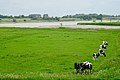
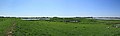
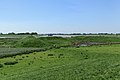
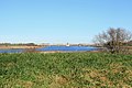
Deutsch: Mündung der Leda in die Ems auf der Grenze von Leer (Ostfriesland) und Westoverledingen.
Subcategories
This category has only the following subcategory.
A
Media in category "Ledamündung"
The following 16 files are in this category, out of 16 total.
-
 20180605 Mess-Schiff Weekeborg uit Emden nabij de uitmonding Leda in de Ems nabij Leer.jpg 5,184 × 3,456; 3.18 MB
-
 2120180605 uitmonding Leda in de Ems nabij Leer.jpg 5,184 × 3,456; 3.86 MB
-
 Leer - Ems + Leda-Mündung (Jann-Berghaus-Brücke) 01 ies.jpg 5,616 × 3,744; 17.83 MB
-
 Leer - Ems + Leda-Mündung (Jann-Berghaus-Brücke) 02 ies.jpg 14,003 × 3,254; 39.42 MB
-
 Leer - Ems + Leda-Mündung (Jann-Berghaus-Brücke) 03 ies.jpg 5,334 × 3,556; 18.08 MB
-
 Leer Leerort + Westoverledingen - Emsdeich + Ledamündung 01 ies.jpg 5,616 × 3,744; 24.86 MB
-
 Leer Leerort + Westoverledingen - Emsdeich + Ledamündung 02 ies.jpg 5,616 × 3,744; 17.95 MB
-
 Leer Leerort + Westoverledingen - Ledadeich + Leda + Festung Leerort 01 ies.jpg 11,196 × 3,344; 26.65 MB
-
 Leer Leerort + Westoverledingen - Ledamündung + Hegemann III + Festung Leerort 01 ies.jpg 5,616 × 3,744; 19.11 MB
-
 Leer Leerort + Westoverledingen - Ledamündung + Hegemann III + Festung Leerort 02 ies.jpg 5,616 × 3,744; 28.41 MB
-
 Leer Leerort + Westoverledingen - Ledamündung + Hegemann III 01 ies.jpg 5,616 × 3,744; 17.98 MB
-
 Leer Leerort + Westoverledingen - Ledamündung + Hegemann III 02 ies.jpg 5,616 × 3,744; 16.95 MB
-
 Leer Leerort + Westoverledingen - Ledamündung 01 ies.jpg 5,616 × 3,744; 17.98 MB
-

-

-


_01_ies.jpg)
_03_ies.jpg)


_01_ies.jpg)
_01_ies.jpg)
_02_ies.jpg)
_02_ies.jpg)