Category:Lifebuoys in the East Riding of Yorkshire
Media in category "Lifebuoys in the East Riding of Yorkshire"
The following 44 files are in this category, out of 44 total.
-
 A good walk spoiled - geograph.org.uk - 611360.jpg 433 × 640; 133 KB
-
 A model of the pier (geograph 1992519).jpg 800 × 600; 276 KB
-

-
 Bridlington quay entrance light. - geograph.org.uk - 493677.jpg 438 × 640; 42 KB
-
 Central Promenade, Withernsea (geograph 5082705).jpg 1,200 × 799; 289 KB
-
 Cliff Steps at Flamborough South Landing - geograph.org.uk - 391704.jpg 520 × 640; 138 KB
-
 Flood Defences, North Ferriby (geograph 6062240).jpg 1,500 × 1,125; 473 KB
-
 Footbridge, south side of the pond, Wold Newton (geograph 2724661).jpg 1,024 × 768; 152 KB
-
 Footpath at the side of Beverley Beck - geograph.org.uk - 732618.jpg 640 × 460; 149 KB
-
 Former Pier Entrance, Withernsea (geograph 3390630).jpg 1,024 × 682; 154 KB
-
 Hessle Foreshore - geograph.org.uk - 415061.jpg 640 × 481; 114 KB
-
 High Farm Country Park - geograph.org.uk - 488421.jpg 640 × 480; 98 KB
-
 Hornsea sea wall and promenade.jpg 426 × 640; 164 KB
-
 Lagoon near Faxfleet Ness - geograph.org.uk - 806862.jpg 480 × 640; 215 KB
-
 Life Preservers, Danes Dyke - geograph.org.uk - 1211625.jpg 640 × 480; 44 KB
-
 Ornamental Pond Patrington Haven.jpg 451 × 640; 140 KB
-
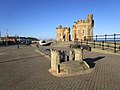
 Pier Towers (geograph 4101974).jpg 1,024 × 683; 107 KB
-
 Pier Towers x 2 (geograph 4330361).jpg 1,024 × 768; 182 KB
-
 Pier Towers, Withernsea (geograph 3110177).jpg 1,600 × 1,191; 286 KB
-
 Pier Towers, Withernsea (geograph 3110200).jpg 1,600 × 1,389; 366 KB
-
 Pond near Gallymoor Roundabout - geograph.org.uk - 1600693.jpg 640 × 480; 105 KB
-

-
 River Ouse Floodbank - geograph.org.uk - 1603480.jpg 640 × 480; 73 KB
-
-
 Steps to the sea, Withernsea (geograph 1841137).jpg 477 × 640; 221 KB
-
 Telephone box on Rainsburgh Lane. Wold Newton (geograph 5171698).jpg 640 × 480; 68 KB
-
 The end of the promenade (geograph 2096143).jpg 800 × 600; 175 KB
-

-
 The Pier Towers, Withernsea (geograph 3607043).jpg 1,024 × 768; 129 KB
-
 The Promenade Fence at Withernsea - geograph.org.uk - 932244.jpg 640 × 452; 76 KB
-
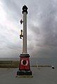
 The Red and the Green - geograph.org.uk - 1475771.jpg 475 × 640; 76 KB
-
 The Sandcastle - geograph.org.uk - 304284.jpg 640 × 480; 73 KB
-
 The Telephone Box at Wold Newton (geograph 3352298).jpg 4,310 × 3,204; 3.7 MB
-
 Tophill Low Bridge (geograph 6147473).jpg 1,024 × 768; 261 KB
-
 View South West From Weighton Lock - geograph.org.uk - 235995.jpg 640 × 426; 128 KB
-
 Wansford lock on the Driffield canal - geograph.org.uk - 1427202.jpg 640 × 480; 100 KB
-
 Withernsea (17345846946).jpg 3,840 × 2,160; 2.16 MB
-
 Withernsea Pier Entrance - geograph.org.uk - 1743094.jpg 800 × 600; 94 KB
-
 Withernsea Promenade Fence - geograph.org.uk - 1412914.jpg 640 × 562; 75 KB
-
 Withernsea seafront (geograph 1842443).jpg 640 × 438; 187 KB
-
 Withernsea south beach (geograph 2201417).jpg 800 × 600; 221 KB
-
 Withernsea, entrance to the beach - geograph.org.uk - 133786.jpg 640 × 429; 67 KB
-
 Withernsea, promenade - geograph.org.uk - 71931.jpg 640 × 480; 82 KB
-
 Would you let the kids play here^ - geograph.org.uk - 1801487.jpg 4,000 × 3,000; 2.38 MB

.jpg)


.jpg)

.jpg)
.jpg)

.jpg)


.jpg)
.jpg)
.jpg)
.jpg)


.jpg)
.jpg)
.jpg)
.jpg)

.jpg)


.jpg)
.jpg)


.jpg)


.jpg)
.jpg)


