Category:Lime kilns in Cornwall
Subcategories
This category has the following 2 subcategories, out of 2 total.
Media in category "Lime kilns in Cornwall"
The following 18 files are in this category, out of 18 total.
-
 Calstock, Limekiln on Lower Kelly - geograph.org.uk - 673406.jpg 427 × 640; 176 KB
-

-
 Disused lime kiln by the riverbank - geograph.org.uk - 404049.jpg 640 × 480; 182 KB
-
 Disused Lime Kiln near Cotehele Bridge - geograph.org.uk - 1217997.jpg 640 × 427; 124 KB
-

-
 Halton Quay Limekilns - geograph.org.uk - 337350.jpg 640 × 480; 86 KB
-
 Lime kiln (4942488935).jpg 2,312 × 1,455; 2.86 MB
-
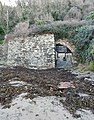
 Lime kiln at Cotehele Quay - geograph.org.uk - 196016.jpg 480 × 640; 115 KB
-
 Lime Kiln, Calstock - geograph.org.uk - 196130.jpg 640 × 480; 126 KB
-
 Lime kiln, Point - geograph.org.uk - 1218182.jpg 640 × 426; 114 KB
-
 Old Lime Kiln at Perranarworthal - geograph.org.uk - 160872.jpg 640 × 413; 137 KB
-
 Old lime kiln, Boscastle - geograph.org.uk - 2393648.jpg 640 × 480; 104 KB
-

-
 Polkerris Lime Kiln 1.jpg 3,024 × 3,208; 4.01 MB
-
 Polkerris Lime Kiln 2.jpg 3,438 × 4,400; 5.37 MB
-
 St Endellion, lime kiln at Port Gaverne - geograph.org.uk - 850883.jpg 640 × 427; 215 KB
-
 The Edgcumbe Arms Tea Room - geograph.org.uk - 1215506.jpg 640 × 427; 119 KB
-
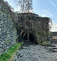
 Verdant growth in the lime kiln - geograph.org.uk - 196057.jpg 640 × 480; 142 KB


.jpg)


