Category:Linden (Belgium)
Linden is part of the municipality Lubbeek in Belgium.
| Object location | | View all coordinates using: OpenStreetMap |
|---|
section of Lubbeek, Belgium | |||||
| Upload media | |||||
| Instance of |
| ||||
|---|---|---|---|---|---|
| Location | Lubbeek, Arrondissement of Leuven, Flemish Brabant, Flemish Region, Belgium | ||||
 | |||||
Subcategories
This category has the following 6 subcategories, out of 6 total.
C
- Cemetery of Linden (Belgium) (7 F)
G
K
R
- Rood Kasteel, Linden (4 F)
S
- Saint Quentin Church, Linden (7 F)
Media in category "Linden (Belgium)"
The following 50 files are in this category, out of 50 total.
-
 Coat of arms of Linden (Belgium).jpg 321 × 343; 10 KB
-
 Linden 1914.jpg 800 × 1,066; 121 KB
-
 Linden bednapoleon2.jpg 1,024 × 768; 152 KB
-
 Linden bedvannapoleon.jpg 1,024 × 768; 207 KB
-
 Linden chartreuzebos.jpg 1,024 × 768; 307 KB
-
 Linden chartreuzebos2.jpg 1,024 × 768; 115 KB
-
 Linden derozenhoeve.jpg 1,024 × 768; 126 KB
-
 Linden dorpskern.jpg 1,024 × 768; 111 KB
-
 Linden gemeentehuis.jpg 1,024 × 768; 142 KB
-
 Linden graafbeek.jpg 1,024 × 768; 223 KB
-
 Linden graafpoel.jpg 1,024 × 768; 251 KB
-
 Linden graafpoort.jpg 800 × 1,066; 220 KB
-
 Linden graafveldweg.jpg 1,024 × 768; 270 KB
-
 Linden graafvijver.jpg 1,024 × 768; 191 KB
-
 Linden grenspaal.jpg 800 × 1,066; 261 KB
-
 Linden hoevePlein.jpg 1,024 × 768; 174 KB
-
 Linden hoeveSpeelberg.jpg 1,024 × 768; 143 KB
-
 Linden hoeveSpeelberg2.jpg 1,024 × 768; 189 KB
-
 Linden holsbeek.jpg 1,024 × 768; 99 KB
-
 Linden holsbeek2.jpg 1,024 × 768; 74 KB
-
 Linden hooglinden.jpg 1,024 × 768; 93 KB
-
 Linden hooglindenverkaveling.jpg 1,024 × 768; 167 KB
-
 Linden huisje.jpg 1,024 × 768; 218 KB
-
 Linden kapelDavid.jpg 800 × 1,067; 175 KB
-
 Linden kappeltempelstraat.jpg 800 × 1,066; 198 KB
-
 Linden keizersberg.jpg 1,280 × 960; 168 KB
-
 Linden kessello.jpg 1,024 × 768; 153 KB
-
 Linden koe.jpg 1,024 × 768; 134 KB
-
 Linden manspad.jpg 1,024 × 768; 180 KB
-
 Linden parkingbos.jpg 1,024 × 768; 285 KB
-
 Linden Pellenberg.jpg 1,024 × 768; 163 KB
-
 Linden Scheistraat.jpg 1,024 × 768; 133 KB
-
 Linden seftingen.jpg 1,024 × 768; 133 KB
-
 Linden seftingen2.jpg 1,024 × 768; 183 KB
-
 Linden speelberg.jpg 1,024 × 768; 153 KB
-
 Linden speelbergveldweg.jpg 1,024 × 768; 275 KB
-
 Linden steenveld.jpg 1,024 × 768; 202 KB
-
 Linden steenveldhoeve.jpg 1,024 × 768; 139 KB
-
 Linden steenveldhoeve2.jpg 1,024 × 768; 238 KB
-
 Linden tempelveld.jpg 1,024 × 768; 120 KB
-
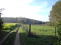
 Linden veldweg.jpg 1,024 × 768; 296 KB
-
 Linden verkavelinglaaglinden.jpg 1,024 × 768; 111 KB
-
 Linden vervallenhoeve.jpg 1,024 × 768; 159 KB
-
 Linden voetbalveld.jpg 1,024 × 768; 162 KB
-
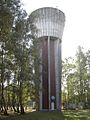 Linden watertoren.jpg 800 × 1,067; 225 KB
-
 Linden wegwijze.jpg 1,024 × 768; 188 KB
-
 Linden wijnbouw.jpg 1,015 × 620; 198 KB
-
 Linden wolvenpad.jpg 1,024 × 768; 152 KB
-
 Linden zicht kortrijkstraat.jpg 1,024 × 768; 181 KB
-
 Linden zusterschool.jpg 1,024 × 768; 139 KB
.jpg)


