Category:Line of Control
demarcation line between India and Pakistan over the disputed region of Kashmir   | |||||
| Upload media | |||||
| Instance of | |||||
|---|---|---|---|---|---|
| Part of | |||||
| Inception |
| ||||
 | |||||
Media in category "Line of Control"
The following 18 files are in this category, out of 18 total.
-
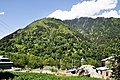
 Aurang kel valley Azad Kashmir Pakistan.jpg 3,264 × 2,448; 3.71 MB
-
 Azad Kashmire of Pakistan Side.jpg 3,264 × 2,448; 3.9 MB
-
 CFL as described on UN Map to Karachi Agreement 1949 - 2nd Page.JPG 554 × 888; 194 KB
-
 Face to Face, Pakistan India LOC.JPG 4,288 × 2,848; 9.88 MB
-
 Kashmir diaries.jpg 1,296 × 864; 270 KB
-
 Keran, India Pakistan LOC.JPG 4,288 × 2,848; 10.22 MB
-
 Line of Control LoC.png 1,920 × 1,080; 151 KB
-
 LOC Wire between India and Pakistan.jpg 735 × 385; 72 KB
-
 Nagrad pather towards LOC.jpg 4,608 × 3,456; 988 KB
-
 Near pakistan-india LOC.jpg 3,264 × 2,448; 2.86 MB
-
 Neelumvalleyborder.jpg 3,264 × 2,448; 3.75 MB
-
 Pakistan and India Border from Azad Kashmir side.jpg 3,264 × 2,448; 3.46 MB
-
 Point 5240 on LSIB 2020 (1).png 1,758 × 604; 143 KB
-
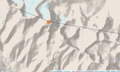 Point 5353 and vicinity OpenStreetMap.png 1,328 × 793; 655 KB
-
 RiverPoonchTN.jpg 2,816 × 1,872; 406 KB
-
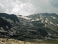
 Toli Peer-2-01.jpg 4,928 × 3,264; 5.07 MB
-
 Toli Peer-3-01.jpg 4,928 × 3,264; 6.45 MB
-
 Upper Kashmir.png 2,448 × 3,264; 15.96 MB


.png)