Category:Lingedijk 7, Wadenoijen
| Object location | | View all coordinates using: OpenStreetMap |
|---|
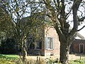
farmhouse in Tiel, Netherlands  | |||||
| Upload media | |||||
| Instance of | |||||
|---|---|---|---|---|---|
| Location | Wadenoijen, Gelderland, Netherlands | ||||
| Street address |
| ||||
| Located on street |
| ||||
| Heritage designation |
| ||||
 | |||||
|
This is a category about rijksmonument number 35619
|
| Address |
|
Media in category "Lingedijk 7, Wadenoijen"
The following 4 files are in this category, out of 4 total.
-
 Voorgevel - Wadenoijen - 20248681 - RCE.jpg 1,200 × 810; 281 KB
-
 Wadenoijen Lingedijk 7 1.jpg 3,264 × 2,448; 2.39 MB
-
 Wadenoijen Lingedijk 7 2.jpg 3,264 × 2,448; 2.45 MB
-
 Wadenoijen Lingedijk 7 3.jpg 3,264 × 2,448; 2.76 MB


