Category:Listed buildings in County Durham
Ceremonial counties of England: Bedfordshire · Berkshire · Buckinghamshire · Cambridgeshire · Cheshire · Cornwall · Cumbria · Derbyshire · Devon · Dorset · Durham · East Riding of Yorkshire · East Sussex · Essex · Gloucestershire · Greater London · Greater Manchester · Hampshire · Herefordshire · Hertfordshire · Kent · Lancashire · Leicestershire · Lincolnshire · Merseyside · Norfolk · North Yorkshire · Northamptonshire · Northumberland · Nottinghamshire · Oxfordshire · Rutland · Shropshire · Somerset · South Yorkshire · Staffordshire · Suffolk · Surrey · Tyne and Wear · Warwickshire · West Midlands · West Sussex · West Yorkshire · Wiltshire · Worcestershire
City-counties: Bristol · City of London
Former historic counties: Westmorland ·
Other former counties:
City-counties: Bristol · City of London
Former historic counties: Westmorland ·
Other former counties:
Wikimedia category | |||||
| Upload media | |||||
| Instance of | |||||
|---|---|---|---|---|---|
| |||||
Subcategories
This category has the following 8 subcategories, out of 8 total.
*
D
H
S
Media in category "Listed buildings in County Durham"
The following 44 files are in this category, out of 44 total.
-
 131203 Houghton Mines Rescue 002 The Building.jpg 4,608 × 3,440; 3.81 MB
-
 41, Newgate bc.jpg 8,000 × 6,000; 11.83 MB
-
 60, Newgate.jpg 6,000 × 8,000; 14.9 MB
-
 Amrita Cottage.jpg 8,000 × 6,000; 18.75 MB
-
 Barn And Attached Wall At Spring Lodge.jpg 8,000 × 6,000; 15.24 MB
-
 Burtree Pasture mine sign at Weardale Museum And High House Chapel.jpg 6,000 × 8,000; 7.95 MB
-
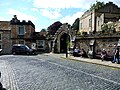 Castle Wall Including Market Lodge, Gateway And Bus Shelter.jpg 8,000 × 6,000; 14.63 MB
-
 Church called St John the Baptist.jpg 8,000 × 6,000; 12.66 MB
-
 Coach House behind that wall North Of The Rectory.jpg 6,000 × 8,000; 17.98 MB
-
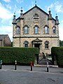
 Concert at Nenthead Methodist Church.jpg 8,000 × 6,000; 12.05 MB
-
 Cragside Cottage.jpg 8,000 × 6,000; 16.62 MB
-
 East And West Houses, Longhorn Ends.jpg 8,000 × 6,000; 10.25 MB
-
 Former Chapel With Front Walls And Steps.jpg 6,000 × 8,000; 13.3 MB
-
 Former Stable, Outbuildings And Walls To The Vicarage And Glebe Cottage.jpg 8,000 × 6,000; 12.39 MB
-
-
 Hackword Tomb About 2 Metres East Of East End Of Church Of St John.jpg 6,000 × 8,000; 19.97 MB
-

-
 Iley Tomb Circa 28 Metres South Of Church Of St Thomas.jpg 6,000 × 8,000; 20.29 MB
-
 John Wesley Monument today.jpg 8,000 × 6,000; 18.51 MB
-

-
 Main Elevation of Barningham Park.png 1,064 × 1,080; 954 KB
-
 North Lodge And Wall To Stanhope Castle (Castle Lodge).jpg 8,000 × 6,000; 16.96 MB
-
 Number 1 And Houses Adjoining In Butts Head, The Butts.jpg 8,000 × 6,000; 11.77 MB
-
 Numbers 1 - 4 Consecutive And Stables Attached.jpg 8,000 × 6,000; 13.5 MB
-
 Outbuildings To North Of Phoenix Inn.jpg 8,000 × 6,000; 16.3 MB
-
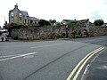
 Pound At West End Of Village.jpg 8,000 × 6,000; 20.33 MB
-
 Premises Formerly Occupied By J And G Archibald Limited.jpg 8,000 × 6,000; 13.64 MB
-
 Premises Occupied By Wh Busby And Market Cottage.jpg 8,000 × 6,000; 14.84 MB
-
 Rancho Del Rio.jpg 8,000 × 6,000; 20.35 MB
-
 South Boundary Wall To Grounds Of Bowes Museum And Church Of St Mary.jpg 6,000 × 8,000; 12.12 MB
-
 Spring Lodge Cottage.jpg 8,000 × 6,000; 12.67 MB
-
 Stables And Coach House Approximately 10 Metres East Of Spring Lodge With Walls And Outhouse.jpg 8,000 × 6,000; 13.34 MB
-
 The Curatage And House Adjoining On West.jpg 8,000 × 6,000; 18.01 MB
-
 The Rectory Stanhope.jpg 8,000 × 6,000; 14.7 MB
-
 The Vicarage And Glebe Cottage.jpg 8,000 × 6,000; 16.71 MB
-
 Trustees Savings Bank today.jpg 6,000 × 8,000; 14.57 MB
-
 Unthank Mill, Houses And Cow House Attached.jpg 8,000 × 6,000; 15.77 MB
-
 Wall of Former Rectory Garden, Now Stanhope Caravan Site.jpg 8,000 × 6,000; 17 MB
-
 Wall on North East Side of Castle Garden, and Gazebo Attached.jpg 8,000 × 6,000; 18.41 MB
-
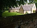
 Walls Around Spring Lodge Garden.jpg 8,000 × 6,000; 16.46 MB
-
 Walls To The Vicarage And Glebe Cottage.jpg 8,000 × 6,000; 17.88 MB
-
 Weardale Museum And High House Chapel.jpg 8,000 × 6,000; 13.73 MB
-
 Wearhead Primary School.jpg 8,000 × 6,000; 11.49 MB
-
 Weavers Workshop At Junction Of A689 And Causeway Road.jpg 8,000 × 6,000; 13.88 MB


.jpg)


