Category:Literacy maps of India
Media in category "Literacy maps of India"
The following 13 files are in this category, out of 13 total.
-
 2011 Census India literacy distribution map by states and union territories.svg 1,500 × 1,615; 1.89 MB
-
 2011 Kolkata literacy rate by Wards (bn).svg 512 × 479; 184 KB
-
 2011 Kolkata literacy rate by Wards (en).svg 512 × 479; 172 KB
-
 Alphabetisierungsrate Indien 2011.svg 828 × 929; 886 KB
-
 Alphabetisierungsrate.png 527 × 600; 120 KB
-
 Alphabetisierungsraten Indien 2011.svg 967 × 1,134; 538 KB
-
 India literacy rate map de.svg 825 × 929; 878 KB
-
 India literacy rate map en.svg 1,639 × 1,852; 878 KB
-
 India literacy rate map he.svg 1,639 × 1,852; 1.33 MB
-
 India literacy rate map.svg 1,639 × 1,852; 803 KB
-
 Tamil Nadu Literacy Map 2011.png 1,122 × 1,240; 235 KB
-
 Tamilnadu Literacy Map 2001.png 2,104 × 1,488; 422 KB
-
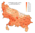 Uttar Pradesh literacy 2011.svg 800 × 750; 614 KB

.svg)
.svg)


