Category:Little Paxton
English: Little Paxton in Cambridgeshire, England is a village near Great Paxton north of St Neots. It is in the district and historic county of Huntingdonshire. Until the 1970s it was a minor village and the church was under threat of closure. The building of a housing estate and a junior school revived its fortunes and the establishment of the Paxton Pits Nature Reserve around part of the nearby gravel pits has brought visitors to the village.
village in the United Kingdom  | |||||
| Upload media | |||||
| Instance of | |||||
|---|---|---|---|---|---|
| Location | Huntingdonshire, Cambridgeshire, East of England, England | ||||
| Said to be the same as | Little Paxton (Wikimedia duplicated page, civil parish) | ||||
 | |||||
Subcategories
This category has the following 2 subcategories, out of 2 total.
J
- St James' Church, Little Paxton (11 F)
L
- Little Paxton Pits (3 F)
Media in category "Little Paxton"
The following 113 files are in this category, out of 113 total.
-
 A1 by Little Paxton - geograph.org.uk - 6324565.jpg 1,024 × 576; 67 KB
-
 A1 near Little Paxton - geograph.org.uk - 3129924.jpg 640 × 480; 75 KB
-
 A1 near Little Paxton - geograph.org.uk - 4668212.jpg 640 × 379; 29 KB
-
 A1 northbound - geograph.org.uk - 4534981.jpg 640 × 478; 46 KB
-
 A1 northbound - geograph.org.uk - 4534985.jpg 640 × 480; 51 KB
-
 A1 northbound - geograph.org.uk - 466200.jpg 640 × 480; 69 KB
-
 B1041 bridge, A1 - geograph.org.uk - 4668214.jpg 640 × 369; 35 KB
-
 B1041 road bridge across A1 - geograph.org.uk - 5895665.jpg 1,024 × 656; 150 KB
-
 B1043 towards Great Paxton - geograph.org.uk - 442818.jpg 640 × 480; 71 KB
-
 B1043 towards St Neots - geograph.org.uk - 442817.jpg 640 × 318; 46 KB
-
 Boardwalk, Paxton Pits - geograph.org.uk - 4996309.jpg 1,600 × 1,200; 1.25 MB
-
 Car park, Paxton Pits - geograph.org.uk - 4996317.jpg 1,600 × 1,188; 695 KB
-
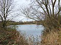
 Cloudy Lake, Paxton Pits Nature Reserve - geograph.org.uk - 2726844.jpg 4,000 × 3,000; 4.08 MB
-
 Country road near Little Paxton - geograph.org.uk - 2102994.jpg 640 × 383; 123 KB
-
 Ditch by Great Ouse - geograph.org.uk - 4996297.jpg 1,600 × 1,098; 668 KB
-
 Down stream on the Kym - geograph.org.uk - 1278962.jpg 640 × 480; 134 KB
-
 Education Centre at Paxton Pits Nature Reserve - geograph.org.uk - 2726840.jpg 4,000 × 3,000; 4.32 MB
-
 Entrance to Little Paxton Quarry - geograph.org.uk - 2726841.jpg 4,000 × 3,000; 4.46 MB
-
 Farm track exit - entrance - geograph.org.uk - 1278939.jpg 640 × 480; 78 KB
-
 Farmland near Little Paxton - geograph.org.uk - 3129895.jpg 640 × 480; 78 KB
-
 Farmland near the A1 - geograph.org.uk - 3129900.jpg 640 × 506; 75 KB
-
 Farmland near the A1 - geograph.org.uk - 3129928.jpg 640 × 480; 87 KB
-
 Farmland towards Little Paxton Wood - geograph.org.uk - 3129935.jpg 640 × 480; 70 KB
-
 Farmland towards the A1 - geograph.org.uk - 3129906.jpg 640 × 480; 86 KB
-
 Footbridge and B1041 crossing the Great Ouse - geograph.org.uk - 4996212.jpg 1,600 × 1,200; 786 KB
-
 Footbridge over River Great Ouse - geograph.org.uk - 3129888.jpg 640 × 480; 87 KB
-
 Ford and footbridge near Hail Weston - geograph.org.uk - 3129944.jpg 640 × 480; 107 KB
-
 Glimpse of a train passing - Paxton Hill - August 2013 - panoramio.jpg 4,000 × 3,000; 2.34 MB
-
 Glimpse of the new windfarm around Toseland from Paxton Pits - August 2013 - panoramio.jpg 3,000 × 4,000; 1.65 MB
-
 Gordon Road, Little Paxton - geograph.org.uk - 4952931.jpg 1,600 × 1,248; 664 KB
-
 Gravel pits at Little Paxton - geograph.org.uk - 222064.jpg 640 × 599; 99 KB
-
 Gravel plant - Little Paxton - geograph.org.uk - 1547935.jpg 640 × 414; 98 KB
-
 Great Meadow - geograph.org.uk - 4996289.jpg 1,600 × 1,200; 917 KB
-

-
 Great River Ouse, St Neots - geograph.org.uk - 1260341.jpg 640 × 480; 95 KB
-
 Hail Weston Ford and Footbridge - geograph.org.uk - 1495351.jpg 640 × 480; 165 KB
-
 Hail Weston Ford from the North Side - geograph.org.uk - 1278953.jpg 640 × 480; 112 KB
-
 Hail Weston Ford looking north - geograph.org.uk - 1278971.jpg 640 × 480; 114 KB
-
 Hayling Avenue, Little Paxton - geograph.org.uk - 3129916.jpg 640 × 480; 54 KB
-
 Hayling Lake, Paxton Pits - geograph.org.uk - 4996306.jpg 1,600 × 1,200; 477 KB
-
 Hayling Walk, Little Paxton - geograph.org.uk - 707441.jpg 640 × 480; 103 KB
-
 Heronry South Lake, Paxton Pits Nature Reserve - geograph.org.uk - 2726843.jpg 4,000 × 3,000; 4.44 MB
-
 High Street - geograph.org.uk - 1732947.jpg 2,592 × 1,944; 2.21 MB
-
 High Street, Little Paxton - geograph.org.uk - 1206516.jpg 640 × 428; 97 KB
-
 High Street, Little Paxton - geograph.org.uk - 3129918.jpg 640 × 480; 62 KB
-
 Houses by the Great Ouse - geograph.org.uk - 4996223.jpg 1,600 × 1,025; 576 KB
-
 Island in the Great Ouse - geograph.org.uk - 4996225.jpg 1,600 × 1,200; 616 KB
-
 Lake at Paxton Pits - 30th August 2013 - panoramio.jpg 4,000 × 3,000; 1.63 MB
-
 Lake in late summer - Paxton Pits - August 2013 - panoramio.jpg 4,000 × 3,000; 2.12 MB
-

-

-
 Late summer - Paxton Pits - August 2013 - panoramio.jpg 4,000 × 3,000; 1.58 MB
-
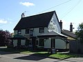
 The Anchor, Little Paxton - geograph.org.uk - 1255263.jpg 640 × 480; 73 KB
-
 Little Paxton Cemetery - geograph.org.uk - 3129933.jpg 640 × 480; 84 KB
-
 Little Paxton Lane - geograph.org.uk - 1732964.jpg 2,592 × 1,944; 2.41 MB
-
 Little Paxton Village Sign - geograph.org.uk - 1260281.jpg 480 × 640; 89 KB
-
 Lock No. 9 - geograph.org.uk - 3788653.jpg 4,320 × 3,240; 6.38 MB
-
 Looking north from Hail Weston Ford - geograph.org.uk - 1495271.jpg 640 × 480; 169 KB
-
 Mill Lane - geograph.org.uk - 1732976.jpg 2,592 × 1,944; 2.35 MB
-
 Mill Lane heading north - geograph.org.uk - 3129891.jpg 640 × 480; 83 KB
-
 New flats on a Great Ouse island - geograph.org.uk - 4996208.jpg 1,600 × 1,200; 586 KB
-
 Old aggregate yard at Paxton Pits - August 2013 - panoramio.jpg 3,896 × 2,858; 1.32 MB
-
 Old Milepost - geograph.org.uk - 2883552.jpg 768 × 1,024; 404 KB
-
 Old Milepost - geograph.org.uk - 2883556.jpg 1,024 × 768; 240 KB
-
 Ouse Valley Way - geograph.org.uk - 4996286.jpg 1,600 × 1,200; 987 KB
-
 Ouse Valley Way - geograph.org.uk - 4996293.jpg 1,600 × 1,200; 879 KB
-
 Ouse Valley Way - geograph.org.uk - 4996302.jpg 1,600 × 1,200; 808 KB
-
 Ouse Valley Way - geograph.org.uk - 4996338.jpg 1,600 × 1,200; 971 KB
-
 Ouse Valley Way east of Little Paxton - geograph.org.uk - 708320.jpg 566 × 440; 153 KB
-
 Ouse Valley Way, Paxton Pits - geograph.org.uk - 4996320.jpg 1,600 × 1,200; 1.27 MB
-
 Papermill Lock development continuing - geograph.org.uk - 4996191.jpg 1,600 × 1,200; 519 KB
-
 Papermill Lock development continuing - geograph.org.uk - 4996204.jpg 1,600 × 1,200; 624 KB
-
 Papermill Lock sales office - geograph.org.uk - 4996186.jpg 1,200 × 1,600; 644 KB
-
 Path and meadow, Paxton Pits - geograph.org.uk - 4996312.jpg 1,600 × 1,200; 767 KB
-
 Path in Paxton Pits Nature Reserve - geograph.org.uk - 2726845.jpg 4,000 × 3,000; 4.36 MB
-
 Paxton Pits Nature Reserve - geograph.org.uk - 1206569.jpg 640 × 428; 116 KB
-
 Permissive path, Paxton Pits - geograph.org.uk - 4996337.jpg 1,600 × 1,216; 843 KB
-
 Pollarded willow by the Great Ouse - geograph.org.uk - 4996299.jpg 1,600 × 1,200; 865 KB
-
 River Great Ouse - geograph.org.uk - 3788659.jpg 4,320 × 3,240; 4.08 MB
-
 River Great Ouse - geograph.org.uk - 4996301.jpg 1,600 × 1,200; 617 KB
-
 River Great Ouse at Little Paxton.jpg 972 × 1,296; 601 KB
-
 River Great Ouse, St Neots - geograph.org.uk - 684755.jpg 640 × 480; 63 KB
-
 River Kym, Hail Weston Ford - geograph.org.uk - 1495290.jpg 640 × 480; 200 KB
-
 Road closure gates - geograph.org.uk - 1278947.jpg 640 × 480; 97 KB
-
 Road to Hail Weston - geograph.org.uk - 1987614.jpg 640 × 480; 64 KB
-
 Rudd Lake, Paxton Pits - geograph.org.uk - 4996315.jpg 1,600 × 1,207; 522 KB
-
 Samuel Jones Crescent - geograph.org.uk - 4996164.jpg 1,600 × 1,200; 672 KB
-
 Samuel Jones Crescent - geograph.org.uk - 4996169.jpg 1,600 × 1,200; 477 KB
-
 Samuel Jones Crescent - geograph.org.uk - 4996181.jpg 1,600 × 1,200; 575 KB
-
 Scrub growth alongside the river - Paxton Pits - August 2013 - panoramio.jpg 4,000 × 3,000; 2.47 MB
-
 Skipper Way - geograph.org.uk - 4996227.jpg 1,600 × 1,247; 665 KB
-
 Sluice on the Great Ouse - geograph.org.uk - 4996220.jpg 1,200 × 1,600; 803 KB
-
 St James' Cottage, Little Paxton - geograph.org.uk - 1260083.jpg 640 × 480; 79 KB
-
 St Neots Housing development - geograph.org.uk - 1260333.jpg 640 × 480; 63 KB
-
 St Neots Lock No.9 - geograph.org.uk - 1260326.jpg 480 × 640; 75 KB
-
 St Neots lock, Little Paxton - geograph.org.uk - 707098.jpg 640 × 480; 95 KB
-
 St Neots Sluice. - geograph.org.uk - 1226545.jpg 640 × 480; 69 KB
-
 The Anchor Inn, High Street, Little Paxton - geograph.org.uk - 2733827.jpg 4,000 × 3,000; 2.47 MB
-
 The Anchor, Little Paxton - geograph.org.uk - 3129914.jpg 640 × 482; 56 KB
-
 The Great River Ouse, St Neots - geograph.org.uk - 1260311.jpg 640 × 480; 72 KB
-
 The Mill House - geograph.org.uk - 3788667.jpg 4,320 × 3,240; 4.32 MB
-
-
 Track to Paxton Lakes Sailing Club - geograph.org.uk - 3129921.jpg 640 × 480; 124 KB
-
 Track towards Quarry, Little Paxton - geograph.org.uk - 3129923.jpg 480 × 640; 69 KB
-

-
 Turning for Little Paxton - geograph.org.uk - 3320781.jpg 640 × 452; 30 KB
-
 Upstream from Hail Weston Ford - geograph.org.uk - 1278967.jpg 640 × 480; 96 KB
-
 Visitor Centre, Paxton Pits - geograph.org.uk - 4996316.jpg 1,600 × 1,200; 667 KB
-
 Water lillies - Paxton Pits - August 2013 - panoramio.jpg 4,000 × 3,000; 1.91 MB
-
 Weedy Lake, Paxton Pits Nature Reserve - geograph.org.uk - 2726839.jpg 4,000 × 3,000; 4.35 MB
-

-
 Roadside Meteorological Sensor Mast - geograph.org.uk - 536195.jpg 480 × 640; 50 KB
-
 Sewage works entrance - geograph.org.uk - 442814.jpg 640 × 531; 77 KB


