Category:Liverpool Royal Infirmary
| Object location | | View all coordinates using: OpenStreetMap |
|---|
former hospital in Pembroke Place, Liverpool  | |||||
| Upload media | |||||
| Instance of | |||||
|---|---|---|---|---|---|
| Location | Liverpool, Merseyside, North West England, England | ||||
| Architect | |||||
| Inception |
| ||||
| Date of official closure |
| ||||
 | |||||

Subcategories
This category has the following 6 subcategories, out of 6 total.
Media in category "Liverpool Royal Infirmary"
The following 16 files are in this category, out of 16 total.
-
 Infirmary, Brownlow Street, patient carried on stretcher. Wellcome L0001728EB.jpg 1,636 × 1,138; 898 KB
-
 Liverpool Royal Infirmary 1931 (14672494533).jpg 3,264 × 2,448; 2.99 MB
-
 Liverpool Royal Infirmary circular ward (14649332181).jpg 3,072 × 2,304; 2.66 MB
-
 Liverpool Royal Infirmary fundraising concert, 1926 (14465900680).jpg 2,304 × 3,072; 2.73 MB
-
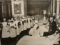 Liverpool Royal Infirmary nurses carol singing 1930s (14629613516).jpg 3,264 × 2,448; 2.98 MB
-

-
 Liverpool Royal Infirmary Nurses Home, official opening, 1931 (14652187022).jpg 3,264 × 2,448; 3.42 MB
-
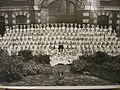
 Liverpool Royal Infirmary Nurses Training School (14465905590).jpg 3,264 × 2,448; 3.51 MB
-
 Liverpool Royal Infirmary nurses, 1930s (14465955859).jpg 3,264 × 2,448; 3.35 MB
-
 Liverpool Royal Infirmary nurses, 1930s (14650364194).jpg 3,264 × 2,448; 3.57 MB
-
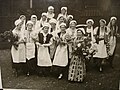
 Liverpool Royal Infirmary nurses, Christmas Eve 1930s (14465902080).jpg 3,264 × 2,448; 3.02 MB
-
 Liverpool Royal Infirmary ward (14629610246).jpg 1,300 × 688; 111 KB
-
 Liverpool Royal Infirmary x-ray room, early 20th century (14466148847).jpg 3,264 × 2,448; 3.43 MB
-
 Mortuary, Liverpool Royal Infirmary.jpg 4,850 × 3,031; 7.87 MB
-
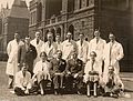 Professor Hay's firm, Liverpool Royal Infirmary (14465879870).jpg 2,517 × 1,905; 2.47 MB
-
 Second Liverpool Royal Infirmary (14652158422).jpg 3,405 × 2,401; 4.15 MB

.jpg)
.jpg)
.jpg)
.jpg)
.jpg)
.jpg)
.jpg)
.jpg)
.jpg)
.jpg)
.jpg)
.jpg)

.jpg)
.jpg)