Category:Llandegla (surrounding area)

Media in category "Llandegla (surrounding area)"
The following 200 files are in this category, out of 256 total.
(previous page) (next page)-
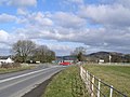
 'A' Road Junction - geograph.org.uk - 327823.jpg 640 × 480; 174 KB
-
 A5104 by Cae Madoc Uchaf - geograph.org.uk - 355733.jpg 640 × 480; 198 KB
-
 A5104 near Llandegla - geograph.org.uk - 461560.jpg 640 × 427; 87 KB
-
 A5104 near Llandegla - geograph.org.uk - 461567.jpg 640 × 427; 90 KB
-
 A5104 towards Corwen - geograph.org.uk - 356525.jpg 640 × 480; 197 KB
-

-
 Access Track to Chweleiriog - geograph.org.uk - 1310863.jpg 640 × 480; 79 KB
-

-
 BT mast on Cyrn-y-Brain - geograph.org.uk - 1227995.jpg 480 × 640; 68 KB
-

-
 Castell y Rhodwydd - geograph.org.uk - 127753.jpg 640 × 479; 44 KB
-
 Clearing in Llandegla Forest - geograph.org.uk - 1178925.jpg 640 × 480; 111 KB
-
 Cyrn y Brain - geograph.org.uk - 1227921.jpg 640 × 480; 63 KB
-
 Dangerous Welsh wildlife - geograph.org.uk - 1178812.jpg 640 × 480; 142 KB
-
 Dinosaur skeleton^ - geograph.org.uk - 1219576.jpg 640 × 394; 160 KB
-
 Entrance to Llandegla Forest - geograph.org.uk - 1303302.jpg 640 × 480; 105 KB
-

-
 Forest drive, Llandegla Forest - geograph.org.uk - 1149838.jpg 640 × 480; 66 KB
-
 Garden Pond Tan-y-Fron near Llandegla - geograph.org.uk - 1111197.jpg 640 × 480; 119 KB
-
 Gate and stile on Cyrn-y-Brain track - geograph.org.uk - 1210826.jpg 640 × 427; 133 KB
-
 Graig Covert - geograph.org.uk - 1178823.jpg 640 × 480; 62 KB
-
 Graig Farm near Llandegla - geograph.org.uk - 1178855.jpg 640 × 480; 77 KB
-
 Grey Heron in Llandegla.jpg 4,818 × 3,212; 2.78 MB
-
 Grouse trail, Llandegla Forest - geograph.org.uk - 1179758.jpg 480 × 640; 124 KB
-
 Hafod Bilston.jpg 4,000 × 3,000; 1.31 MB
-
 Hedge Line and Sheep Pasture - geograph.org.uk - 363868.jpg 640 × 480; 213 KB
-
 Hedge Lines by the A5104 - geograph.org.uk - 356610.jpg 640 × 480; 275 KB
-
 Hollow Cairn - geograph.org.uk - 1070346.jpg 640 × 480; 71 KB
-
 In Llandegla Forest - geograph.org.uk - 1310795.jpg 640 × 480; 103 KB
-
 Lane to Hafod Bilston - geograph.org.uk - 1303366.jpg 640 × 480; 89 KB
-
 Lime Kiln near Llanarmon yn Ial - geograph.org.uk - 342897.jpg 640 × 480; 253 KB
-
 Lime Kiln near Llanarmon yn Ial - geograph.org.uk - 342901.jpg 640 × 480; 278 KB
-
 Llandegla Forest - geograph.org.uk - 1179612.jpg 640 × 480; 99 KB
-
 Llandegla Forest - geograph.org.uk - 1179613.jpg 640 × 480; 75 KB
-
 Llandegla Forest - geograph.org.uk - 1179755.jpg 640 × 480; 102 KB
-
 Llandegla Forest - geograph.org.uk - 1219387.jpg 640 × 614; 276 KB
-
 Llandegla Forest - geograph.org.uk - 1219444.jpg 640 × 600; 242 KB
-

-
 Llandegla Forest, Clwydian Range And Dee Valley Area of Natural Beauty.jpg 5,184 × 3,456; 7.65 MB
-
 Llangollen VHF masts on Cyrn-y-Brain - geograph.org.uk - 1228042.jpg 480 × 640; 69 KB
-

-
 Lonely Sitka - geograph.org.uk - 1303276.jpg 640 × 480; 96 KB
-
 Masts, Cyrn-y-Brain - geograph.org.uk - 1227982.jpg 640 × 480; 59 KB
-
 Minor road near Llandegla. - geograph.org.uk - 644731.jpg 640 × 480; 122 KB
-
 Minor Road. - geograph.org.uk - 644948.jpg 640 × 480; 77 KB
-

-

-

-

-
 Mountain bike trail, Llandegla Forest - geograph.org.uk - 1219519.jpg 427 × 640; 128 KB
-
 Newly felled logs - geograph.org.uk - 1219557.jpg 640 × 427; 161 KB
-
 Nurse Gorlan - geograph.org.uk - 129067.jpg 640 × 480; 95 KB
-
 Offa's Dyke Long Distance Path - geograph.org.uk - 1227812.jpg 640 × 480; 90 KB
-
 Offa's Dyke Path - geograph.org.uk - 1178930.jpg 480 × 640; 105 KB
-
 Offa's Dyke Path - geograph.org.uk - 207886.jpg 480 × 640; 92 KB
-
 Offa's Dyke Path - geograph.org.uk - 644840.jpg 640 × 480; 105 KB
-
 Offa's Dyke Path - geograph.org.uk - 773637.jpg 480 × 640; 141 KB
-

-
 Offa's Dyke Path at Hafod Bilston - geograph.org.uk - 1178905.jpg 480 × 640; 125 KB
-
 Offa's Dyke Path beside River Alyn - geograph.org.uk - 1310856.jpg 640 × 480; 98 KB
-
 Offa's Dyke Path in Llandegla - geograph.org.uk - 1310837.jpg 640 × 480; 71 KB
-
 Offa's Dyke Path in Llandegla Forest - geograph.org.uk - 1149841.jpg 640 × 480; 104 KB
-
 Offa's Dyke Path in Llandegla Forest - geograph.org.uk - 1178924.jpg 480 × 640; 126 KB
-
 Offa's Dyke Path on Cyrn-y-Brain - geograph.org.uk - 1306554.jpg 640 × 480; 83 KB
-

-

-
 Old Hedge Line - geograph.org.uk - 356555.jpg 640 × 480; 201 KB
-
 Old hedgerow near Llandegla Forest - geograph.org.uk - 1178827.jpg 480 × 640; 147 KB
-

-
 On the Road to Minera - geograph.org.uk - 1306538.jpg 640 × 480; 62 KB
-
 Oxbow bend in the River Alyn - geograph.org.uk - 341978.jpg 640 × 480; 229 KB
-
 Parking place on the way to Llangollen - geograph.org.uk - 579993.jpg 640 × 480; 140 KB
-
 Path across Cyrn-y-Brain - geograph.org.uk - 1306545.jpg 640 × 480; 71 KB
-
 Pentre Isaf farm - geograph.org.uk - 1178800.jpg 640 × 480; 66 KB
-
 Plas yn Bwlch - geograph.org.uk - 1228113.jpg 640 × 480; 87 KB
-
 Pond in Llandegla, Clwydian Range And Dee Valley Area of Natural Beauty.jpg 3,456 × 5,184; 5.97 MB
-
 Ponderosa cafe and gift shop - geograph.org.uk - 1079910.jpg 640 × 426; 36 KB
-
 Ponderosa Cafe and Gift shop - geograph.org.uk - 1731911.jpg 640 × 480; 66 KB
-
 Ponderosa cafe car park - geograph.org.uk - 1507034.jpg 467 × 350; 143 KB
-
 Ponderosa Cafe car park - geograph.org.uk - 1507223.jpg 640 × 480; 112 KB
-
 Ponderosa Cafe entrance - geograph.org.uk - 1731915.jpg 640 × 480; 76 KB
-
 Post-box by the road junction. - geograph.org.uk - 644980.jpg 480 × 640; 83 KB
-
 Pylon next to Llandegla Forest - geograph.org.uk - 351351.jpg 480 × 640; 157 KB
-
 Pylons near Llandegla - geograph.org.uk - 151670.jpg 640 × 480; 73 KB
-
 Quarry near Tomen y Rhodwydd - geograph.org.uk - 566888.jpg 640 × 480; 112 KB
-

-

-
 Rhos Isaf - geograph.org.uk - 1587674.jpg 640 × 422; 62 KB
-
 Rhos Isaf limekiln - geograph.org.uk - 62353.jpg 640 × 480; 137 KB
-
 River Alyn alongside the Offa's Dyke Path - geograph.org.uk - 773632.jpg 480 × 640; 133 KB
-
 River Alyn and Offa's Dyke Path - geograph.org.uk - 644805.jpg 640 × 480; 127 KB
-
 River Alyn near Llandegla. - geograph.org.uk - 644720.jpg 640 × 480; 137 KB
-
 Road Junction. - geograph.org.uk - 644979.jpg 640 × 480; 74 KB
-
 Roundabout at Dafarn Dywyrch - geograph.org.uk - 127771.jpg 640 × 478; 77 KB
-

-
 Sheepfold by the A5104 - geograph.org.uk - 356519.jpg 640 × 480; 197 KB
-
 Sir Watkin's Tower and Trig point - geograph.org.uk - 1228009.jpg 640 × 480; 67 KB
-
 Slate stratas, Llandegla Forest - geograph.org.uk - 1179610.jpg 640 × 420; 123 KB
-
 Small Cave - geograph.org.uk - 644892.jpg 640 × 480; 144 KB
-

-
 Spider webs in Llandegla Forest, Clwydian Range And Dee Valley Area of Natural Beauty.jpg 5,184 × 3,456; 5.26 MB
-
 St. Tegla's Well, Llandegla. - geograph.org.uk - 644717.jpg 640 × 480; 141 KB
-
 The Ponderosa Cafe - geograph.org.uk - 1228087.jpg 640 × 480; 66 KB
-
 The Ponderosa Cafe - geograph.org.uk - 541904.jpg 586 × 427; 104 KB
-
 The road to Bryneglwys - geograph.org.uk - 138442.jpg 640 × 463; 102 KB
-
 The road to Llangollen - geograph.org.uk - 579991.jpg 480 × 640; 68 KB
-
 The Road to Minera - geograph.org.uk - 1306523.jpg 640 × 480; 60 KB
-
 Thinning of Sitka, Llandegla Forest - geograph.org.uk - 1303321.jpg 480 × 640; 98 KB
-
 Toadstool in Llandegla Forest, Clwydian Range And Dee Valley Area of Natural Beauty.jpg 3,516 × 3,141; 2.58 MB
-
 Toadstools in Llandegla Forest, Clwydian Range And Dee Valley Area of Natural Beauty.jpg 4,439 × 3,119; 2.71 MB
-
 Towards Llandegla (107810080).jpg 2,298 × 3,456; 4.43 MB
-
 Track ascending Cyrn-y-Brain - geograph.org.uk - 1211850.jpg 640 × 386; 128 KB
-
 Track on Cryn-y-Brain col - geograph.org.uk - 1219638.jpg 640 × 427; 95 KB
-
 Track on the west face of Cyrn-y-Brain - geograph.org.uk - 1211859.jpg 640 × 427; 142 KB
-
 Track to Cyrn-y-Brain transmitters - geograph.org.uk - 1210678.jpg 640 × 438; 132 KB
-
 Transmitter towers on Cyrn-y-Brain - geograph.org.uk - 1211870.jpg 640 × 437; 99 KB
-
 Transmitter towers on Cyrn-y-Brain - geograph.org.uk - 1212277.jpg 640 × 404; 115 KB
-
 Tree at Chweleiriog Lwyd - geograph.org.uk - 773623.jpg 480 × 640; 81 KB
-
 Trig Point on Cyrn-y-Brain - geograph.org.uk - 1228017.jpg 480 × 640; 102 KB
-
 Trig point, Cyrn-y-Brain - geograph.org.uk - 1218736.jpg 640 × 427; 115 KB
-
 View Across the River Alyn - geograph.org.uk - 335811.jpg 640 × 480; 191 KB
-
 View down the Eglwyseg Valley - geograph.org.uk - 1306531.jpg 640 × 480; 81 KB
-

-
 Afon Alun. - geograph.org.uk - 569208.jpg 640 × 480; 123 KB
-
 Ancient Stone Clapper Bridge. - geograph.org.uk - 342884.jpg 480 × 640; 210 KB
-
 Another step on the Offa's Dyke Path - geograph.org.uk - 207905.jpg 480 × 640; 132 KB
-
 Back to the Road. - geograph.org.uk - 569210.jpg 640 × 480; 207 KB
-
 Bath for weary Walkers^ - geograph.org.uk - 341912.jpg 640 × 480; 206 KB
-
 Bridleway to Graianrhyd ^2 - geograph.org.uk - 349738.jpg 640 × 480; 246 KB
-
 Cae'r-hafod - geograph.org.uk - 237715.jpg 640 × 480; 102 KB
-
 Chweleiriog Lwyd - geograph.org.uk - 772606.jpg 640 × 480; 85 KB
-
 Clear fell in Nant Fron-lwyd - geograph.org.uk - 237703.jpg 640 × 480; 111 KB
-
 Clwydian Way near Pant Glas - geograph.org.uk - 242963.jpg 640 × 480; 84 KB
-
 Coniferous forests and bracken - geograph.org.uk - 205287.jpg 640 × 480; 105 KB
-
 Country Footpath - geograph.org.uk - 151657.jpg 480 × 640; 102 KB
-
 Cyrn - y - Brain Llangollen BT-Tower - geograph.org.uk - 41524.jpg 392 × 600; 136 KB
-
 Cyrn - y - Brain Llangollen VHF-Tower - geograph.org.uk - 41519.jpg 393 × 600; 126 KB
-
 Entrance to Gelli Gynan - geograph.org.uk - 207925.jpg 480 × 640; 136 KB
-
 Esclusham Mountain Road - geograph.org.uk - 166135.jpg 640 × 480; 72 KB
-
 Fallen Tree near Llanarmon yn Ial - geograph.org.uk - 341851.jpg 640 × 480; 230 KB
-
 Farm pond - geograph.org.uk - 151613.jpg 640 × 428; 93 KB
-
 Farm Road leading to Accre - geograph.org.uk - 129103.jpg 640 × 480; 110 KB
-
 Farmland near Llandegla - geograph.org.uk - 151654.jpg 640 × 435; 64 KB
-
 Farmland near Llandegla - geograph.org.uk - 644872.jpg 640 × 480; 63 KB
-
 Farmland near Llandegla. - geograph.org.uk - 644870.jpg 640 × 480; 69 KB
-
 Field and forest - geograph.org.uk - 180595.jpg 640 × 479; 70 KB
-
 Field Gates at Tan-y-celn - geograph.org.uk - 327993.jpg 640 × 480; 266 KB
-
 Field of sheep - geograph.org.uk - 129087.jpg 640 × 446; 78 KB
-
 Footbridge over the Alun - geograph.org.uk - 773635.jpg 640 × 480; 125 KB
-
 Footbridge over the River Alyn. - geograph.org.uk - 644729.jpg 640 × 480; 128 KB
-
 Footpath and Hedge - geograph.org.uk - 349657.jpg 640 × 480; 270 KB
-
 Footpath and Hollow Way - geograph.org.uk - 349664.jpg 480 × 640; 262 KB
-
 Footpath below Alyn Bank - geograph.org.uk - 341994.jpg 640 × 480; 218 KB
-
 Footpath below Alyn Bank - geograph.org.uk - 341999.jpg 640 × 480; 277 KB
-
 Footpath by Graig Quarry - geograph.org.uk - 335865.jpg 480 × 640; 239 KB
-
 Footpath from Llanarmon yn Ial - geograph.org.uk - 341872.jpg 640 × 480; 197 KB
-
 Footpath leading from minor road. - geograph.org.uk - 644863.jpg 640 × 480; 106 KB
-
 Footpath near Bryn-yr-odyn - geograph.org.uk - 541885.jpg 640 × 480; 138 KB
-
 Footpath near Bryn-yr-odyn - geograph.org.uk - 541888.jpg 480 × 640; 141 KB
-
 Footpath near Llanarmon yn Ial - geograph.org.uk - 341887.jpg 640 × 480; 130 KB
-
 Footpath on slopes of Moel y Waun. - geograph.org.uk - 644945.jpg 640 × 480; 74 KB
-
 Footpath on slopes of Moel yr-Accre - geograph.org.uk - 644955.jpg 640 × 480; 68 KB
-

-
 Footpath to Accre Hall - geograph.org.uk - 566886.jpg 640 × 480; 99 KB
-
 Footpath to Eglwyseg - geograph.org.uk - 541893.jpg 640 × 480; 132 KB
-
 Footpath to Llanarmon yn Ial - geograph.org.uk - 341825.jpg 480 × 640; 153 KB
-
 Footpath to Llanarmon yn Ial - geograph.org.uk - 341838.jpg 640 × 480; 182 KB
-
 Footpath to Llanarmon yn Ial - geograph.org.uk - 341861.jpg 640 × 480; 257 KB
-
 Footpath to Llanarmon yn Ial - geograph.org.uk - 341880.jpg 640 × 480; 175 KB
-
 Footpath towards Creigiog-Ucha - geograph.org.uk - 349671.jpg 480 × 640; 244 KB
-
 Footpath towards Creigiog-Ucha - geograph.org.uk - 349674.jpg 640 × 480; 247 KB
-
 Ford at World's End - geograph.org.uk - 766637.jpg 640 × 480; 106 KB
-
 Gate and Track to Hafod-lwyd - geograph.org.uk - 353011.jpg 640 × 480; 203 KB
-
 Gate to track leading to Cyrn-y-Brain - geograph.org.uk - 541902.jpg 566 × 438; 118 KB
-
 Geese at Pen-y-Ffrith Bird Gardens - geograph.org.uk - 531137.jpg 640 × 480; 137 KB
-
 Glorious mud - geograph.org.uk - 579994.jpg 640 × 480; 110 KB
-
 Graig Farm near Llandegla - geograph.org.uk - 205256.jpg 640 × 480; 84 KB
-
 Grazings at Pentre Isaf - geograph.org.uk - 208056.jpg 640 × 480; 72 KB
-
 Great walk in - geograph.org.uk - 209293.jpg 640 × 480; 106 KB
-
 Grouse moor below Cyrn-y-Brain - geograph.org.uk - 50033.jpg 640 × 480; 125 KB
-
 Heather clad Maesyrychen Mountain - geograph.org.uk - 541877.jpg 640 × 480; 141 KB
-
 Heather on Maesyrychen Mountain - geograph.org.uk - 541883.jpg 640 × 480; 140 KB
-
 Hillock with trees - geograph.org.uk - 129122.jpg 640 × 480; 91 KB
-
 Lake at Pen y Ffrith - geograph.org.uk - 207894.jpg 640 × 480; 103 KB
-
 Lane to Gweryd Fishing Lakes - geograph.org.uk - 277077.jpg 640 × 480; 221 KB
-
 Limestone outcrops, near Llandegla - geograph.org.uk - 773832.jpg 640 × 480; 63 KB
-
 Limestone Pasture above the River Alyn - geograph.org.uk - 343059.jpg 640 × 480; 208 KB
-
 Llandegla Forest - geograph.org.uk - 113763.jpg 640 × 480; 82 KB
-

-
 Looking up the Offa's Dyke Path - geograph.org.uk - 644926.jpg 480 × 640; 140 KB
-
 Maesyrychen Mountain colours - geograph.org.uk - 541897.jpg 640 × 480; 130 KB
-
 Meander on the River Alyn. - geograph.org.uk - 644726.jpg 640 × 480; 101 KB
-

-
 Moel y Faen Slate Quarry and Spoil Heaps - geograph.org.uk - 352878.jpg 640 × 480; 208 KB
-
 Moel y Waen - geograph.org.uk - 129060.jpg 640 × 480; 63 KB
-
 Moel yr Accre - geograph.org.uk - 127750.jpg 640 × 479; 61 KB
-
 Moorland - geograph.org.uk - 151618.jpg 640 × 480; 125 KB
-
 Moorland and Forest Boundary - geograph.org.uk - 351827.jpg 640 × 480; 241 KB
-
 Mountain grazing. - geograph.org.uk - 127758.jpg 640 × 479; 85 KB
-
 Mountain Track near the Ponderosa - geograph.org.uk - 352421.jpg 640 × 480; 176 KB


.jpg)


&diffonly=true&filefrom=ZMowing+-+geograph.org.uk+-+207912.jpg%0AMowing+-+geograph.org.uk+-+207912.jpg#mw-category-media)