Category:Llandegveth
village in Monmouthshire, Wales _-_geograph.org.uk_-_561315.jpg) | |||||
| Upload media | |||||
| Instance of | |||||
|---|---|---|---|---|---|
| Location | Monmouthshire, Wales | ||||
 | |||||
Subcategories
This category has the following 2 subcategories, out of 2 total.
L
S
- St Tegfedd's Church, Llandegveth (11 F)
Media in category "Llandegveth"
The following 24 files are in this category, out of 24 total.
-
 "The Buildings" in Llandegveth - geograph.org.uk - 422204.jpg 640 × 480; 59 KB
-
 Ford near Walnut Tree Farm - geograph.org.uk - 91852.jpg 640 × 480; 123 KB
-
 Llangibby trig - geograph.org.uk - 100674.jpg 640 × 427; 127 KB
-
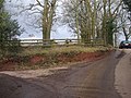
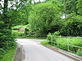
 Road junction - geograph.org.uk - 552614.jpg 640 × 482; 109 KB
-
 Sor Brook, Llandegveth - geograph.org.uk - 3380659.jpg 640 × 480; 124 KB
-
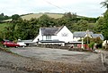 The Farmers Arms, Llandegveth - geograph.org.uk - 3380138.jpg 640 × 440; 89 KB
-
 The track to Pen-y-banc Uchaf Farm - geograph.org.uk - 1702758.jpg 3,296 × 2,472; 1.85 MB
-
 Track to Berllan-deg - geograph.org.uk - 1704295.jpg 3,296 × 2,472; 1.86 MB
-
 Turn left ahead for Llandegveth - geograph.org.uk - 3380145.jpg 640 × 518; 84 KB
-
 Bridge over the brook - geograph.org.uk - 543292.jpg 640 × 482; 131 KB
-
 Bridge over the Sor Brook - geograph.org.uk - 91853.jpg 640 × 480; 103 KB
-

-
 Country road near Coed-y-paen - geograph.org.uk - 91847.jpg 640 × 480; 94 KB
-

-
 Looking down the new road - geograph.org.uk - 422191.jpg 640 × 480; 144 KB
-
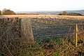
 Monmouthshire countryside - geograph.org.uk - 617197.jpg 640 × 344; 52 KB
-
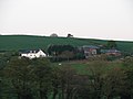
 Pennywan farmhouse - geograph.org.uk - 422224.jpg 640 × 480; 92 KB
-
 Put the pedal to the Metal - geograph.org.uk - 422177.jpg 640 × 480; 121 KB
-
 Sor Brook Valley, Monmouthshire - geograph.org.uk - 92879.jpg 640 × 480; 110 KB
-
 Straight road to nowhere - geograph.org.uk - 543307.jpg 640 × 482; 133 KB
-
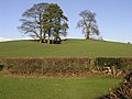 Trees and a Hill - geograph.org.uk - 316394.jpg 640 × 480; 107 KB
-
 Trig Point near Llangybi - geograph.org.uk - 91850.jpg 640 × 480; 59 KB
-
 Ty Capten Farm - geograph.org.uk - 610828.jpg 640 × 480; 132 KB
-


