Category:Llanfair Dyffryn Clwyd
village in Denbighshire, Wales    | |||||
| Upload media | |||||
| Instance of | |||||
|---|---|---|---|---|---|
| Location | Denbighshire, Wales | ||||
| Population |
| ||||
| Area |
| ||||
 | |||||
Cymraeg: Pentref yn Nyffryn Clwyd tua dwy filltir i'r de o Rhuthun yn ne Sir Ddinbych yw Llanfair Dyffryn Clwyd.
English: Llanfair Dyffryn Clwyd is a village in Denbighshire, Wales, situated in the Vale of Clwyd about one mile south of the town of Ruthin. By the 2001 census, it had 1048 residents and 50.6% of them could speak Welsh. The age group with the highest percentage of Welsh speakers was the 15 year olds where every one could speak it.
Subcategories
This category has the following 8 subcategories, out of 8 total.
Media in category "Llanfair Dyffryn Clwyd"
The following 200 files are in this category, out of 245 total.
(previous page) (next page)-
 "Finds" at a metal detectors outing - geograph.org.uk - 2482049.jpg 640 × 480; 82 KB
-
 A 'Great Stone', Moel Gyw and a great plane^ - geograph.org.uk - 5691972.jpg 766 × 1,024; 150 KB
-
 A find^ - geograph.org.uk - 2482071.jpg 480 × 640; 99 KB
-

-
 A stoat crossing the road - geograph.org.uk - 3644522.jpg 1,024 × 663; 133 KB
-
 A Yappy Welcome - geograph.org.uk - 1570312.jpg 480 × 640; 104 KB
-
 A525, Nant Y Garth Pass - geograph.org.uk - 6041741.jpg 640 × 512; 472 KB
-
 Afon Hesbin - geograph.org.uk - 5943557.jpg 4,000 × 3,000; 2.89 MB
-
 Afon Hesbin near Llanfair Dyffryn Clwyd - geograph.org.uk - 5942695.jpg 4,000 × 3,000; 2.91 MB
-
 Ancient Yew, Llanfair Dyffryn Clwyd churchyard, Denbighshire.jpg 4,896 × 3,672; 3.82 MB
-

-

-

-

-

-

-

-

-

-

-

-

-

-

-

-

-

-

-

-

-

-

-

-

-

-

-

-

-

-

-

-
 Boundary Stone, Jericho Lane - geograph.org.uk - 6031819.jpg 4,000 × 3,000; 2.9 MB
-
 Bridleway near Graigadwywynt - geograph.org.uk - 5943476.jpg 4,000 × 3,000; 2.87 MB
-
 Bridleway to Plas-uchaf - geograph.org.uk - 4526884.jpg 800 × 531; 142 KB
-
 Bron-y-Clwyd, Llanfair D C - geograph.org.uk - 3004932.jpg 640 × 480; 63 KB
-
 Bryn-rhedyn - geograph.org.uk - 5112578.jpg 3,316 × 3,631; 1.71 MB
-
 Brynffynnon Hall - geograph.org.uk - 5943517.jpg 4,000 × 3,000; 2.4 MB
-
 Capel Bethel, Graigfechan - geograph.org.uk - 5943581.jpg 4,000 × 3,000; 2.77 MB
-
 Capel Salem - geograph.org.uk - 127734.jpg 640 × 479; 88 KB
-
 Cattle grid near Moel y Gelli - geograph.org.uk - 129037.jpg 640 × 465; 70 KB
-
 Cefn Coch - geograph.org.uk - 4862671.jpg 640 × 480; 79 KB
-
 Chapel near Llanfair Dyffryn Clwyd - geograph.org.uk - 111946.jpg 640 × 480; 67 KB
-
 Clearing up after the winds - geograph.org.uk - 676445.jpg 480 × 640; 88 KB
-
 Cottage at Pentre-côch - geograph.org.uk - 3633858.jpg 1,024 × 680; 172 KB
-
 Country lane near Rhyd-y-Meudwy - geograph.org.uk - 5943534.jpg 4,000 × 3,000; 2.28 MB
-
 Country road near Bryn-rhedyn - geograph.org.uk - 3644527.jpg 1,024 × 680; 247 KB
-
 Countryside view - geograph.org.uk - 4094097.jpg 640 × 480; 74 KB
-
 Countryside view - geograph.org.uk - 4094103.jpg 640 × 480; 85 KB
-
 Cowshed at Maes Llan Farm - geograph.org.uk - 5714290.jpg 640 × 464; 68 KB
-
 Cricor Chapel - geograph.org.uk - 1578043.jpg 640 × 479; 76 KB
-
 Crossroads, Plas Isa - geograph.org.uk - 1102887.jpg 640 × 480; 99 KB
-
 Crowning the queen at the village fair - geograph.org.uk - 815092.jpg 640 × 509; 108 KB
-
 Dead oak tree near Merllyn Farm - geograph.org.uk - 5297697.jpg 640 × 480; 68 KB
-
 Dingle - geograph.org.uk - 5114511.jpg 4,529 × 2,602; 1.72 MB
-
 Dry Stone Wall - geograph.org.uk - 369439.jpg 640 × 480; 151 KB
-
 Dustbin day at Derwen Deg - geograph.org.uk - 5943528.jpg 4,000 × 3,000; 2.85 MB
-
 Entering Graigfechan from the north - geograph.org.uk - 4884906.jpg 640 × 480; 91 KB
-
 Entrance to Coleg Cambria, Llysfasi - geograph.org.uk - 6041736.jpg 800 × 600; 555 KB
-
 Eyarth Hall - geograph.org.uk - 4526882.jpg 800 × 531; 149 KB
-
 Eyarth Hall - geograph.org.uk - 5942699.jpg 4,000 × 3,000; 2.9 MB
-
 Eyarth railway no more - geograph.org.uk - 369423.jpg 640 × 480; 174 KB
-
 Farmland above Nant y Garth Pass - geograph.org.uk - 3632083.jpg 1,024 × 680; 231 KB
-
 Farmland above the Vale of Clwyd - geograph.org.uk - 3632436.jpg 1,024 × 680; 263 KB
-
 Farmland and the Clwydian Hills - geograph.org.uk - 3633807.jpg 1,024 × 680; 188 KB
-
 Farmland near Llanfair Dyffryn Clwyd - geograph.org.uk - 3633781.jpg 1,024 × 680; 236 KB
-
 Ffolt crossroads - geograph.org.uk - 4884905.jpg 640 × 480; 65 KB
-
 Field and stream in the snow - geograph.org.uk - 6056909.jpg 4,288 × 3,216; 3.34 MB
-
 Field and wood near Ty'n Llanfair - geograph.org.uk - 4526872.jpg 1,024 × 680; 292 KB
-
 Field beside Eyarth House Wood - geograph.org.uk - 4527696.jpg 1,024 × 680; 323 KB
-
 Field near Llanfair Dyffryn - geograph.org.uk - 6041031.jpg 640 × 427; 294 KB
-
 Fields beside Pen-dyffryn - geograph.org.uk - 4532782.jpg 3,264 × 2,448; 3.83 MB
-
 Fields in the Clwydian Range - geograph.org.uk - 4532741.jpg 640 × 480; 107 KB
-
 Fields west of Bwlch-y-llyn Farm - geograph.org.uk - 4532766.jpg 640 × 480; 83 KB
-

-
 Footpath from Eyarth Bridge to Pwllglas - geograph.org.uk - 5314770.jpg 480 × 640; 125 KB
-
 Footpath near Pant Myharan - geograph.org.uk - 4532752.jpg 640 × 480; 146 KB
-
 Footpath through Coed Plas y Nant - geograph.org.uk - 873648.jpg 640 × 480; 149 KB
-
 Genus bull stud, Ruthin - geograph.org.uk - 6017657.jpg 4,000 × 3,000; 2.81 MB
-
 Glan Hesbin Farm, Rhyd-y-Meudwy - geograph.org.uk - 5943530.jpg 4,000 × 3,000; 2.85 MB
-
 Graig - geograph.org.uk - 5112531.jpg 3,890 × 1,930; 1.86 MB
-
 Graig - geograph.org.uk - 5112536.jpg 5,184 × 3,456; 1.9 MB
-
 Graig-fechan - geograph.org.uk - 5114497.jpg 4,640 × 3,272; 1.55 MB
-
 Gravestones, Capel Salem - geograph.org.uk - 4862664.jpg 640 × 472; 73 KB
-

-
 Grazing horses near Eyarth Hall - geograph.org.uk - 5942700.jpg 4,000 × 3,000; 2.89 MB
-
 Grazing land below Moel Llanfair - geograph.org.uk - 6152389.jpg 1,024 × 683; 159 KB
-
 Heading towards Bathafarn Farm - geograph.org.uk - 1921155.jpg 640 × 459; 115 KB
-
 Hill to the west of Moel y Waen summit - geograph.org.uk - 6361630.jpg 4,000 × 3,000; 2.37 MB
-
 Horse Mushrooms on Moel y Waen - geograph.org.uk - 6361633.jpg 4,000 × 3,000; 2.88 MB
-
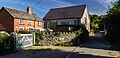
 Houses, Llanfair Dyffryn Clwyd - geograph.org.uk - 1409962.jpg 640 × 480; 83 KB
-
 In the Clwydian Hills - geograph.org.uk - 971471.jpg 640 × 480; 71 KB
-
 Junction of footpaths - geograph.org.uk - 4532756.jpg 640 × 480; 85 KB
-
 Kissing gate, Jericho Lane - geograph.org.uk - 6031823.jpg 4,000 × 3,000; 2.47 MB
-
 Limestone outcrop near Ty'n Llanfair - geograph.org.uk - 1580003.jpg 640 × 480; 57 KB
-
 Llain Wen Uchaf - geograph.org.uk - 5112738.jpg 5,184 × 3,456; 1.64 MB
-
 Llanfair across the meadow - geograph.org.uk - 5788420.jpg 640 × 480; 86 KB
-
 Llanfair D.C. - geograph.org.uk - 6055670.jpg 4,202 × 3,100; 2.4 MB
-
 Llanfair Dyffryn Clwyd Church, Wales.jpg 4,896 × 3,672; 5.68 MB
-
 Llanfair Dyffryn Clwyd Church. Tower and nave. Denbighshire.jpg 4,896 × 3,672; 6.72 MB
-
 Llanfair Dyffryn Clwyd cross, Wales.jpg 4,896 × 3,672; 6.46 MB
-
 Llanfair Dyffryn Clwyd lych gate. Wales.jpg 4,896 × 3,672; 6.17 MB
-
 Llanfair Dyffryn Clwyd, Alms houses. Denbighshire.jpg 4,896 × 3,672; 4.67 MB
-

-
 Llysfasi College - geograph.org.uk - 5112529.jpg 5,184 × 2,355; 1.7 MB
-
 Llysfasi College - geograph.org.uk - 6041739.jpg 640 × 427; 304 KB
-

-
 Lodge to Llwyn Ynn Hall - geograph.org.uk - 129191.jpg 592 × 640; 155 KB
-

-
 Looking towards Ruthin from Llanfair - geograph.org.uk - 6090555.jpg 2,880 × 2,160; 2.83 MB
-

-

-
 Maize stubble in a field near Llanfair Dyffryn Clwyd - geograph.org.uk - 5942703.jpg 4,000 × 3,000; 2.86 MB
-
 Manor House at Llysfasi College - geograph.org.uk - 1618985.jpg 640 × 480; 76 KB
-
 Melin Garthgynnan - geograph.org.uk - 1570316.jpg 640 × 480; 132 KB
-

-
 Merllyn Farm - geograph.org.uk - 5788416.jpg 640 × 480; 91 KB
-
 Metal detector "meet" at Pentrecelyn - geograph.org.uk - 2482052.jpg 640 × 480; 86 KB
-
 Metal detector enthusiasts at work - geograph.org.uk - 2482054.jpg 640 × 480; 76 KB
-

-
 Moel y Plas - geograph.org.uk - 4525890.jpg 640 × 364; 46 KB
-
 Moel yr Accre from Moel y Waen - geograph.org.uk - 6361634.jpg 4,000 × 3,000; 2.62 MB
-
 Moel-y-Gelli - geograph.org.uk - 5114546.jpg 5,184 × 3,456; 1.59 MB
-
 Moss covered wall - geograph.org.uk - 5943506.jpg 4,000 × 3,000; 2.86 MB
-
 Muck bury in a stubble field - geograph.org.uk - 3632421.jpg 1,024 × 680; 231 KB
-
 Mynydd Cricor - geograph.org.uk - 5112576.jpg 5,183 × 2,233; 1.7 MB
-
 Mynydd Cricor - Trig Point - geograph.org.uk - 2260685.jpg 2,592 × 1,728; 1.03 MB
-
 Nant-y-Garth Pass - geograph.org.uk - 5112758.jpg 5,184 × 2,072; 1.73 MB
-
 New school at Llanfair D C - geograph.org.uk - 6022655.jpg 4,000 × 3,000; 2.41 MB
-
 Newlay-laid tarmac on a country road - geograph.org.uk - 6368730.jpg 4,000 × 3,000; 2.88 MB
-
O Deued Pob Cristion.webmsd 03.webm 4 min 39 s, 718 × 404; 24.05 MB
-
 Offa's Dyke Path - geograph.org.uk - 2284066.jpg 640 × 480; 84 KB
-
 Offa's Dyke Path - geograph.org.uk - 971502.jpg 640 × 480; 124 KB
-
 Offa's Dyke Path below Moel Llanfair - geograph.org.uk - 1312279.jpg 640 × 480; 63 KB
-
 Offa's Dyke Path below Moel Llech - geograph.org.uk - 1312275.jpg 640 × 480; 63 KB
-

-

-
 Old hedgerow - geograph.org.uk - 5788407.jpg 640 × 480; 117 KB
-

-

-

-
 Old railway bridge - geograph.org.uk - 1102871.jpg 640 × 480; 99 KB
-
 One man and his dog - geograph.org.uk - 4862668.jpg 640 × 480; 64 KB
-
 Pasture near Rhyd-y-Meudw - geograph.org.uk - 4526879.jpg 800 × 531; 125 KB
-
 Pentre Coch Cottage, Graig-fechan - geograph.org.uk - 4532773.jpg 640 × 480; 123 KB
-
 Pentre-Celyn - geograph.org.uk - 5114506.jpg 5,184 × 3,456; 1.86 MB
-
 Pentre-Celyn - geograph.org.uk - 5114515.jpg 5,165 × 2,497; 1.59 MB
-
 Pentre-Coch Manor lake - geograph.org.uk - 132587.jpg 640 × 480; 109 KB
-
 Plas Bedw - geograph.org.uk - 5112573.jpg 4,507 × 2,870; 1.64 MB
-
 Plas Newydd Hall - geograph.org.uk - 5298897.jpg 640 × 477; 77 KB
-
 Plas Newydd Lodge - geograph.org.uk - 4862660.jpg 640 × 500; 95 KB
-
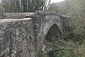 Pont Eyarth.jpg 1,379 × 930; 283 KB
-
 Post it - geograph.org.uk - 369470.jpg 480 × 640; 150 KB
-
 PXL 20220527 151929851~2.jpg 4,032 × 2,268; 2.6 MB
-
 River Clwyd near Pwllglas - geograph.org.uk - 5314774.jpg 480 × 640; 156 KB
-
 Road approaching Pont Eyarth - geograph.org.uk - 4527704.jpg 800 × 531; 159 KB
-
 Road junction near Pentre Coch Manor - geograph.org.uk - 2151317.jpg 640 × 480; 128 KB
-
 Road junction onto the A525 - geograph.org.uk - 3632425.jpg 1,024 × 680; 261 KB
-
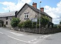 Road junction, Llanfair D.C. - geograph.org.uk - 1409973.jpg 640 × 471; 88 KB
-
 Ruin in the field near Ty'n Llanfair - geograph.org.uk - 1843440.jpg 640 × 480; 94 KB
-
 Seion, Llanfair D.C. - geograph.org.uk - 662577.jpg 640 × 480; 60 KB
-
 Silage ready to be collected - geograph.org.uk - 5942696.jpg 4,000 × 3,000; 2.91 MB
-
-
 Snowscene near Bathafarn - geograph.org.uk - 5697157.jpg 640 × 480; 67 KB
-
 Spring is on its way in Llanfair - geograph.org.uk - 6022657.jpg 4,000 × 3,000; 2.89 MB
-
 Stable gate, near Eyarth - geograph.org.uk - 6032398.jpg 3,799 × 2,849; 2.32 MB
-
 The Bungalow, Nant y Garth - geograph.org.uk - 1581646.jpg 640 × 480; 155 KB
-
 The Llanfair Dyffryn Clwyd Church. Tower and nave. Denbighshire.jpg 4,896 × 3,672; 4.92 MB
-
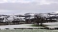
 The Vale of Clwyd - geograph.org.uk - 3633907.jpg 1,024 × 680; 146 KB
-
 The Vale of Clwyd - geograph.org.uk - 3644530.jpg 1,024 × 680; 236 KB
-

-

-
 Three Pigeons Inn - geograph.org.uk - 3633760.jpg 1,024 × 680; 139 KB
-
 Three Pigeons Inn, Graigfechan - geograph.org.uk - 4884907.jpg 640 × 480; 54 KB
-
 Trig Point on Mynydd Cricor - geograph.org.uk - 1585079.jpg 640 × 479; 75 KB
-
 Two black sheep at Eyarth Station - geograph.org.uk - 6090556.jpg 2,880 × 2,160; 2.55 MB
-
 Ty Brith, Pentrecelyn - geograph.org.uk - 5943559.jpg 4,000 × 3,000; 2.83 MB
-
 Ty Gwyn - geograph.org.uk - 6055671.jpg 4,288 × 3,216; 7.21 MB
-
 Ty'n Llanfair - geograph.org.uk - 3970884.jpg 2,288 × 1,712; 851 KB
-
 Ty'n Llanfair - geograph.org.uk - 4514663.jpg 640 × 480; 66 KB
-
 Ty'n Llanfair - geograph.org.uk - 4526874.jpg 800 × 531; 110 KB
-
 Unsurfaced road near Moel Llech - geograph.org.uk - 6152387.jpg 1,024 × 683; 186 KB
-
 Vale of Clwyd - geograph.org.uk - 176219.jpg 640 × 480; 91 KB
-
 Vale of Clwyd under snow - geograph.org.uk - 1580033.jpg 640 × 480; 61 KB
-
 Valley leading West from Moel y Plas - geograph.org.uk - 6152373.jpg 1,024 × 683; 182 KB
-

-
 View from Moel y Plâs - geograph.org.uk - 971493.jpg 640 × 467; 75 KB
-
 View from the bridleway - geograph.org.uk - 5943501.jpg 2,853 × 1,109; 823 KB
-
 View from the northern slopes of Moel y Waen - geograph.org.uk - 6361627.jpg 4,000 × 3,000; 2.49 MB
-
 View over the Vale of Clwyd - geograph.org.uk - 3633733.jpg 1,024 × 680; 183 KB
-
 View to Rhoslydan Farm - geograph.org.uk - 3628326.jpg 1,024 × 680; 176 KB


,_nr_Roman_Fort,_Rhuthun,_Cymru_(Wales)_01.jpg)
,_nr_Roman_Fort,_Rhuthun,_Cymru_(Wales)_02.jpg)
,_nr_Roman_Fort,_Rhuthun,_Cymru_(Wales)_03.png)
,_nr_Roman_Fort,_Rhuthun,_Cymru_(Wales)_04.png)
,_nr_Roman_Fort,_Rhuthun,_Cymru_(Wales)_05.png)
,_nr_Roman_Fort,_Rhuthun,_Cymru_(Wales)_06.jpg)
_01.jpg)
_02.jpg)
_03.jpg)
_04.jpg)
_05.jpg)
_06.jpg)
_07.jpg)
_08.jpg)
_09.jpg)
_10.jpg)
_11.jpg)
_12.jpg)
_13.jpg)
_14.jpg)
_15.jpg)
_16.jpg)
_17.png)
_18.png)
_19.png)
_20.png)
_21.png)
_22.png)
_23.png)
_24.png)
_25.png)


