Category:Llangollen Rural
Cymraeg: Cymuned ym mwrdeisdref sirol Wrecsam yw Llangollen Wledig. Pan ad-drefnwyd llywodraeth leol yn 1996 roedd y gymuned yn rhan o Sir Ddinbych, ond yn 1998 trosglwyddwyd hi i Wrecsam. Mae'n cynnwys pentrefi Froncysyllte, Pontcysyllte a Trefor. Roedd poblogaeth y gymuned yn 2001 yn 1,999.
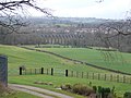
English: Llangollen Rural is a local government community in Wrexham County Borough, Wales. It contains the villages of Froncysyllte, Garth, and Trevor, and had a population of 1,999 at the 2001 census, increasing to 2,059 at the 2011 Census.

community in Wrexham   | |||||
| Upload media | |||||
| Instance of | |||||
|---|---|---|---|---|---|
| Location | Wrexham County Borough, Wales | ||||
| Population |
| ||||
| Area |
| ||||
 | |||||
Subcategories
This category has the following 5 subcategories, out of 5 total.
Media in category "Llangollen Rural"
The following 200 files are in this category, out of 340 total.
(previous page) (next page)-
 "The stream in the sky" - geograph.org.uk - 3027903.jpg 1,600 × 1,200; 325 KB
-
 'Bean Goose' moored near Trevor - geograph.org.uk - 4959514.jpg 640 × 480; 301 KB
-
 'Glas-y-dorlan' moored at Trevor Basin - geograph.org.uk - 4794051.jpg 640 × 480; 221 KB
-
 'Pip Duddon' moored in Trevor Basin - geograph.org.uk - 4794055.jpg 640 × 480; 221 KB
-
 'Sally' at Trevor - geograph.org.uk - 3668076.jpg 1,280 × 856; 365 KB
-

-
 A bit of a tight squeeze - geograph.org.uk - 4724464.jpg 3,996 × 2,994; 3.88 MB
-
 A green and pleasant land - geograph.org.uk - 5103857.jpg 4,000 × 3,000; 4.79 MB
-
 A relic from the forties - geograph.org.uk - 4953251.jpg 5,184 × 3,456; 7.42 MB
-
 A stream in the sky Plaque, Pontcysyllte Aqueduct - geograph.org.uk - 5496241.jpg 1,000 × 1,500; 1.52 MB
-
 A tight turn, Llangollen Canal, Froncysyllte - geograph.org.uk - 5852674.jpg 1,024 × 683; 1.07 MB
-

-
 A weekday boat trip - geograph.org.uk - 3194359.jpg 1,600 × 1,200; 611 KB
-
 A5 approaching the Trevor turning - geograph.org.uk - 3131284.jpg 640 × 430; 95 KB
-
 A539 passing the Aussie Rooster - geograph.org.uk - 2153729.jpg 640 × 499; 71 KB
-
 Afon Dyfrdwy looking upstream - geograph.org.uk - 2874922.jpg 1,600 × 1,200; 724 KB
-
 Another view of J C Edwards Brickworks - geograph.org.uk - 4899965.jpg 2,592 × 1,728; 4.27 MB
-
 Approaching Froncysyllte - geograph.org.uk - 6029445.jpg 1,280 × 943; 1.04 MB
-

-
 Approaching Pontcysyllte Aqueduct - geograph.org.uk - 2912756.jpg 800 × 600; 150 KB
-
 Approaching Pontcysyllte Aqueduct - geograph.org.uk - 5948636.jpg 1,280 × 851; 512 KB
-
-
 Approaching the Pontcysyllte Aqueduct - geograph.org.uk - 1894545.jpg 480 × 640; 175 KB
-

-
 Aqueduct Auctions - geograph.org.uk - 1818269.jpg 640 × 480; 77 KB
-
 Aqueduct Inn Froncysyllte - geograph.org.uk - 4730722.jpg 3,456 × 4,608; 3.38 MB
-
 Aqueduct Inn, Froncysyllte - geograph.org.uk - 4298176.jpg 3,264 × 2,448; 2.29 MB
-

-
-
 At the top of Methodist Hill - geograph.org.uk - 5614124.jpg 1,469 × 1,102; 524 KB
-
 Autumn in the Brick Works Basin - geograph.org.uk - 3194330.jpg 1,600 × 1,200; 777 KB
-
 Badgers Bolt - geograph.org.uk - 6375511.jpg 6,000 × 4,000; 1.64 MB
-
 Banks of the Dee, just below Pontcysyllte Aqueduct - geograph.org.uk - 5398934.jpg 3,674 × 2,758; 4.78 MB
-
 Barns at Blaenau'r-dwr farm - geograph.org.uk - 5614132.jpg 1,469 × 1,102; 636 KB
-
 Benchmark on canal bridge 31, Trevor - geograph.org.uk - 2526743.jpg 3,000 × 4,000; 4.27 MB
-
 Benchmark on Gate Road, Trevor - geograph.org.uk - 2526742.jpg 3,000 × 4,000; 5.11 MB
-
 Bend on the Llangollen Canal - geograph.org.uk - 4988876.jpg 1,600 × 1,064; 400 KB
-

-
 Blaenau'r-dwr farmhouse - geograph.org.uk - 5614133.jpg 1,142 × 857; 413 KB
-
 Boat and walkers on the Pontcysyllte Aqueduct - geograph.org.uk - 1860286.jpg 1,024 × 768; 159 KB
-
 Boat on the Pontcysyllte Aqueduct - geograph.org.uk - 1965302.jpg 712 × 1,024; 251 KB
-
 Boat ^ cyclists on Pontcysyllte Aqueduct - geograph.org.uk - 5851427.jpg 1,024 × 768; 1.09 MB
-
 Bollards at Trevor Junction - geograph.org.uk - 5948652.jpg 1,280 × 851; 398 KB
-
 Bont Playing Fields - geograph.org.uk - 6029427.jpg 1,280 × 960; 828 KB
-
 Bont Playing Fields - geograph.org.uk - 6029431.jpg 1,280 × 960; 736 KB
-
 Brick Works Basin - geograph.org.uk - 3194341.jpg 1,600 × 1,200; 593 KB
-
 Bridge - geograph.org.uk - 4305577.jpg 683 × 1,024; 292 KB
-
 Bridge over the Dee - geograph.org.uk - 3407601.jpg 2,304 × 1,728; 1.65 MB
-
 Bridge over the Tref-y-Nant - geograph.org.uk - 2874912.jpg 1,600 × 1,200; 744 KB
-
 Bron y Gamlas, Trefor - geograph.org.uk - 5564367.jpg 1,024 × 768; 209 KB
-
 Bungalows by the winding hole - geograph.org.uk - 1860219.jpg 1,024 × 768; 118 KB
-
 Canada Bill - geograph.org.uk - 2336264.jpg 640 × 480; 95 KB
-
 Canada Bill Sculpture, Llangollen Canal - geograph.org.uk - 5496198.jpg 1,500 × 1,000; 1.89 MB
-
 Canal arm at Trevor Junction, Wrexham - geograph.org.uk - 5418363.jpg 1,280 × 838; 783 KB
-
 Canal at Frontcysyllte - geograph.org.uk - 4733651.jpg 640 × 428; 86 KB
-
 Canal basin at Pont Cysyllte - geograph.org.uk - 6375276.jpg 3,599 × 2,399; 1.2 MB
-
 Canal Basin at Pontcysyllte in 2004 - geograph.org.uk - 3169162.jpg 800 × 600; 196 KB
-
 Canal Basin at Trevor - geograph.org.uk - 5463762.jpg 1,600 × 1,200; 755 KB
-
 Canal boat "Tommy" turning round at Froncysyllte - geograph.org.uk - 4730740.jpg 3,928 × 2,902; 4.06 MB
-
 Canal boat and bridge - geograph.org.uk - 2153720.jpg 640 × 480; 80 KB
-
 Canal boat going under the B5434 road bridge - geograph.org.uk - 4724477.jpg 3,984 × 2,978; 3 MB
-
 Canal boats at Pontcysyllte wharf - geograph.org.uk - 2153697.jpg 640 × 480; 97 KB
-
 Canal boats in Brickworks Basin - geograph.org.uk - 4954138.jpg 3,264 × 2,448; 3.56 MB
-
 Canal Boats, Llangollen Canal - geograph.org.uk - 5496262.jpg 1,500 × 1,000; 1.61 MB
-
 Canal Towpath - geograph.org.uk - 4736081.jpg 640 × 428; 137 KB
-
 Canal Up in the Air - geograph.org.uk - 4736056.jpg 640 × 428; 108 KB
-
 Canal-side houses in Froncysyllte - geograph.org.uk - 2336231.jpg 640 × 480; 57 KB
-
 Canoeing at Pontcysyllte - geograph.org.uk - 4249779.jpg 1,600 × 1,148; 469 KB
-
 Canoeing on the river Dee at Pontcysyllte - geograph.org.uk - 4902645.jpg 5,184 × 3,456; 4.43 MB
-
 Canoeists on the Llangollen Canal - geograph.org.uk - 6028432.jpg 1,280 × 1,008; 1.22 MB
-
 Cascade on the river Dee - geograph.org.uk - 5575453.jpg 1,024 × 768; 207 KB
-
 Cefn Mawr - a panoramic view - geograph.org.uk - 4898907.jpg 17,493 × 3,391; 7.3 MB
-
 Close your eyes now if you suffer from vertigo - geograph.org.uk - 5564295.jpg 1,024 × 768; 172 KB
-
 Coffee shop - geograph.org.uk - 6265880.jpg 1,600 × 1,200; 670 KB
-
 Congestion on the Llangollen Canal - geograph.org.uk - 5564357.jpg 1,024 × 768; 237 KB
-
 Croesi'r gamlas - Crossing the canal - geograph.org.uk - 6135479.jpg 1,024 × 768; 234 KB
-

-
 Crossing Pontcysyllte Aqueduct (on foot) - geograph.org.uk - 4794072.jpg 640 × 480; 161 KB
-
 Crossing Pontcysyllte Aqueduct - geograph.org.uk - 3664326.jpg 1,280 × 856; 369 KB
-
 Crossing Pontcysyllte Aqueduct - geograph.org.uk - 5344718.jpg 1,280 × 851; 439 KB
-
 Crossing Pontcysyllte Aqueduct - geograph.org.uk - 5948642.jpg 1,280 × 851; 533 KB
-
 Crossing Pontcysyllyte Aqueduct - geograph.org.uk - 5344710.jpg 1,280 × 851; 357 KB
-
 Crossing the Aqueduct - geograph.org.uk - 4792961.jpg 640 × 480; 175 KB
-
 Crossing the Pontcysyllte Aqueduct - geograph.org.uk - 5463777.jpg 1,600 × 1,200; 547 KB
-
 Cycling beside the Llangollen Canal - geograph.org.uk - 4792966.jpg 640 × 480; 238 KB
-
 Cysylltau Bridge - geograph.org.uk - 3701214.jpg 4,000 × 3,000; 3.39 MB
-
 Cysylltau Bridge - geograph.org.uk - 4534366.jpg 4,320 × 3,240; 4.89 MB
-
 Cysylltau Bridge - geograph.org.uk - 6029421.jpg 1,280 × 1,136; 928 KB
-
 Cysylltau Bridge - Trevor, Wrexham - geograph.org.uk - 5900296.jpg 1,024 × 651; 148 KB
-
 Cysylltau Bridge - Upstream View of the River Dee - geograph.org.uk - 6389878.jpg 3,648 × 2,736; 4.23 MB
-
 Cysylltau Bridge from the aqueduct - geograph.org.uk - 4921908.jpg 1,333 × 1,000; 1.36 MB
-

-
 Cysyllte Bridge seen from Pontcysyllte Aqueduct - geograph.org.uk - 6408737.jpg 900 × 1,600; 346 KB
-
 Ddol-isaf - geograph.org.uk - 3179414.jpg 640 × 426; 112 KB
-
 Decorated Sign post - geograph.org.uk - 5496258.jpg 1,000 × 1,500; 1.73 MB
-
 Dee below Cysylltau Bridge, 1976 - geograph.org.uk - 2882274.jpg 640 × 428; 127 KB
-
 Detail of Pont Cysylltau - geograph.org.uk - 5564378.jpg 768 × 1,024; 255 KB
-
 Detail of the Pontcysyllte Aqueduct - geograph.org.uk - 5564297.jpg 768 × 1,024; 252 KB
-
 Dewi Sant, moored at Froncysyllte - geograph.org.uk - 4793951.jpg 640 × 480; 211 KB
-
 Distant view of Pontcysyllte aqueduct - geograph.org.uk - 5564269.jpg 1,024 × 768; 166 KB
-
 Dock House, Trevor - geograph.org.uk - 4900609.jpg 1,600 × 908; 227 KB
-
 Dockside tracks - geograph.org.uk - 5564362.jpg 1,024 × 768; 218 KB
-
 Down below flows the Dee - Trevor, Wrexham - geograph.org.uk - 5900286.jpg 1,024 × 692; 132 KB
-

-
 Duck with two ducklings - geograph.org.uk - 5564349.jpg 1,024 × 768; 269 KB
-
 Eastenders comes to Trevor - geograph.org.uk - 2357417.jpg 2,592 × 1,944; 2.2 MB
-
 End span of Telford's aqueduct - geograph.org.uk - 5463752.jpg 1,600 × 1,200; 523 KB
-

-
 Entering the Pontcysyllte Aqueduct - geograph.org.uk - 1894552.jpg 640 × 480; 200 KB
-
 Essential winter maintenance - geograph.org.uk - 2867527.jpg 1,600 × 1,200; 737 KB
-
 Exiting the Pontcysyllte Aqueduct - geograph.org.uk - 1894563.jpg 480 × 640; 195 KB
-
 Farmland in the Valley of the River Dee - geograph.org.uk - 5398991.jpg 3,674 × 2,758; 5.53 MB
-
 Field with a view - geograph.org.uk - 5900227.jpg 5,184 × 3,888; 4.67 MB
-

-

-

-
 Footpath across common land - geograph.org.uk - 4959511.jpg 640 × 480; 177 KB
-
 Footpath into the woods - geograph.org.uk - 5900206.jpg 5,184 × 3,888; 6.59 MB
-

-
 Footpath near Trevor - geograph.org.uk - 4959501.jpg 640 × 480; 271 KB
-
 Footpath under the aqueduct - geograph.org.uk - 2300226.jpg 706 × 480; 140 KB
-
 Former industrial site, Trevor - geograph.org.uk - 1860307.jpg 1,024 × 768; 100 KB
-
 Former Methodist chapel, Froncysyllte - geograph.org.uk - 5564244.jpg 1,024 × 768; 170 KB
-
 From the Trevor end of the Pontcysyllte Aqueduct - geograph.org.uk - 4724493.jpg 2,710 × 3,798; 4.93 MB
-
 Fron from Garth mountain - geograph.org.uk - 4902639.jpg 5,044 × 3,220; 4.08 MB
-
 Froncysyllte - 1996 - geograph.org.uk - 3297981.jpg 2,272 × 1,514; 764 KB
-
 Froncysyllte - 1996 - geograph.org.uk - 3297986.jpg 2,272 × 1,515; 565 KB
-
 Froncysyllte - 1996 - geograph.org.uk - 3297989.jpg 2,272 × 1,515; 715 KB
-
 Froncysyllte Aqueduct - geograph.org.uk - 2336225.jpg 640 × 480; 80 KB
-
 Froncysyllte Aqueduct - geograph.org.uk - 3407607.jpg 640 × 480; 70 KB
-
 Froncysyllte Bridge, Llangollen Canal - 1984 - geograph.org.uk - 2369834.jpg 2,272 × 1,515; 310 KB
-
 Froncysyllte Community Centre - geograph.org.uk - 5575458.jpg 1,024 × 768; 181 KB
-
 Froncysyllte Long Term Moorings - geograph.org.uk - 5564292.jpg 1,024 × 768; 239 KB
-
 Froncysyllte Post Office - geograph.org.uk - 3133938.jpg 640 × 435; 63 KB
-
 Froncysyllte village hall - geograph.org.uk - 2153605.jpg 640 × 480; 80 KB
-
 Froncysyllte, Llangollen Canal - geograph.org.uk - 4197151.jpg 640 × 427; 361 KB
-
 Ganzee at Trevor - geograph.org.uk - 6030455.jpg 1,280 × 960; 1.45 MB
-
 Gate Road - geograph.org.uk - 6315770.jpg 3,648 × 2,736; 4.35 MB
-
 Gate Road Bridge - geograph.org.uk - 3222335.jpg 640 × 469; 122 KB
-
 Gate Road leading to the Cysylltau Bridge - geograph.org.uk - 6130020.jpg 5,333 × 3,555; 6.65 MB
-
 Gate Road, Froncysyllte - geograph.org.uk - 5116394.jpg 5,184 × 3,152; 4.71 MB
-
 Gateway to nowhere - geograph.org.uk - 4276884.jpg 480 × 272; 84 KB
-
 George Avenue, Trevor - geograph.org.uk - 6066169.jpg 1,280 × 851; 453 KB
-
 Glas-Y-Dorlan at Trevor Basin - geograph.org.uk - 6028872.jpg 1,280 × 1,132; 1.3 MB
-
 Grassland between B5434 and Pontcysyllte Aqueduct - geograph.org.uk - 3701229.jpg 4,000 × 3,000; 2.25 MB
-
 Green shed in green fields - geograph.org.uk - 1860290.jpg 1,024 × 768; 141 KB
-
 Hafod Farm - geograph.org.uk - 4538019.jpg 800 × 531; 120 KB
-
 Hafod Farm from the south-west - geograph.org.uk - 3827957.jpg 3,648 × 2,736; 4.68 MB
-
 Having a chat by the canal - geograph.org.uk - 4792960.jpg 640 × 480; 206 KB
-
 Holly Cottage at Trevor-isaf - geograph.org.uk - 4968907.jpg 3,264 × 2,448; 3.48 MB
-
 Holyhead 80 - geograph.org.uk - 5178213.jpg 1,024 × 683; 247 KB
-
 House and farm buildings at Blaenau'r-dwr - geograph.org.uk - 3375395.jpg 1,600 × 1,200; 535 KB
-
 House with a view - geograph.org.uk - 2337598.jpg 640 × 480; 66 KB
-
 Houses above Ty Isa farm - geograph.org.uk - 2944347.jpg 1,600 × 1,200; 496 KB
-
 Humorous notice by the Llangollen Canal - geograph.org.uk - 5564282.jpg 1,024 × 768; 195 KB
-
 I mewn i'r coed - Into the woods - geograph.org.uk - 6135499.jpg 1,024 × 768; 398 KB
-
 Improved footpath towards Ty Mawr Country Park - geograph.org.uk - 2874650.jpg 1,600 × 1,200; 1,004 KB
-

-
 Industrial memories - geograph.org.uk - 1860216.jpg 1,024 × 768; 200 KB
-
 Jeffrey's Wood - geograph.org.uk - 1805495.jpg 1,500 × 1,000; 170 KB
-
 Jones the Boat for trips over the Pontcysyllte Aqueduct - geograph.org.uk - 4724452.jpg 3,842 × 2,776; 5.09 MB
-
 Jones the Boats - geograph.org.uk - 6028426.jpg 1,280 × 960; 1.09 MB
-
 Laid up for winter - geograph.org.uk - 4334880.jpg 1,024 × 581; 98 KB
-
 Lane beside the Graesser Chemicals site - geograph.org.uk - 2874607.jpg 1,600 × 1,200; 558 KB
-
 Lane descending in Garth - geograph.org.uk - 3861539.jpg 640 × 480; 51 KB
-
 Lane junction at Tower Wood - geograph.org.uk - 3861536.jpg 640 × 480; 84 KB
-
 Lane near Cefn-y-fedw - geograph.org.uk - 3861534.jpg 640 × 481; 103 KB
-
 Leaving the woods - geograph.org.uk - 3179423.jpg 425 × 640; 182 KB
-
 Llanerch Farm trig point - geograph.org.uk - 5614135.jpg 1,102 × 1,469; 806 KB
-
 Llangollen - 1984 - geograph.org.uk - 2369930.jpg 2,272 × 1,514; 672 KB
-
 Llangollen on Christmas Day - geograph.org.uk - 4883120.jpg 4,752 × 3,168; 1.1 MB
-
 Llangollen Road, Trevor - geograph.org.uk - 4959497.jpg 640 × 480; 214 KB
-
 Llangollen Road-Garth Road junction - geograph.org.uk - 3861546.jpg 640 × 480; 65 KB
-
 Llangollen, River Dee - 1984 - geograph.org.uk - 2369988.jpg 1,514 × 2,270; 520 KB
-
 Local bus on Gate Road - geograph.org.uk - 5575470.jpg 1,024 × 768; 164 KB
-
 Massive brown field site - geograph.org.uk - 2874589.jpg 1,600 × 1,200; 462 KB
-
 Methodist Hill, Froncysyllte - geograph.org.uk - 5564247.jpg 1,024 × 768; 145 KB
-
 Mile Stone - Llangollen 3 - geograph.org.uk - 5142932.jpg 423 × 640; 103 KB
-
 Modern timber building - geograph.org.uk - 3375387.jpg 1,600 × 1,200; 429 KB
-
 Moorings on branch canal, Pontcysyllte - geograph.org.uk - 4276858.jpg 640 × 480; 106 KB
-
 Narrow boat at Pontcysyllte - geograph.org.uk - 4249772.jpg 1,600 × 1,107; 445 KB
-
 Narrow boat at Trevor - geograph.org.uk - 4897038.jpg 4,000 × 3,000; 3.42 MB
-
 Narrow boats at Pontcysyllte - geograph.org.uk - 4244008.jpg 1,600 × 935; 265 KB
-
 Narrowboat at Trevor - geograph.org.uk - 3668086.jpg 1,280 × 856; 306 KB
-
 Narrowboat leaving the Aqueduct - geograph.org.uk - 4733718.jpg 640 × 428; 91 KB
-
 Newbridge Viaduct - geograph.org.uk - 5524408.jpg 3,968 × 2,976; 2.67 MB
-
 No match today - geograph.org.uk - 4792954.jpg 640 × 480; 158 KB
-
 Offa's Dyke path entering Trevor Hall Wood - geograph.org.uk - 6148542.jpg 1,024 × 683; 226 KB
-
 Old bridge over the Dee at Froncysyllte - geograph.org.uk - 4376303.jpg 640 × 480; 120 KB
-

-
 Old lime kiln at Froncysyllte - geograph.org.uk - 4793954.jpg 640 × 480; 197 KB
-
 Old Milestone - geograph.org.uk - 5178224.jpg 683 × 1,024; 199 KB
-

-
 On the tow-path of the Llangollen Canal - geograph.org.uk - 4792963.jpg 640 × 480; 240 KB
-
 OS benchmark - Trevor, canal bridge no 31 - geograph.org.uk - 5614039.jpg 1,102 × 1,469; 1.07 MB
-
 OS flush bracket on Llanerch Farm trig pillar - geograph.org.uk - 5614136.jpg 857 × 1,142; 662 KB
-
 Our canal boat awaits us. - geograph.org.uk - 2912735.jpg 800 × 600; 145 KB
-
 Over Aqueduct playing field toward Pontcysyllte Aqueduct - geograph.org.uk - 4730708.jpg 4,608 × 3,456; 3.6 MB
-
 Pasture near Froncysyllte - geograph.org.uk - 4792956.jpg 640 × 480; 153 KB
-


_Anglo-Welsh_hire_boats_at_Trevor_Basin_-_geograph.org.uk_-_4794065.jpg)


_-_geograph.org.uk_-_4794072.jpg)


