Category:Llantwit Major
town and community in the Vale of Glamorgan, Wales, UK   | |||||
| Upload media | |||||
| Instance of | |||||
|---|---|---|---|---|---|
| Location | Vale of Glamorgan, Wales | ||||
 | |||||
Subcategories
This category has the following 16 subcategories, out of 16 total.
*
B
- Llantwit Major Beach (32 F)
- Bridges in Llantwit Major (9 F)
C
- Afon Col-Huw (8 F)
E
F
- Frampton, Vale of Glamorgan (14 F)
L
- Llantwit Major railway station (15 F)
O
- Ogney Brook (8 F)
R
S
- Snow in Llantwit Major (22 F)
- Stiles in Llantwit Major (6 F)
T
- Tresilian Bay (8 F)
W
Media in category "Llantwit Major"
The following 200 files are in this category, out of 630 total.
(previous page) (next page)-
-
 .... and so it came to pass^ - geograph.org.uk - 1930895.jpg 1,500 × 996; 1.16 MB
-
 A flurry of Blackthorn blossom. - geograph.org.uk - 1207268.jpg 640 × 480; 238 KB
-
 A Glimpse Across Fields - geograph.org.uk - 5048554.jpg 3,264 × 2,448; 2.99 MB
-
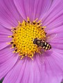 A Hover Fly on Cosmos flower - geograph.org.uk - 1967926.jpg 1,137 × 1,500; 1.43 MB
-
 A rural scene in Llantwit Major - geograph.org.uk - 3390269.jpg 640 × 480; 97 KB
-
 A seat with a view - geograph.org.uk - 5079841.jpg 4,608 × 3,456; 3.96 MB
-
 A seating area on amenity land - geograph.org.uk - 5867436.jpg 6,000 × 4,000; 5.42 MB
-
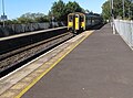 Aberdare train arriving at Llantwit Major station - geograph.org.uk - 6270743.jpg 1,600 × 1,181; 487 KB
-
 Agricultural Depot - geograph.org.uk - 5070058.jpg 3,264 × 2,448; 2.62 MB
-
 American Kestrel at the Falconry UK display - Boverton - geograph.org.uk - 2072793.jpg 3,168 × 2,534; 4.07 MB
-

-
 Andrews House, Llantwit Major - geograph.org.uk - 4412034.jpg 800 × 540; 91 KB
-

-
 Autumn in Cwm Col-Huw.jpg 5,752 × 3,835; 12.58 MB
-

-

-
 B4265 east of Boverton - geograph.org.uk - 2321909.jpg 640 × 480; 54 KB
-
 B4265 near end of runway at St Athan - geograph.org.uk - 3049553.jpg 640 × 481; 37 KB
-
 Baker's Lane, Llantwit Major - geograph.org.uk - 4421663.jpg 800 × 800; 128 KB
-
 Barclays Bank, Llantwit Major - geograph.org.uk - 3177529.jpg 640 × 480; 68 KB
-
 Barley field and hedge line - geograph.org.uk - 1926345.jpg 1,500 × 996; 1.3 MB
-

-
 Barons Close Wine Shop, Llantwit Major - geograph.org.uk - 3493289.jpg 800 × 593; 105 KB
-
 Beach at Col-huw Point - geograph.org.uk - 5003963.jpg 6,000 × 4,000; 6.19 MB
-
 Beach defences - Llantwit Major - geograph.org.uk - 1581766.jpg 640 × 425; 85 KB
-
 Bench for a weary walker - geograph.org.uk - 1653479.jpg 640 × 425; 114 KB
-
 Bend and trees on the Hoddnant - Boverton - geograph.org.uk - 2285108.jpg 2,859 × 1,899; 5.74 MB
-
 Bethesda'r Fro Chapel - geograph.org.uk - 5361267.jpg 1,600 × 1,200; 402 KB
-
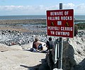 Beware of falling rocks, Llantwit Beach - geograph.org.uk - 3491549.jpg 800 × 668; 163 KB
-
 Bilingual name sign on Llantwit Major railway station - geograph.org.uk - 6264239.jpg 1,327 × 1,600; 383 KB
-

-
 Blockley's Barber's shop - Boverton - geograph.org.uk - 2074310.jpg 1,600 × 1,063; 1.34 MB
-

-
 Boverton Brook, Boverton - geograph.org.uk - 6276980.jpg 1,462 × 1,600; 603 KB
-
 Boverton Court, Boverton - geograph.org.uk - 6277105.jpg 1,600 × 1,272; 457 KB
-
 Boverton Mill Farm - geograph.org.uk - 5048527.jpg 2,448 × 2,448; 1.69 MB
-
 Boverton Post Office name sign - geograph.org.uk - 6277018.jpg 506 × 1,024; 121 KB
-
 Boverton Road - geograph.org.uk - 5866757.jpg 6,000 × 4,000; 6.46 MB
-

-
 Boverton Road from Boverton towards Llantwit Major - geograph.org.uk - 6276989.jpg 1,600 × 1,501; 458 KB
-
 Boverton Road, Llantwit Major - geograph.org.uk - 2389933.jpg 883 × 651; 137 KB
-
 Bowling green wall - Llantwit Major - geograph.org.uk - 1700124.jpg 1,200 × 900; 1.11 MB
-
 Bridge over the Hoddnant - geograph.org.uk - 5209914.jpg 3,264 × 2,448; 1.82 MB
-

-

-
 Bumblebee, Bombus hypnorum. - geograph.org.uk - 5863533.jpg 4,292 × 2,919; 6.2 MB
-
 Burial Lane, Llantwit Major - geograph.org.uk - 4412736.jpg 692 × 800; 165 KB
-
 Castle Court, Llantwit Major - geograph.org.uk - 4421847.jpg 800 × 462; 85 KB
-
 Castle Street, Llantwit Major - geograph.org.uk - 4417760.jpg 800 × 608; 95 KB
-
 Cattle by the coast - geograph.org.uk - 5867504.jpg 5,793 × 3,860; 2.54 MB
-
 Cattle Pond - geograph.org.uk - 5070065.jpg 3,264 × 2,448; 3.92 MB
-
 Cattle waterer near Flanders Farm - geograph.org.uk - 5867469.jpg 6,000 × 4,000; 4.94 MB
-
 Caves at Stout Point (geograph 6214157).jpg 1,024 × 768; 197 KB
-
 CCTV is CTCC in Welsh, Llantwit Major railway station - geograph.org.uk - 6270858.jpg 1,436 × 1,600; 742 KB
-
 Chaseford Stud - geograph.org.uk - 5185006.jpg 3,264 × 2,448; 2.87 MB
-
 Cherry Tree Cottage - geograph.org.uk - 5048507.jpg 3,264 × 2,448; 2.66 MB
-
 Church Lane - geograph.org.uk - 5867491.jpg 6,000 × 4,000; 5.08 MB
-
 Church of Our Lady and St.Illtyd - geograph.org.uk - 5209871.jpg 3,264 × 2,448; 1.69 MB
-
 Church Street businesses, Llantwit Major - geograph.org.uk - 4412748.jpg 800 × 692; 121 KB
-

-
 Churchyard cross, St Illtud's, Llantwit Major - geograph.org.uk - 5082396.jpg 3,456 × 4,608; 3.59 MB
-
 Churchyard footbridge, Llantwit Major.jpg 1,200 × 900; 700 KB
-
 Classic Talbot car in Llantwit Major - geograph.org.uk - 5428964.jpg 800 × 600; 118 KB
-
 Clearly a favourite spot for barbecue-lovers - geograph.org.uk - 5079833.jpg 4,608 × 3,456; 3.88 MB
-
 Cliff and pebbly beach, Llantwit Major - geograph.org.uk - 3491493.jpg 800 × 564; 146 KB
-
 Cliff near Trebeferad, Llantwit Major - geograph.org.uk - 854227.jpg 640 × 480; 62 KB
-
 Cliff, Rockfall, Beach and Fence - geograph.org.uk - 5235318.jpg 2,448 × 3,264; 3.92 MB
-
 Cliff, rocks and sea - Llantwit Major (geograph 2067695).jpg 2,000 × 1,328; 2.15 MB
-
 Cliff-top fields and path on Glamorgan coast - geograph.org.uk - 2781867.jpg 4,000 × 3,000; 3.71 MB
-
 Cliffs at Llantwit Major (7961638074).jpg 3,897 × 2,451; 5.54 MB
-
-
 Cliffs near Llantwit Beach - geograph.org.uk - 2115590.jpg 640 × 480; 161 KB
-
 Cliffs near Llantwit beach - geograph.org.uk - 2115596.jpg 640 × 480; 155 KB
-
 Cliffs near Llantwit Major - geograph.org.uk - 5004127.jpg 6,000 × 4,000; 4.31 MB
-
 Clifftop path east of Llantwit Beach - geograph.org.uk - 3536572.jpg 800 × 600; 145 KB
-

-
 Clifftop track east of Llantwit Beach - geograph.org.uk - 3724664.jpg 800 × 587; 145 KB
-
 Coast Cafe, 11 Pounds Field, Llantwit Major - geograph.org.uk - 6275749.jpg 1,600 × 1,444; 372 KB
-
 Coast near Col-huw Point - geograph.org.uk - 5867510.jpg 6,000 × 4,000; 4.62 MB
-
 Coastal Erosion - geograph.org.uk - 5235317.jpg 2,448 × 3,264; 3.35 MB
-
 Coastal Hedges - geograph.org.uk - 5235327.jpg 3,264 × 2,448; 4.08 MB
-

-
 Coastline Llantwit Major - geograph.org.uk - 3458875.jpg 3,264 × 2,448; 3.64 MB
-
 Col-huw - geograph.org.uk - 4632849.jpg 640 × 480; 100 KB
-
 Col-huw beach at Llantwit Major - geograph.org.uk - 2408470.jpg 640 × 480; 82 KB
-
 Col-huw Point - geograph.org.uk - 3536558.jpg 800 × 600; 182 KB
-
 Col-Huw Point - geograph.org.uk - 5209937.jpg 2,313 × 3,082; 1.47 MB
-
 Col-huw Point, Llantwit Major - geograph.org.uk - 3491623.jpg 800 × 600; 165 KB
-
 Cold water tank - Llantwit Major - geograph.org.uk - 1653514.jpg 640 × 425; 67 KB
-

-

-
 College Gardens, Llantwit Major - geograph.org.uk - 1114104.jpg 640 × 480; 94 KB
-
 Commercial Street - geograph.org.uk - 3049122.jpg 640 × 480; 74 KB
-
 Common House Spider - geograph.org.uk - 1925372.jpg 1,500 × 1,004; 1.17 MB
-

-

-
 Cool lion, Llanmaes Road, Llantwit Major - geograph.org.uk - 6277888.jpg 1,600 × 1,512; 612 KB
-

-

-
 Cornerhouse Tearooms, Llantwit Major - geograph.org.uk - 4412732.jpg 800 × 494; 85 KB
-
 Cottages on Eagleswell Road - Boverton - geograph.org.uk - 2074318.jpg 1,600 × 1,030; 1.27 MB
-

-
 Country lane above Cwm Col-huw, Llantwit Major.jpg 6,000 × 4,000; 11.85 MB
-

-
 Cow and gate near Llantwit Major - geograph.org.uk - 3725008.jpg 800 × 600; 132 KB
-
 Cows on the Wales Coast Path near Llantwit Major Beach.jpg 3,956 × 2,637; 3.82 MB
-
 Cwm Col-Huw looking seaward - geograph.org.uk - 846869.jpg 640 × 254; 48 KB
-

-
 Cycling towards Llantwit Major - geograph.org.uk - 4420301.jpg 800 × 800; 153 KB
-

-
 Daisies in a playground - Llantwit Major - geograph.org.uk - 1716662.jpg 1,200 × 900; 1.15 MB
-

-

-

-
 Detached houses, Llanmaes Road, Llantwit Major - geograph.org.uk - 6277700.jpg 1,600 × 1,114; 349 KB
-
 Diamond Jubilee field, Llantwit Major - geograph.org.uk - 4412099.jpg 800 × 600; 208 KB
-

-

-
 Downhill path - Col-huw Point - geograph.org.uk - 1652728.jpg 640 × 425; 112 KB
-
 Eagleswell Cottages, Eagleswell Road, Boverton - geograph.org.uk - 6277086.jpg 1,600 × 1,277; 457 KB
-
 Eagleswell Primary School - Llantwit Major - geograph.org.uk - 4591683.jpg 3,000 × 1,993; 1.52 MB
-

-

-

-

-
 East Street businesses, Llantwit Major - geograph.org.uk - 4412731.jpg 800 × 600; 113 KB
-

-
 Edward VII postbox in Llantwit Major - geograph.org.uk - 1232117.jpg 480 × 640; 97 KB
-

-

-
 Engine and plough - Boverton - geograph.org.uk - 2072224.jpg 1,500 × 996; 1.32 MB
-

-
 Entrance to Llantwit Major ambulance station - geograph.org.uk - 6277655.jpg 1,600 × 1,109; 432 KB
-
 Eventide - Llantwit Major - geograph.org.uk - 2811661.jpg 2,880 × 2,021; 3.28 MB
-
 Exit path from Llantwit Major railway station - geograph.org.uk - 6270755.jpg 1,600 × 1,536; 825 KB
-

-
 Fairfield Rise, Llantwit Major - geograph.org.uk - 6277556.jpg 1,600 × 1,529; 438 KB
-
 Farm Buildings - geograph.org.uk - 5070067.jpg 3,264 × 2,448; 3.45 MB
-

-
 Farmland near Ogney Brook - geograph.org.uk - 5867456.jpg 5,706 × 3,802; 3.74 MB
-
 Farnham's Fish ^ Chips shop in Boverton - geograph.org.uk - 6276956.jpg 1,600 × 1,379; 406 KB
-
 Female Blackcap - Llantwit Major - geograph.org.uk - 4338416.jpg 2,400 × 1,763; 328 KB
-
 Female Hoverfly (Sphaerophoria sp.) hovering - geograph.org.uk - 6203136.jpg 1,808 × 1,206; 1.57 MB
-
 Ffug Dwr Orchard House Folly - geograph.org.uk - 4632892.jpg 640 × 480; 121 KB
-
 Field beside the Hoddnant - Boverton - geograph.org.uk - 2285611.jpg 2,859 × 1,899; 5.99 MB
-

-
 Field Hedge and Winter Crop - geograph.org.uk - 5235458.jpg 2,448 × 3,264; 2.97 MB
-
 Field near Flanders Farm - geograph.org.uk - 5867475.jpg 6,000 × 4,000; 4.22 MB
-
 Field next to the road to Llantwit beach - geograph.org.uk - 3541890.jpg 640 × 480; 166 KB
-
 Field of cattle near Llantwit Major - geograph.org.uk - 2003545.jpg 640 × 480; 61 KB
-
 Fields and plane near Llantwit Major - geograph.org.uk - 2781863.jpg 3,000 × 4,000; 2.32 MB
-
 Fields near Llantwit Major - geograph.org.uk - 2781837.jpg 4,000 × 3,000; 3.22 MB
-
 Fields near Llantwit Major - geograph.org.uk - 4627239.jpg 6,000 × 4,000; 4.62 MB
-
 Fields on the edge of Llantwit Major - geograph.org.uk - 4627073.jpg 6,000 × 4,000; 5.14 MB
-
 Filco, Llantwit Major - geograph.org.uk - 3176559.jpg 640 × 430; 67 KB
-
 Flanders Meadow, Llantwit Major - geograph.org.uk - 3393112.jpg 640 × 447; 67 KB
-
 Flood flow - Llantwit Major - geograph.org.uk - 3243491.jpg 3,000 × 1,987; 3.2 MB
-
 Footbridge near Frampton - geograph.org.uk - 2775642.jpg 1,800 × 1,167; 2.19 MB
-

-
 Footpath 'tween trees and fence - Boverton - geograph.org.uk - 2285118.jpg 2,859 × 1,899; 5.95 MB
-
 Footpath above Col-huw Point - geograph.org.uk - 1652700.jpg 640 × 425; 102 KB
-
 Footpath and Stile - geograph.org.uk - 5235617.jpg 2,448 × 3,264; 4.03 MB
-
 Footpath beside the Hoddnant - Boverton - geograph.org.uk - 2285040.jpg 2,859 × 1,899; 5.74 MB
-
 Footpath near Llantwit Major - geograph.org.uk - 2781841.jpg 4,000 × 3,000; 3.56 MB
-
 Footpath near Llantwit Major - geograph.org.uk - 2781846.jpg 4,000 × 3,000; 3.1 MB
-
 Footpath past the windmill - geograph.org.uk - 5866799.jpg 6,000 × 4,000; 4.73 MB
-

-
 Footpath to Dimhole - geograph.org.uk - 5226988.jpg 3,264 × 2,448; 3.29 MB
-
 Footpath to Dimhole and Tresilian - geograph.org.uk - 5869403.jpg 6,000 × 4,000; 7.72 MB
-

-
 Footpath towards Llantwit Major - geograph.org.uk - 5867480.jpg 5,200 × 3,467; 7.03 MB
-

-
 Ford sign, Turkey Street, Llantwit Major - geograph.org.uk - 4413232.jpg 800 × 764; 163 KB
-
 Former Christian Centre buildings at Boverton - geograph.org.uk - 2781882.jpg 4,000 × 3,000; 3.8 MB
-
 Former Frampton Windmill, Llantwit Major - geograph.org.uk - 3176429.jpg 415 × 640; 101 KB
-
 Former windmill near Llantwit Major - geograph.org.uk - 5869412.jpg 6,000 × 4,000; 4.94 MB
-
 Fossil at Llantwit Major Beach - geograph.org.uk - 3458883.jpg 3,264 × 2,448; 3.7 MB
-
 Four Acre, Llantwit Major - geograph.org.uk - 6277828.jpg 1,600 × 1,148; 416 KB
-
 Frampton Lane - geograph.org.uk - 5866820.jpg 6,000 × 4,000; 4.55 MB
-
 Gate and driveway to Tir Abad, Llantwit Major - geograph.org.uk - 5079682.jpg 4,608 × 3,456; 3.94 MB
-

-

-
 Gate to a path to Llantwit Beach - geograph.org.uk - 3393273.jpg 640 × 480; 88 KB
-
 Glamorgan Coast at Penry Bay - geograph.org.uk - 2781892.jpg 4,000 × 3,000; 3.14 MB
-
 Glamorgan coast from Stout Point - geograph.org.uk - 2781854.jpg 4,000 × 3,000; 3.88 MB
-
 Glamorgan coast near Llantwit Major - geograph.org.uk - 2781849.jpg 4,000 × 3,000; 3.53 MB
-
 Glamorgan coast near Summerhouse Point - geograph.org.uk - 2781889.jpg 4,000 × 3,000; 3.76 MB
-
 Glamorgan Coast near Tresilian - geograph.org.uk - 2003515.jpg 640 × 480; 104 KB
-

-

-
 Grange Gardens, Llantwit Major - geograph.org.uk - 6277708.jpg 1,600 × 1,296; 462 KB
-
 Grave of an unknown airman - Llantwit Major - geograph.org.uk - 1742746.jpg 884 × 1,200; 434 KB
-

-
 Great Frampton - geograph.org.uk - 5185009.jpg 3,264 × 2,448; 3.09 MB
-
 Great House Meadows, Llantwit Major - geograph.org.uk - 4417850.jpg 800 × 673; 119 KB
-
 Green and trees in Boverton - geograph.org.uk - 6277109.jpg 1,600 × 1,200; 588 KB
-
 Green Lane - Llantwit Major - geograph.org.uk - 1926319.jpg 1,500 × 996; 1.39 MB
-
 Greenfinch and parasitic tick - geograph.org.uk - 4666657.jpg 3,365 × 2,228; 6.2 MB
-
 Groeswen, Llantwit Major - geograph.org.uk - 4418715.jpg 800 × 643; 131 KB


.jpg)


.jpg)

.jpg)


,_Llantwit_Major_-_geograph.org.uk_-_5082421.jpg)


_hovering_-_geograph.org.uk_-_6203136.jpg)


_-_Llantwit_Major_-_geograph.org.uk_-_1742759.jpg)


