Category:Location maps of Asia
| This category should only contain blank "Location maps" created for geo-location purposes which follow a same uniform standard, and have been created with a Geographic information system (GIS) software program using a compatible equirectangular or conical projection and for which the geographic coordinate system is known. For more information or questions see the wikiproject: German Wikipedia:Kartenwerkstatt/Positionskarten and this discussion page. |
Subcategories
This category has the following 56 subcategories, out of 56 total.
+
A
- Location maps of Armenia (24 F)
B
- Location maps of Bahrain (4 F)
- Location maps of Bhutan (9 F)
- Location maps of Brunei (3 F)
C
- Location maps of Cyprus (18 F)
E
- Location maps of Egypt (16 F)
G
I
- Location maps of Iran (8 F)
- Location maps of Iraq (15 F)
J
- Location maps of Jordan (3 F)
K
- Location maps of Kuwait (3 F)
L
- Location maps of Laos (6 F)
- Location maps of Lebanon (11 F)
M
- Location maps of Malaysia (10 F)
- Location maps of Myanmar (5 F)
N
O
- Location maps of Oman (5 F)
P
Q
- Location maps of Qatar (4 F)
R
S
- Location maps of Syria (16 F)
T
V
- Location maps of Vietnam (11 F)
Y
- Location maps of Yemen (5 F)
Media in category "Location maps of Asia"
The following 37 files are in this category, out of 37 total.
-
Mediterranean Sea East location map.svg 957 × 765; 186 KB
-
AFC location map.png 2,953 × 2,409; 792 KB
-
Arab world location map.svg 1,524 × 1,082; 547 KB
-
Arcipelago siciliano nel Mar Mediterraneo.svg 1,754 × 862; 1.2 MB
-
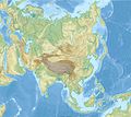
Asia laea location map +Cyprus −Russia.svg 1,181 × 1,050; 10.7 MB
-
Asia laea location map.svg 1,181 × 1,050; 11.77 MB
-
Asia laea relief location map.jpg 1,181 × 1,050; 1.23 MB
-
Basemap for dialect synonyms of Azerbaijani in Spherical Mercator projection.svg 930 × 1,002; 207 KB
-
Bay of Bengal location map simple.svg 370 × 383; 335 KB
-
Caspian Sea relief location map.jpg 900 × 1,794; 771 KB
-
Central Kurdish Blank map.svg 1,000 × 750; 247 KB
-
Chinese dialectal variation location map, relief.jpg 2,497 × 2,238; 1.46 MB
-
Chinese dialectal variation location map.svg 799 × 746; 4.31 MB
-
East Asia location map.svg 512 × 455; 871 KB
-
East China Sea map with topography border.png 755 × 755; 520 KB
-
Israel location map current borders.svg 461 × 856; 80 KB
-
Karakoram location map plus.png 2,701 × 1,812; 9.82 MB
-
Karakoram location map.png 2,701 × 1,812; 8.57 MB
-
Karakoram relief location map.svg 865 × 580; 978 KB
-
Location map of Nagorno-Karabakh.svg 744 × 1,052; 187 KB
-
Malay dialectal variation location map.svg 752 × 404; 5.54 MB
-
Map of Arabian & Gulf of Aden.png 1,344 × 848; 1.81 MB
-
Map of Penang International Airport destinations.png 2,765 × 1,601; 654 KB
-
Mediterranean Sea location map (blank) 2.svg 1,754 × 862; 1.02 MB
-
Mediterranean Sea location map (blank).svg 1,754 × 862; 1.01 MB
-
Mediterranean Sea location map islands-de.svg 1,576 × 794; 1.57 MB
-
Mediterranean Sea location map with blue Sicily.svg 1,754 × 862; 1.2 MB
-
Mesopotamia location map with rivers.svg 802 × 601; 86 KB
-
Mesopotamia location map.svg 800 × 600; 34 KB
-
Outline map of Middle East 2.svg 667 × 633; 2.16 MB
-
Outline map of Middle East.svg 1,000 × 654; 2.71 MB
-
Persian Gulf relief location map.png 1,100 × 896; 1.22 MB
-
Relief Map of Middle East 2.jpg 1,000 × 950; 280 KB
-
Relief Map of Middle East.jpg 1,500 × 982; 330 KB
-
Sinosphere synonymous vocabulary location map.svg 1,618 × 1,519; 54.28 MB
-
South Asia political.jpg 2,324 × 2,151; 1.88 MB
-
Southeastern China location map.png 1,369 × 897; 1.66 MB


