Category:Location maps of French Guiana
Administrative regions and territorial collectivity of Metropolitan France (‡ since start of 2016):
Auvergne-Rhône-Alpes‡ · Bourgogne-Franche-Comté‡ · Brittany · Centre-Val de Loire · Corsica · Grand Est‡ · Hauts-de-France‡ · Île-de-France · Normandy‡ · New Aquitaine‡ · Occitania‡ · Pays de la Loire · Provence-Alpes-Côte d'Azur
Former administrative regions of Metropolitan France (until end of 2015):
Alsace · Aquitaine · Auvergne · Burgundy · Champagne-Ardenne · Franche-Comté · Languedoc-Roussillon · Limousin · Lorraine · Midi-Pyrénées · Nord-Pas-de-Calais · Lower Normandy · Upper Normandy · Picardy · Poitou-Charentes · Rhône-Alpes
Overseas departments and regions: Guadeloupe · Martinique · French Guiana · Réunion · Mayotte
Overseas collectivities: Saint Barthélemy · Saint-Martin · Saint Pierre and Miquelon · French Polynesia · Wallis and Futuna
Sui generis territories: New Caledonia
Departments of Metropolitan France: Ain [01] · Aisne [02] · Allier [03] · Alpes-de-Haute-Provence [04] · Hautes-Alpes [05] · Alpes-Maritimes [06] · Ardèche [07] · Ardennes [08] · Ariège [09] · Bouches-du-Rhône [13] · Cantal [15] · Charente-Maritime [17] · Cher [18] · Corse-du-Sud [2A]† · Haute-Corse [2B]† · Côtes-d'Armor [22] · Dordogne [24] · Doubs [25] · Drôme [26] · Eure [27] · Finistère [29] · Haute-Garonne [31] · Gers [32] · Gironde [33] · Hérault [34] · Ille-et-Vilaine [35] · Indre [36] · Indre-et-Loire [37] · Isère [38] · Jura [39] · Landes [40] · Loire [42] · Haute-Loire [43] · Loire-Atlantique [44] · Loiret [45] · Lot [46] · Lot-et-Garonne [47] · Maine-et-Loire [49] · Manche [50] · Marne [51] · Haute-Marne [52] · Mayenne [53] · Morbihan [56] · Moselle [57] · Nièvre [58] · Nord [59] · Oise [60] · Orne [61] · Puy-de-Dôme [63] · Pyrénées-Atlantiques [64] · Hautes-Pyrénées [65] · Pyrénées-Orientales [66] · Bas-Rhin [67] · departmental district of the Rhône [69] · Rhône [69D]‡ · Saône-et-Loire [71] · Savoie [73] · Haute-Savoie [74] · Paris [75] · Seine-Maritime [76] · Seine-et-Marne [77] · Deux-Sèvres [79] · Somme [80] · Tarn [81] · Tarn-et-Garonne [82] · Var [83] · Vaucluse [84] · Vienne [86] · Haute-Vienne [87] · Vosges [88] · Yonne [89] · Territoire de Belfort [90] · Essonne [91] · Seine-Saint-Denis [93] · Val-de-Marne [94]
Overseas departments and regions: Guadeloupe [971] · Martinique [972] · French Guiana [973] · Réunion [974] · Mayotte [976]
Overseas collectivities: Saint Pierre and Miquelon [975] · Saint Barthélemy [977] · Saint-Martin [978] · Wallis and Futuna [986] · French Polynesia [987]
Sui generis territories: New Caledonia [988]
 |
This category should only contain blank "Location maps" created for geo-location purposes which follow a same uniform standard, and have been created with a Geographic information system (GIS) software program using a compatible equirectangular or conical projection and for which the geographic coordinate system is known. For more information or questions see the wikiproject: German Wikipedia:Kartenwerkstatt/Positionskarten and this discussion page. |
Media in category "Location maps of French Guiana"
The following 34 files are in this category, out of 34 total.
-
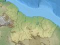
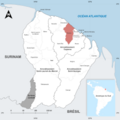
 Cayenne location map.png 1,455 × 1,561; 1.3 MB
-
 French Guiana Arrondissement and Communes Map.png 4,250 × 4,250; 857 KB
-
 French Guiana Arrondissements and Communes.png 3,060 × 3,960; 613 KB
-
 Guianas location map disputed relief.png 2,542 × 1,902; 6.85 MB
-
 Guianas location map with disputed boundaries.svg 1,277 × 952; 98 KB
-
 Guianas location map.svg 1,277 × 952; 69 KB
-
 Guyane department location map.svg 1,183 × 1,427; 433 KB
-
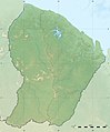 Guyane department relief location map.jpg 1,183 × 1,427; 439 KB
-
 Locator Map of Apatou Neutral FR.png 4,250 × 4,250; 860 KB
-
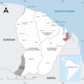
 Locator map of Arrondissement Cayenne Neutral FR.png 4,250 × 4,250; 879 KB
-
 Locator map of Arrondissement Saint-Georges Neutral FR.png 4,250 × 4,250; 881 KB
-
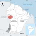
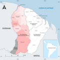 Locator map of Arrondissement Saint-Laurent-du-Maroni Neutral FR.png 4,250 × 4,250; 887 KB
-
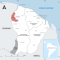
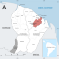
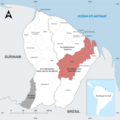
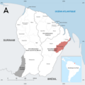
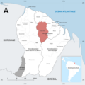
 Locator map of Arrondissements of French Guiana Neutral Colored.png 4,250 × 4,250; 909 KB
-
 Locator Map of Awala-Yalimapo Neutral FR.png 4,250 × 4,250; 857 KB
-
 Locator Map of Camopi Neutral FR.png 4,250 × 4,250; 859 KB
-
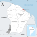
 Locator Map of Cayenne Neutral FR.png 4,250 × 4,250; 857 KB
-
 Locator Map of Grand-Santi Neutral FR.png 4,250 × 4,250; 861 KB
-
 Locator Map of Iracoubo Neutral FR.png 4,250 × 4,250; 859 KB
-
 Locator Map of Kourou Neutral FR.png 4,250 × 4,250; 860 KB
-
 Locator Map of Macouria Neutral FR.png 4,250 × 4,250; 859 KB
-
 Locator Map of Mana Neutral FR.png 4,250 × 4,250; 862 KB
-
 Locator Map of Maripasoula Neutral FR.png 4,250 × 4,250; 868 KB
-
 Locator Map of Matoury Neutral FR.png 4,250 × 4,250; 858 KB
-
 Locator Map of Montsinéry-Tonnegrande Neutral FR.png 4,250 × 4,250; 860 KB
-
 Locator Map of Ouanary Neutral FR.png 4,250 × 4,250; 859 KB
-
 Locator Map of Papaïchton Neutral FR.png 4,250 × 4,250; 860 KB
-
 Locator Map of Remire-Montjoly Neutral FR.png 4,250 × 4,250; 857 KB
-
 Locator Map of Roura Neutral FR.png 4,250 × 4,250; 862 KB
-
 Locator Map of Régina Neutral FR.png 4,250 × 4,250; 868 KB
-
 Locator Map of Saint-Georges Neutral FR.png 4,250 × 4,250; 864 KB
-
 Locator Map of Saint-Laurent-du-Maroni Neutral FR.png 4,250 × 4,250; 865 KB
-
 Locator Map of Saint-Élie Neutral FR.png 4,250 × 4,250; 864 KB
-
 Locator Map of Saül Neutral FR.png 4,250 × 4,250; 863 KB
-
 Locator Map of Sinnamary Neutral FR.png 4,250 × 4,250; 860 KB


