Category:Location maps of Oregon
 |
This category should only contain blank "Location maps" created for geo-location purposes which follow a same uniform standard, and have been created with a Geographic information system (GIS) software program using a compatible equirectangular or conical projection and for which the geographic coordinate system is known. For more information or questions see the wikiproject: German Wikipedia:Kartenwerkstatt/Positionskarten and this discussion page. |
Media in category "Location maps of Oregon"
The following 40 files are in this category, out of 40 total.
-
 Albany OR - OpenStreetMap.png 1,027 × 842; 533 KB
-
 Ashland OR - OpenStreetMap.png 1,421 × 1,070; 631 KB
-
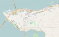 Astoria Oregon - OpenStreetMap.png 1,280 × 796; 395 KB
-
 Baker City OR - OpenStreetMap.png 1,131 × 1,146; 506 KB
-
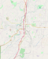 Bend OR - OpenStreetMap.png 939 × 1,154; 730 KB
-
 Coos Bay OR - OpenStreetMap.png 1,013 × 919; 359 KB
-
 Corvallis OR - OpenStreetMap.png 797 × 902; 589 KB
-
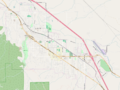
 Dayton OR - OpenStreetMap.png 1,073 × 660; 228 KB
-
 Eugene Oregon - Downtown - OpenStreetMap.png 1,181 × 803; 711 KB
-
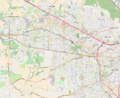
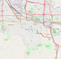
 Eugene Oregon - OpenStreetMap.png 975 × 876; 762 KB
-
 Forest Grove OR - OpenStreetMap.png 1,024 × 722; 497 KB
-
 Grants Pass OR - OpenStreetMap.png 900 × 889; 381 KB
-
 Gresham OR - OpenStreetMap.png 1,090 × 906; 1.09 MB
-
 Hillsboro Beaverton Oregon - OpenStreetMap.png 1,109 × 903; 1.35 MB
-
 Hood River OR - OpenStreetMap.png 995 × 677; 334 KB
-
 Klamath Falls OR - OpenStreetMap.png 1,136 × 1,162; 710 KB
-
 Lake Oswego OR - OpenStreetMap.png 1,099 × 825; 1.07 MB
-
 McMinnville OR - OpenStreetMap.png 1,030 × 623; 328 KB
-
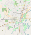
 Medford OR - OpenStreetMap.png 926 × 1,051; 529 KB
-
 North Bend OR - OpenStreetMap.png 1,010 × 903; 336 KB
-
 USA Oregon location map.svg 1,501 × 1,148; 410 KB
-
 Oregon City OR - OpenStreetMap.png 1,149 × 975; 1.01 MB
-
 Oregon Locator Map with US.svg 1,998 × 1,672; 768 KB
-
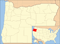 Oregon map with national inset.png 428 × 317; 26 KB
-
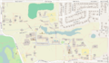
 Oregon State University - OpenStreetMap.png 1,112 × 760; 582 KB
-
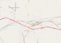
 Pendleton OR - OpenStreetMap.png 955 × 659; 276 KB
-
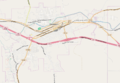
 Pendleton plus Airport OR - OpenStreetMap.png 1,349 × 968; 384 KB
-
 Portland State University Campus OR - OpenStreetMap.png 1,049 × 1,226; 1.08 MB
-
 Redmond OR - OpenStreetMap.png 896 × 1,022; 404 KB
-
 Reed College Portland OR - OpenStreetMap.png 1,857 × 1,088; 698 KB
-
 Salem Oregon - Downtown - OpenStreetMap.png 1,045 × 1,003; 914 KB
-
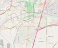
 Salem Oregon - OpenStreetMap.png 777 × 1,070; 748 KB
-
 Spencer Butte and Eugene Oregon - OpenStreetMap.png 730 × 700; 510 KB
-
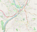
 The Dalles OR - OpenStreetMap.png 1,178 × 994; 607 KB
-
 Tigard OR - OpenStreetMap.png 1,071 × 1,040; 1.3 MB
-
 Tualatin OR - OpenStreetMap.png 1,029 × 851; 759 KB
-
 University of Oregon - OpenStreetMap.png 910 × 1,150; 610 KB
-
 USA - Oregon - Portland - Lewis & Clark College campus - OpenSteetMap.png 1,222 × 936; 514 KB
-
 USA Oregon relief location map.svg 1,501 × 1,148; 4.8 MB
-
 Woodburn OR - OpenStreetMap.png 1,054 × 678; 356 KB


