Category:Location maps of provinces of Nepal
Countries of Asia: People's Republic of China · Indonesia‡ · Nepal · Pakistan · Thailand
‡: partly located in Asia
‡: partly located in Asia
| NO WIKIDATA ID FOUND! Search for Location maps of provinces of Nepal on Wikidata | |
| Upload media |
 |
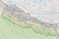
This category should only contain blank "Location maps" created for geo-location purposes which follow a same uniform standard, and have been created with a Geographic information system (GIS) software program using a compatible equirectangular or conical projection and for which the geographic coordinate system is known. For more information or questions see the wikiproject: German Wikipedia:Kartenwerkstatt/Positionskarten and this discussion page. |

Autonomous provinces of Nepal: Bagmati Pradesh (3) · Gandaki Pradesh (4) · Karnali Pradesh (6) · Koshi Pradesh (1) · Lumbini Pradesh (5) · Madhesh Province (2) · Sudurpashchim Pradesh (7)
Subcategories
This category has the following 7 subcategories, out of 7 total.
Media in category "Location maps of provinces of Nepal"
The following 4 files are in this category, out of 4 total.
-
 Nepal adm location map.svg 1,100 × 721; 403 KB
-
 Nepal rel location map.svg 1,100 × 721; 1.86 MB
-
 Provinces of Nepal (unlabelled).svg 1,100 × 721; 1.27 MB
-
 Provinces of Nepal unlabelled (cropped).svg 1,030 × 591; 1.01 MB


.svg)
.svg)