Category:Location maps of the German Democratic Republic
Media in category "Location maps of the German Democratic Republic"
The following 10 files are in this category, out of 10 total.
-
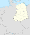 Germany, German Democratic Republic location map January 1957 - October 1990.svg 1,075 × 1,273; 478 KB
-
 Germany, German Democratic Republic location map July 1952 - January 1957.svg 1,075 × 1,273; 480 KB
-
 Germany, German Democratic Republic location map October 1949 - July 1952.svg 1,075 × 1,273; 453 KB
-
 GDR Bezirk Erfurt location map.svg 208 × 167; 28 KB
-
 GDR Bezirk Gera location map.svg 157 × 117; 87 KB
-
 GDR Bezirk Suhl location map.svg 179 × 127; 23 KB
-
 Germany, FRG and GDR location map October 1949 - November 1950.svg 1,075 × 1,273; 492 KB
-

-

-


_location_map_w%C2%B7o_FRG_1990.svg)

