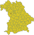
Category:Locator maps of Bavaria
Federal states of Germany:
Subcategories
This category has the following 6 subcategories, out of 6 total.
!
Media in category "Locator maps of Bavaria"
The following 10 files are in this category, out of 10 total.
-
Germany Laender Bayern.png 668 × 910; 13 KB
-
Baden Wuerttemberg Bayern Region Donau-Iller.png 450 × 350; 94 KB
-
Germany lv bayern.gif 166 × 225; 5 KB
-
Höchste Berge Deutschlands.PNG 1,177 × 702; 301 KB
-
Isar-Inn-Hügelland-Karte.png 608 × 600; 168 KB
-
Karte der höchsten Hauptgipfel Deutschlands.png 1,222 × 996; 169 KB
-
Karte toeging in aoe.gif 284 × 295; 4 KB
-
Karte von Bayern Ansbach (Stadt).png 338 × 350; 35 KB
-
Northern Swabia.png 2,077 × 2,048; 1.06 MB
-
Vogtland de.png 668 × 910; 24 KB


