Category:Locator maps of Culebra, Puerto Rico
Media in category "Locator maps of Culebra, Puerto Rico"
The following 12 files are in this category, out of 12 total.
-
 Culebra, Puerto Rico locator map.png 847 × 630; 20 KB
-
 Locator-map-Puerto-Rico-Culebra.svg 1,332 × 360; 97 KB
-
 Map of Culebra (non political).png 1,535 × 895; 156 KB
-
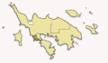
 Map of Culebra highlighting Culebra Pueblo.png 3,198 × 1,865; 344 KB
-
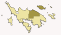
 Map of Culebra highlighting Dewey (Pueblo).jpg 768 × 448; 70 KB
-
 Map of Culebra highlighting Dewey (Pueblo).png 768 × 448; 29 KB
-
 Map of Culebra highlighting Flamenco.png 768 × 448; 32 KB
-
 Map of Culebra highlighting Fraile.png 768 × 448; 32 KB
-
 Map of Culebra highlighting Playa Sardina I.png 768 × 448; 31 KB
-
 Map of Culebra highlighting Playa Sardina II.png 768 × 448; 31 KB
-
 Map of Culebra highlighting San Isidro.png 768 × 448; 32 KB
-
 Map of Puerto Rico highlighting Culebra.svg 6,234 × 4,511; 66 KB

.png)

.jpg)
.png)


