Category:Locator maps of Espita Municipality
Media in category "Locator maps of Espita Municipality"
The following 14 files are in this category, out of 14 total.
-
 032 Esperanto Yucatán.png 595 × 470; 18 KB
-
 ES-Municipio de Espita.svg 751 × 496; 55 KB
-
 Espita area transportation map-blank.svg 306 × 330; 145 KB
-
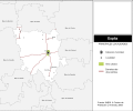
 Espita area transportation map.svg 306 × 330; 236 KB
-
 Espita localidades.svg 300 × 250; 239 KB
-
 Espita Municipality Yucatan Espita Highlighted.svg 324 × 151; 195 KB
-
 Espita Municipality Yucatan Nacuche Highlighted.svg 324 × 151; 196 KB
-
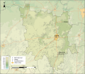 Espita topographic map.svg 512 × 447; 1.13 MB
-
 Mapa de Nacuché.svg 461 × 396; 69 KB
-
 Mexico Yucatan Espita comunities map.svg 512 × 447; 132 KB
-
 Mexico Yucatan Espita location map (urban areas).svg 512 × 419; 102 KB
-
 Mexico Yucatan Espita location map.svg 2,815 × 2,211; 1.01 MB
-
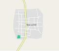
 Nacuche street map.svg 237 × 313; 7 KB
-
 Yuc, Reg 1, Espita.svg 350 × 210; 63 KB


.svg)


