Category:Locator maps of Friesland
Provinces of the Netherlands: Drenthe · Friesland · Groningen ·
Subcategories
This category has only the following subcategory.
Media in category "Locator maps of Friesland"
The following 25 files are in this category, out of 25 total.
-
 Barradeel in 1983 0.PNG 271 × 116; 7 KB
-
 Boarn.png 877 × 620; 47 KB
-
 Dokkumer lokaaltje.png 833 × 696; 29 KB
-
 Friesland in the Netherlands 2019.svg 888 × 1,001; 160 KB
-
 Friesland in the Netherlands.svg 888 × 1,001; 147 KB
-
 Friesland in vroeger tijden.PNG 280 × 130; 8 KB
-
 Friesland position.svg 200 × 236; 157 KB
-
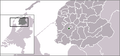
 Friesland-Position.png 200 × 235; 23 KB
-
 Friesland.GIF 201 × 291; 5 KB
-
 Friesland.png 842 × 1,191; 44 KB
-
 FrieslandNetherlandsGlobe.png 500 × 500; 232 KB
-
 FrieslandNetherlandsGlobeGrey.png 500 × 500; 91 KB
-
 FrieslandTranparency.GIF 201 × 291; 6 KB
-
 Kaartje caspar de robblesdiep (1891).PNG 1,397 × 818; 200 KB
-
 Karte Mittelpunkt Ostfriesland.jpg 3,024 × 4,032; 3.67 MB
-
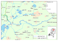
 KnooppuntJoure.PNG 242 × 279; 23 KB
-
 Lauwers Frisian.svg 200 × 130; 50 KB
-
 Lauwers mk.svg 200 × 130; 71 KB
-
 Lauwers.svg 200 × 130; 50 KB
-
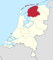
 LocatieProvFriesland.png 534 × 616; 50 KB
-
 Lânkaart lokaasje skiermûntseagersk.gif 805 × 570; 138 KB
-
 Map of Friesland seen from Europe.png 2,000 × 1,529; 397 KB
-
 Nieuwe Wetering Friesland.jpg 1,223 × 977; 303 KB
-
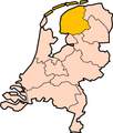
 Provinces of the Netherlands - Friesland.gif 424 × 388; 34 KB
-
 Provinces of the Netherlands - Friesland.svg 595 × 710; 67 KB


.PNG)


