Category:Locator maps of Handewitt
Media in category "Locator maps of Handewitt"
The following 32 files are in this category, out of 32 total.
-
 Altholzkrug Gemeinde Handewitt.png 1,381 × 929; 181 KB
-
 Balm Gemeinde Munkbrarup Karte.png 1,175 × 915; 118 KB
-
 Bockholmwik Gemeinde Munkbrarup Karte.png 1,175 × 915; 120 KB
-
 Christiansheide Gemeinde Handewitt.png 1,381 × 929; 181 KB
-
 Ellund Gemeinde Handewitt.png 1,381 × 929; 181 KB
-
 Ellundbrück Gemeinde Handewitt.png 1,381 × 929; 181 KB
-
 Ellundfeld Gemeinde Handewitt.png 1,381 × 929; 182 KB
-
 Geil Gemeinde Munkbrarup Karte.png 1,175 × 915; 118 KB
-
 Gottrupel Gemeinde Handewitt.png 1,381 × 929; 182 KB
-
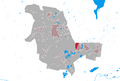
 Handewitt Gemeinde Handewitt.png 1,381 × 929; 183 KB
-
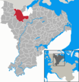 Handewitt in SL.PNG 347 × 363; 8 KB
-
 Handewitt-Busch Gemeinde Handewitt.png 1,381 × 929; 181 KB
-
 Handewitt-Kolonie Gemeinde Handewitt.png 1,381 × 929; 182 KB
-
 Handewitt-West Gemeinde Handewitt.png 1,381 × 929; 181 KB
-
 Haurup Gemeinde Handewitt.png 1,381 × 929; 182 KB
-
 Hoffnung Gemeinde Handewitt.png 1,381 × 929; 181 KB
-
 Hüllerup Gemeinde Handewitt.png 1,381 × 929; 182 KB
-
 Iskiersand Gemeinde Munkbrarup Karte.png 1,175 × 915; 118 KB
-
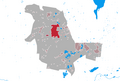
 Jarplund Gemeinde Handewitt.png 1,381 × 929; 182 KB
-
 Kolonistenkrug Gemeinde Handewitt.png 1,381 × 929; 181 KB
-
 Kragholm Gemeinde Munkbrarup Karte.png 1,175 × 915; 118 KB
-
 Langberg Gemeinde Handewitt.png 1,381 × 929; 182 KB
-
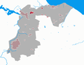
 Munkbrarup Gemeinde Munkbrarup Karte.png 1,175 × 915; 119 KB
-
 Neuholzkrug Gemeinde Handewitt.png 1,381 × 929; 181 KB
-
 Rüde Gemeinde Munkbrarup Karte.png 1,175 × 915; 118 KB
-
 Siegum Gemeinde Munkbrarup Karte.png 1,175 × 915; 119 KB
-
 Siegumlund Gemeinde Munkbrarup Karte.png 1,175 × 915; 118 KB
-
 Timmersiek Gemeinde Handewitt.png 1,381 × 929; 181 KB
-
 Timmersiekfeld Gemeinde Handewitt.png 1,381 × 929; 182 KB
-
 Unaften Gemeinde Handewitt.png 1,381 × 929; 181 KB
-
 Weding Gemeinde Handewitt.png 1,381 × 929; 182 KB
-
 Westerlund Gemeinde Handewitt.png 1,381 × 929; 181 KB


