Category:Locator maps of Hawaiian islands
Media in category "Locator maps of Hawaiian islands"
The following 22 files are in this category, out of 22 total.
-
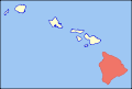
 Hawaii Islands - Hawaii.PNG 436 × 414; 26 KB
-
 Hawaii Island location (Southeastern Islands).png 1,024 × 692; 80 KB
-
 Hawaii Islands - Kahoolawe.PNG 436 × 414; 26 KB
-
 Kahoolawe Island location (Southeastern Islands).png 1,010 × 677; 60 KB
-
 Hawaii Islands - Kauai.PNG 436 × 414; 26 KB
-
 Hawaii Islands - Lanai.PNG 436 × 414; 26 KB
-
 Lanai Island location (Southeastern Islands).png 1,010 × 677; 60 KB
-
 Map of Hawaii highlighting Hawaii (island).svg 6,063 × 4,081; 12 KB
-
 Map of Hawaii highlighting Kahoolawe.svg 6,063 × 4,081; 13 KB
-
 Map of Hawaii highlighting Kauai.svg 6,063 × 4,081; 12 KB
-
 Map of Hawaii highlighting Lanai.svg 6,063 × 4,081; 12 KB
-
 Map of Hawaii highlighting Lehua.svg 1,213 × 681; 12 KB
-
 Map of Hawaii highlighting Maui.svg 6,063 × 4,081; 12 KB
-
 Map of Hawaii highlighting Molokai.svg 6,063 × 4,081; 12 KB
-
 Map of Hawaii highlighting Niihau.svg 6,063 × 4,081; 12 KB
-
 Map of Hawaii highlighting Oahu.svg 6,063 × 4,081; 12 KB
-
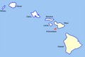
 Hawaii Islands - Maui.PNG 436 × 414; 26 KB
-
 Maui Island Locator.jpg 582 × 401; 64 KB
-
 Hawaii Islands - Molokai.PNG 436 × 414; 26 KB
-
 Hawaii Islands - Ni ihau.PNG 436 × 414; 26 KB
-
 Hawaii Islands - Oahu.PNG 436 × 414; 26 KB
-
 Oahu Island Locator.jpg 292 × 184; 39 KB

.png)

.png)


.png)
.svg)


