Category:Locator maps of Ireland
Subcategories
This category has the following 6 subcategories, out of 6 total.
!
*
L
Media in category "Locator maps of Ireland"
The following 147 files are in this category, out of 147 total.
-
 Aimsitheoir léarscáile na hÉireann san Eoraip.png 640 × 489; 87 KB
-
 AntrimShape.png 532 × 405; 11 KB
-
 ArmaghShape.png 532 × 405; 11 KB
-
 Carlow - British Isles.svg 1,250 × 1,835; 1,024 KB
-
 Carlow Ireland (BI Sect 7).svg 584 × 712; 1,012 KB
-
 Cavan - British Isles.svg 1,250 × 1,835; 1,024 KB
-
 Cavan Ireland (BI Sect 7).svg 584 × 712; 1,012 KB
-
 CelticNationsMap.jpg 464 × 678; 58 KB
-
 Clare - British Isles.svg 1,250 × 1,835; 1,024 KB
-
 Clare Ireland (BI Sect 7).svg 584 × 712; 1,012 KB
-
 Cork - British Isles.svg 1,250 × 1,835; 1,024 KB
-
 Cork Ireland (BI Sect 7).svg 584 × 712; 1,012 KB
-
 Donegal - British Isles.svg 1,250 × 1,835; 1,024 KB
-
 Donegal Ireland (BI Sect 7).svg 584 × 712; 1,012 KB
-
 DownShape.png 532 × 405; 11 KB
-
 Dublin - British Isles.svg 1,250 × 1,835; 1,024 KB
-
 Dublin Ireland (BI Sect 7).svg 584 × 712; 1,012 KB
-
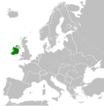
 Europe ireland.svg 680 × 520; 795 KB
-
 Europe location IRL.png 1,600 × 1,200; 712 KB
-
 Europe map ireland.png 1,231 × 929; 41 KB
-
 FermanaghShape.gif 532 × 405; 10 KB
-
 Galway - British Isles.svg 1,250 × 1,835; 1,024 KB
-
 Galway in Ireland.jpg 341 × 427; 18 KB
-
 Galway Ireland (BI Sect 7).svg 584 × 712; 1,012 KB
-
 Hook Head in Ireland.png 800 × 1,021; 99 KB
-
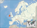
 Ireland (island) in Europe.png 720 × 600; 62 KB
-
 Ireland 1812.svg 450 × 456; 633 KB
-
 Ireland 1942.svg 450 × 456; 500 KB
-
 Ireland glencar.JPG 540 × 540; 89 KB
-
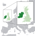 Ireland in the UK and Europe.svg 450 × 456; 1.15 MB
-
 Ireland in the United Kingdom.png 2,000 × 3,496; 120 KB
-
 Ireland Leachta Map.svg 1,450 × 1,807; 611 KB
-
 Ireland location 1791.PNG 470 × 486; 17 KB
-
 Ireland location map Border region.svg 1,450 × 1,807; 1.28 MB
-
 Ireland location map Dublin region.svg 1,450 × 1,807; 1.09 MB
-
 Ireland location map Mid-East.svg 1,450 × 1,807; 1.9 MB
-
 Ireland location map Midlands.svg 1,450 × 1,807; 1.98 MB
-
 Ireland location map South East.svg 1,450 × 1,807; 853 KB
-
 Ireland location map South West.svg 1,450 × 1,807; 1.42 MB
-
 Ireland location map South-East.svg 1,450 × 1,807; 3.63 MB
-
 Ireland location map West region.svg 1,450 × 1,807; 1.09 MB
-
 Ireland map (Wikipedia).png 5,802 × 4,620; 1.35 MB
-
 Ireland medieval location map-es.svg 1,450 × 1,807; 667 KB
-
 Ireland medieval location map.svg 1,450 × 1,807; 666 KB
-
 Irelandrachelrocket72.jpg 500 × 388; 53 KB
-
 IRL Europe location.png 1,074 × 1,040; 347 KB
-
 Irlanda cb.png 231 × 202; 6 KB
-
 Island of Ireland location map Antrim.svg 931 × 701; 826 KB
-
 Island of Ireland location map Armagh.svg 934 × 717; 828 KB
-
 Island of Ireland location map Carlow.svg 1,450 × 1,807; 642 KB
-
 Island of Ireland location map Cavan.svg 1,450 × 1,807; 642 KB
-
 Island of Ireland location map City of Dublin.svg 1,450 × 1,807; 660 KB
-
 Island of Ireland location map Clare.svg 1,450 × 1,807; 642 KB
-
 Island of Ireland location map Cork.svg 1,450 × 1,807; 642 KB
-
 Island of Ireland location map Donegal.svg 1,450 × 1,807; 642 KB
-
 Island of Ireland location map Down.svg 931 × 701; 826 KB
-
 Island of Ireland location map Dublin.svg 1,450 × 1,807; 642 KB
-
 Island of Ireland location map Dun Laoghaire–Rathdown.svg 1,450 × 1,807; 660 KB
-
 Island of Ireland location map Fermanagh.svg 931 × 701; 819 KB
-
 Island of Ireland location map Fingal.svg 1,450 × 1,807; 660 KB
-
 Island of Ireland location map Galway.svg 1,450 × 1,807; 642 KB
-
 Island of Ireland location map Kerry.svg 1,450 × 1,807; 642 KB
-
 Island of Ireland location map Kildare.svg 1,450 × 1,807; 642 KB
-
 Island of Ireland location map Kilkenny.svg 1,450 × 1,807; 642 KB
-
 Island of Ireland location map Laois.svg 1,450 × 1,807; 642 KB
-
 Island of Ireland location map Leitrim.svg 1,450 × 1,807; 642 KB
-
 Island of Ireland location map Limerick.svg 1,450 × 1,807; 642 KB
-
 Island of Ireland location map Londonderry.svg 931 × 701; 826 KB
-
 Island of Ireland location map Longford.svg 1,450 × 1,807; 642 KB
-
 Island of Ireland location map Louth.svg 1,450 × 1,807; 642 KB
-
 Island of Ireland location map Mayo.svg 1,450 × 1,807; 642 KB
-
 Island of Ireland location map Meath.svg 1,450 × 1,807; 642 KB
-
 Island of Ireland location map Monaghan.svg 1,450 × 1,807; 642 KB
-
 Island of Ireland location map North Tipperary.svg 1,450 × 1,807; 839 KB
-
 Island of Ireland location map Offaly.svg 1,450 × 1,807; 642 KB
-
 Island of Ireland location map Roscommon.svg 1,450 × 1,807; 642 KB
-
 Island of Ireland location map Sligo.svg 1,450 × 1,807; 642 KB
-
 Island of Ireland location map South Dublin.svg 1,450 × 1,807; 660 KB
-
 Island of Ireland location map South Tipperary.svg 1,450 × 1,807; 839 KB
-
 Island of Ireland location map Tipperary.svg 1,450 × 1,807; 642 KB
-
 Island of Ireland location map Tyrone.svg 931 × 701; 826 KB
-
 Island of Ireland location map Waterford.svg 1,450 × 1,807; 642 KB
-
 Island of Ireland location map Westmeath.svg 1,450 × 1,807; 642 KB
-
 Island of Ireland location map Wexford.svg 1,450 × 1,807; 642 KB
-
 Island of Ireland location map Wicklow.svg 1,450 × 1,807; 642 KB
-
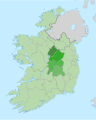
 Island of Ireland location RoI regions.svg 1,450 × 1,807; 771 KB
-
 Island of Ireland.svg 675 × 1,180; 168 KB
-
 Kerry - British Isles.svg 1,250 × 1,835; 1,024 KB
-
 Kerry Ireland (BI Sect 7).svg 584 × 712; 1,012 KB
-
 Kildare - British Isles.svg 1,250 × 1,835; 1,024 KB
-
 Kildare Ireland (BI Sect 7).svg 584 × 712; 1,012 KB
-
 Kilkenny - British Isles.svg 1,250 × 1,835; 1,024 KB
-
 Kilkenny Ireland (BI Sect 7).svg 584 × 712; 1,012 KB
-
 Kingdom of Ireland 1789.svg 450 × 456; 834 KB
-
 Laois - British Isles.svg 1,250 × 1,835; 1,024 KB
-
 Laois Ireland (BI Sect 7).svg 584 × 712; 1,012 KB
-
 Leitrim - British Isles.svg 1,250 × 1,835; 1,024 KB
-
 Leitrim Ireland (BI Sect 7).svg 584 × 712; 1,012 KB
-
 Limerick - British Isles.svg 1,250 × 1,835; 1,024 KB
-
 Limerick Ireland (BI Sect 7).svg 584 × 712; 1,012 KB
-
 Localização da Fenagh.png 499 × 621; 105 KB
-
 Location Ireland 1922.png 222 × 115; 5 KB
-
 Location NATO Ireland.svg 616 × 247; 508 KB
-
 Location-Ireland.png 246 × 115; 6 KB
-
 LocationIreland.png 250 × 115; 5 KB
-
 LocationIrelandA.png 246 × 115; 5 KB
-
 LocationIrelandInEurope.png 415 × 422; 5 KB
-
 LocationIslandIreland.png 250 × 115; 3 KB
-
 LondonderryShape.gif 532 × 405; 10 KB
-
 Longford - British Isles.svg 1,250 × 1,835; 1,024 KB
-
 Longford Ireland (BI Sect 7).svg 584 × 712; 1,012 KB
-
 Louth - British Isles.svg 1,250 × 1,835; 1,024 KB
-
 Louth Ireland (BI Sect 7).svg 584 × 712; 1,012 KB
-
 Map of Ireland in Europe.svg 2,045 × 1,720; 6.93 MB
-
 Mayo - British Isles.svg 1,250 × 1,835; 1,024 KB
-
 Mayo Ireland (BI Sect 7).svg 584 × 712; 1,012 KB
-
 Meath - British Isles.svg 1,250 × 1,835; 1,024 KB
-
 Meath Ireland (BI Sect 7).svg 584 × 712; 1,012 KB
-
 Mid East Ireland 2018.png 796 × 990; 147 KB
-
 Monaghan - British Isles.svg 1,250 × 1,835; 1,024 KB
-
 Monaghan Ireland (BI Sect 7).svg 584 × 712; 1,012 KB
-
 MoyvaneLocation.png 82 × 72; 4 KB
-
 Northern And Southern Ireland.svg 2,045 × 1,720; 75 KB
-
 Offaly - British Isles.svg 1,250 × 1,835; 1,024 KB
-
 Offaly Ireland (BI Sect 7).svg 584 × 712; 1,012 KB
-
 Provinces of Ireland location map.svg 1,450 × 1,807; 1.95 MB
-
 Republic of Ireland - Location Map (2013) - IRL - UNOCHA.svg 250 × 250; 930 KB
-
 Republic of Ireland.svg 675 × 1,180; 205 KB
-
 Roscommon - British Isles.svg 1,250 × 1,835; 1,024 KB
-
 Roscommon Ireland (BI Sect 7).svg 584 × 712; 1,012 KB
-
 Rosses Donegal Map.svg 1,013 × 894; 1.7 MB
-
 Rosses Ireland Map.svg 1,458 × 1,815; 1.7 MB
-
 Sligeach.PNG 279 × 348; 45 KB
-
 Sligo - British Isles.svg 1,250 × 1,835; 1,024 KB
-
 Sligo Ireland (BI Sect 7).svg 584 × 712; 1,012 KB
-
 SouthEastRegionIRL-2018.png 1,449 × 1,807; 308 KB
-
 Tipperary - British Isles.svg 1,250 × 1,835; 1,024 KB
-
 Tipperary Ireland (BI Sect 7).svg 584 × 712; 1,012 KB
-
 TyroneShape.gif 532 × 405; 10 KB
-
 Waterford - British Isles.svg 1,250 × 1,835; 1,024 KB
-
 Waterford Ireland (BI Sect 7).svg 584 × 712; 1,012 KB
-
 Westmeath - British Isles.svg 1,250 × 1,835; 1,024 KB
-
 Westmeath Ireland (BI Sect 7).svg 584 × 712; 1,012 KB
-
 Wexford - British Isles.svg 1,250 × 1,835; 1,024 KB
-
 Wexford Ireland (BI Sect 7).svg 584 × 712; 1,012 KB
-
 Wicklow - British Isles.svg 1,250 × 1,835; 1,024 KB
-
 Wicklow Ireland (BI Sect 7).svg 584 × 712; 1,012 KB


.svg)

.svg)


.svg)

.svg)

.svg)


.svg)


.svg)

_in_Europe.png)


.png)


.svg)

.svg)

.svg)


.svg)

.svg)

.svg)


.svg)

.svg)


.svg)

.svg)


.svg)


.svg)

_-_IRL_-_UNOCHA.svg)


.svg)


.svg)


.svg)


.svg)

.svg)

.svg)

.svg)