Category:Locator maps of Lower Silesian Voivodeship
Media in category "Locator maps of Lower Silesian Voivodeship"
The following 24 files are in this category, out of 24 total.
-
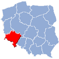
 Dolnoslaskie (EE,E NN,N).png 491 × 454; 348 KB
-
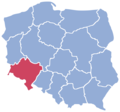
 Dolnoslaskie in Poland.svg 862 × 838; 719 KB
-
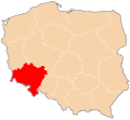
 Dolnoslaskie location map.PNG 2,000 × 1,863; 205 KB
-
 Dolnoslaskie.png 150 × 137; 28 KB
-
 Lesser Poland Voivodship2.png 580 × 425; 5 KB
-
 POL biedrzychowa gmina polkowice map.png 766 × 608; 96 KB
-
 POL dąbrowa gmina polkowice map.png 766 × 608; 96 KB
-
 POL guzice gmina polkowice map.png 766 × 608; 96 KB
-
 POL jędrzychów gmina polkowice map.png 766 × 608; 95 KB
-
 POL kaźmierzów gmina polkowice map.png 766 × 608; 96 KB
-
 POL komorniki gmina polkowice map.png 766 × 608; 96 KB
-
 POL moskorzyn gmina polkowice map.png 766 × 608; 96 KB
-
 POL nowa wieś lubińska gmina polkowice map.png 766 × 608; 96 KB
-
 POL pieszkowice gmina polkowice map.png 766 × 608; 96 KB
-
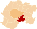
 POL polkowice gmina polkowice map.png 766 × 608; 96 KB
-
 POL sobin gmina polkowice map.png 766 × 608; 96 KB
-
 POL sucha górna gmina polkowice map.png 766 × 608; 96 KB
-
 POL tarnówek gmina polkowice map.png 766 × 608; 96 KB
-
 POL trzebcz gmina polkowice map.png 766 × 608; 96 KB
-
 POL żelazny most gmina polkowice map.png 766 × 608; 96 KB
-
 POL żuków gmina polkowice map.png 766 × 608; 96 KB
-
 Polska podział admin dolnoslaskie.svg 461 × 425; 214 KB
-
 Woj niederschles.png 233 × 233; 28 KB
-
 Wojewodztwo dolnoslaskie.png 580 × 425; 11 KB
.png)


