Category:Locator maps of Nagorno-Karabakh Autonomous Oblast
Media in category "Locator maps of Nagorno-Karabakh Autonomous Oblast"
The following 17 files are in this category, out of 17 total.
-
 Askeran district NKAO location map.png 793 × 971; 31 KB
-
 Dağlık Karabağ.tif 595 × 387; 199 KB
-
 Gadrut district NKAO location map.png 793 × 971; 31 KB
-
 Localización de la región del Alto Karabaj.png 595 × 387; 69 KB
-
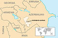 Location Nagorno-Karabakh-EU.jpg 595 × 387; 41 KB
-
 Location Nagorno-Karabakh-hy.png 595 × 387; 44 KB
-
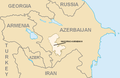 Location Nagorno-Karabakh.png 595 × 387; 64 KB
-
 Location Nagorno-Karabakh2 ar.png 595 × 387; 64 KB
-
 Location Nagorno-Karabakh2-he.png 595 × 387; 64 KB
-
 Location Nagorno-Karabakh2-ru.png 595 × 387; 51 KB
-
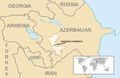 Location Nagorno-Karabakh2.png 595 × 387; 75 KB
-
 LocationNagornoKarabakh.png 343 × 163; 7 KB
-
 Mardakert district NKAO location map.png 793 × 971; 31 KB
-
 Martuni district NKAO location map.png 793 × 971; 32 KB
-
 Nagorno-Karabakh.svg 970 × 620; 20 KB
-
 Shusha district NKAO location map.png 793 × 971; 31 KB
-
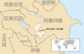 Zh Location Nagorno-Karabakh2.png 595 × 387; 19 KB


