Category:Locator maps of New Brunswick
Provinces and territories of Canada: Alberta · British Columbia · Manitoba · New Brunswick · Newfoundland and Labrador · Nova Scotia · Ontario · Prince Edward Island · Quebec · Saskatchewan · Northwest Territories · Nunavut · Yukon
Subcategories
This category has only the following subcategory.
Media in category "Locator maps of New Brunswick"
The following 104 files are in this category, out of 104 total.
-
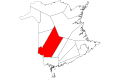
 Acadie-Bathurst.png 1,016 × 943; 13 KB
-
 AcadieBathurst.PNG 926 × 915; 43 KB
-
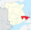
 Beausejour-riding-map.png 1,016 × 943; 13 KB
-
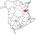
 Beauséjour, riding.png 926 × 915; 43 KB
-
 Blank Map of New Brunswick.svg 4,096 × 2,731; 5.81 MB
-
 Boundaries of Entity 1, Haut-Madawaska.svg 1,052 × 1,052; 3.49 MB
-
 Boundaries of Entity 1.svg 1,052 × 1,052; 1.94 MB
-
 Boundaries of Entity 2.svg 1,052 × 1,052; 3.34 MB
-
 Fredericton, riding.png 926 × 915; 44 KB
-
 Fredericton-Ft Nashwaak.png 926 × 915; 42 KB
-
 Fredericton-Lincoln.png 926 × 915; 41 KB
-
 Fredericton-Nashwaaksis.png 926 × 915; 41 KB
-
 Fredericton-Riding-Map.png 1,016 × 943; 13 KB
-
 Fredericton-Silverwood.png 926 × 915; 41 KB
-
 Fundy Royal.png 926 × 915; 44 KB
-
 Fundy-Royal.png 1,016 × 943; 13 KB
-
 Grand Lake-Gagetown.png 926 × 915; 41 KB
-
 GrandFallsDrummondSaintAndreDistrict.png 926 × 915; 47 KB
-
 Hampton-KingsDistrict.png 926 × 915; 47 KB
-
 Kent NB electoral district.png 926 × 915; 47 KB
-
 Kent South electoral district map.png 926 × 915; 47 KB
-
 KingsEastNBDistrict.png 926 × 915; 47 KB
-
 Localisation Nouveau-Brunswick.svg 1,084 × 920; 96 KB
-
 Locator map for New Brunswick.png 250 × 210; 7 KB
-
 Madawaska canadien.png 216 × 216; 8 KB
-
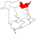
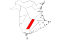
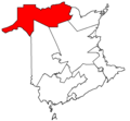 Madawaska-Restigouche.png 1,016 × 943; 13 KB
-
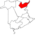
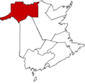 Madawaska—Restigouche.png 926 × 915; 43 KB
-
 Map of New Brunswick highlighting Albert County 2.png 216 × 216; 19 KB
-
 Map of New Brunswick highlighting Albert County.png 1,000 × 984; 240 KB
-
 Map of New Brunswick highlighting Albert County.svg 4,096 × 2,731; 5.81 MB
-
 Map of New Brunswick highlighting Carleton County 2.png 216 × 216; 19 KB
-
 Map of New Brunswick highlighting Carleton County.png 1,000 × 984; 241 KB
-
 Map of New Brunswick highlighting Carleton County.svg 4,096 × 2,731; 5.81 MB
-
 Map of New Brunswick highlighting Charlotte County 2.png 216 × 216; 20 KB
-
 Map of New Brunswick highlighting Charlotte County.png 1,000 × 984; 240 KB
-
 Map of New Brunswick highlighting Charlotte County.svg 4,096 × 2,731; 5.81 MB
-
 Map of New Brunswick highlighting Gloucester County 2.png 216 × 216; 21 KB
-
 Map of New Brunswick highlighting Gloucester County.png 1,000 × 984; 241 KB
-
 Map of New Brunswick highlighting Gloucester County.svg 4,096 × 2,731; 5.81 MB
-
 Map of New Brunswick highlighting Kent County 2.png 216 × 216; 20 KB
-
 Map of New Brunswick highlighting Kent County.png 1,000 × 984; 240 KB
-
 Map of New Brunswick highlighting Kent County.svg 4,096 × 2,731; 5.81 MB
-
 Map of New Brunswick highlighting Kings County 2.png 216 × 216; 20 KB
-
 Map of New Brunswick highlighting Kings County.png 1,000 × 984; 241 KB
-
 Map of New Brunswick highlighting Kings County.svg 4,096 × 2,731; 5.81 MB
-
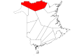
 Map of New Brunswick highlighting Madawaska County 2.png 216 × 216; 20 KB
-
 Map of New Brunswick highlighting Madawaska County.png 1,000 × 984; 44 KB
-
 Map of New Brunswick highlighting Madawaska County.svg 4,096 × 2,731; 5.81 MB
-
 Map of New Brunswick highlighting Northumberland County 2.png 216 × 216; 22 KB
-
 Map of New Brunswick highlighting Northumberland County.png 1,000 × 984; 240 KB
-
 Map of New Brunswick highlighting Northumberland County.svg 4,096 × 2,731; 5.81 MB
-
 Map of New Brunswick highlighting Queens County 2.png 216 × 216; 20 KB
-
 Map of New Brunswick highlighting Queens County.png 1,000 × 984; 241 KB
-
 Map of New Brunswick highlighting Queens County.svg 4,096 × 2,731; 5.81 MB
-
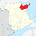
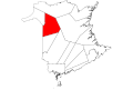
 Map of New Brunswick highlighting Restigouche County 2.png 216 × 216; 21 KB
-
 Map of New Brunswick highlighting Restigouche County.png 1,000 × 984; 240 KB
-
 Map of New Brunswick highlighting Restigouche County.svg 4,096 × 2,731; 5.81 MB
-
 Map of New Brunswick highlighting Saint John County 2.png 216 × 216; 19 KB
-
 Map of New Brunswick highlighting Saint John County.png 1,000 × 984; 240 KB
-
 Map of New Brunswick highlighting Saint John County.svg 4,096 × 2,731; 5.81 MB
-
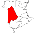
 Map of New Brunswick highlighting Sunbury County.png 1,000 × 984; 241 KB
-
 Map of New Brunswick highlighting Sunbury County.svg 4,096 × 2,731; 5.81 MB
-
 Map of New Brunswick highlighting Victoria County.png 1,000 × 984; 241 KB
-
 Map of New Brunswick highlighting Victoria County.svg 4,096 × 2,731; 5.81 MB
-
 Map of New Brunswick highlighting Westmorland County.png 1,000 × 984; 241 KB
-
 Map of New Brunswick highlighting Westmorland County.svg 4,096 × 2,731; 5.81 MB
-
 Map of New Brunswick highlighting York County.png 216 × 216; 21 KB
-
 Map of New Brunswick highlighting York County.svg 4,096 × 2,731; 5.81 MB
-
 Miramichi Bay-Neguac map.png 926 × 915; 47 KB
-
 Miramichi Centre map.png 926 × 915; 47 KB
-
 Miramichi, New Brunswick Location.PNG 224 × 233; 5 KB
-
 Miramichi, riding.png 926 × 915; 44 KB
-
 Miramichi-Bay du Vin map.png 926 × 915; 47 KB
-
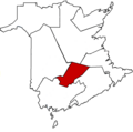
 Miramichi-Grand-Lake.png 1,016 × 943; 13 KB
-
 Moncton New Brunswick Location3.png 230 × 233; 43 KB
-
 Moncton-riverview-Dieppe.png 1,016 × 943; 13 KB
-
 MonctonWestDistrict.png 926 × 915; 27 KB
-
 Moncton—Riverview—Dieppe.png 926 × 915; 43 KB
-
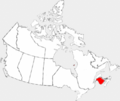
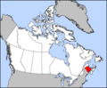
 NB-Canada-province.png 852 × 698; 159 KB
-
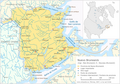
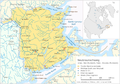 Neubraunschweig.png 2,360 × 1,650; 1.85 MB
-
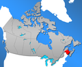
 New Brunswick highlighted in red in Canada.png 1,207 × 1,024; 308 KB
-
 New Brunswick Southwest.png 926 × 915; 43 KB
-
 New Brunswick-map.png 280 × 230; 14 KB
-
 New Maryland-Sunbury West.png 926 × 915; 41 KB
-
 New-Brunswick-Southwest.png 1,016 × 943; 13 KB
-
 Nouveau-Brunswick.png 2,360 × 1,650; 1.79 MB
-
 Nuevo Brunswick.png 2,360 × 1,650; 1.87 MB
-
 PetitcodiacDistrict.png 926 × 915; 47 KB
-
 Péninsule acadienne.png 216 × 216; 6 KB
-
 RiverviewDistrict.png 926 × 915; 47 KB
-
 Rogersville-Kouchibouguac map.png 926 × 915; 47 KB
-
 RothesayDistrict.png 926 × 915; 47 KB
-
 Saint John, riding.png 926 × 915; 43 KB
-
 Saint-John-Rothesay.png 1,016 × 943; 13 KB
-
 SaintJohnEastDistrict.png 926 × 915; 47 KB
-
 SaintJohnHarbourDistrict.png 926 × 915; 47 KB
-
 SaintJohnLancasterDistrict.png 926 × 915; 47 KB
-
 SaintJohnPortlandDistrict.png 926 × 915; 47 KB
-
 Shediac-Cap-Pele district.png 926 × 915; 47 KB
-
 Southwest Miramichi district map.png 926 × 915; 47 KB
-
 Tantramar (provincial electoral district).PNG 926 × 915; 21 KB
-
 Tobique-Mactaquac-Riding-Map.png 1,016 × 943; 13 KB
-
 Tobique-Mactaquac.png 926 × 915; 44 KB
-
 Tracadie-Sheila district map.png 926 × 915; 47 KB


.PNG)


