Category:Locator maps of Patillas, Puerto Rico
Media in category "Locator maps of Patillas, Puerto Rico"
The following 18 files are in this category, out of 18 total.
-
 Apeadero, Patillas, Puerto Rico locator map.png 1,100 × 1,188; 129 KB
-
 Bajo, Patillas, Puerto Rico locator map.png 1,100 × 1,188; 129 KB
-
 Cacao Alto, Patillas, Puerto Rico locator map.png 1,100 × 1,188; 129 KB
-
 Cacao Bajo, Patillas, Puerto Rico locator map.png 1,100 × 1,188; 129 KB
-
 Egozcue, Patillas, Puerto Rico locator map.png 1,100 × 1,188; 129 KB
-
 Guardarraya, Patillas, Puerto Rico locator map.png 1,100 × 1,188; 129 KB
-
 Jacaboa, Patillas, Puerto Rico locator map.png 1,100 × 1,188; 129 KB
-
 Jagual, Patillas, Puerto Rico locator map.png 1,100 × 1,188; 129 KB
-
 Locator-map-Puerto-Rico-Patillas.svg 1,332 × 360; 97 KB
-
 Mamey, Patillas, Puerto Rico locator map.png 1,100 × 1,188; 129 KB
-
 Marín, Patillas, Puerto Rico locator map.png 1,100 × 1,188; 129 KB
-
 Mulas, Patillas, Puerto Rico locator map.png 1,100 × 1,188; 129 KB
-
 Muñoz Rivera, Patillas, Puerto Rico locator map.png 1,100 × 1,188; 129 KB
-
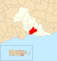
 Patillas barrio-pueblo, Patillas, Puerto Rico locator map.png 1,100 × 1,188; 129 KB
-
 Patillas, Puerto Rico locator map.png 1,103 × 909; 121 KB
-
 Pollos, Patillas, Puerto Rico locator map.png 1,100 × 1,188; 129 KB
-
 Quebrada Arriba, Patillas, Puerto Rico locator map.png 1,100 × 1,188; 129 KB
-
 Ríos, Patillas, Puerto Rico locator map.png 1,100 × 1,188; 129 KB


